Dickerson in Frederick County, Maryland — The American Northeast (Mid-Atlantic)
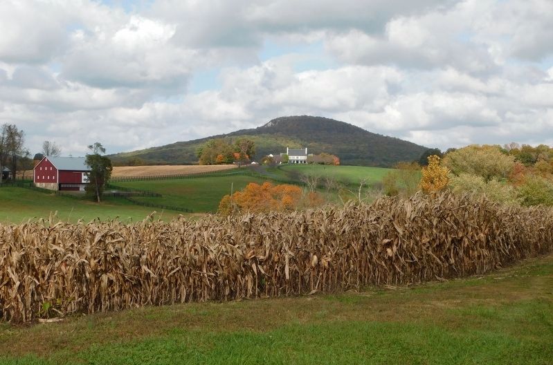
Sugarloaf Mountain
A Signalman’s Lot
— Antietam Campaign 1862 —
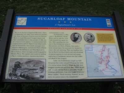
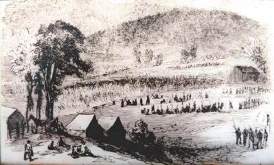
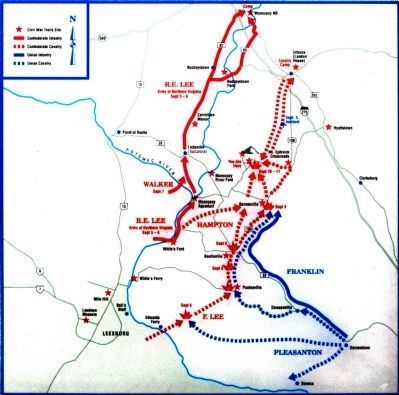
You are at the foot of Sugarloaf Mountain, where on September 5-6, 1862, Union observers watched the Army of Northern Virginia cross the Potomac River to invade Maryland. A signal station had been established here in the summer of 1861, one in a chain of such stations. It communicated with a signal station and U.S. Signal Corps school southeast of Darnestown, from which messages were relayed to Washington, and with the Point of Rocks railhead of the Baltimore and Ohio Railroad to the northwest, where messages would be passed to Harpers Ferry. The signals were made by holding a flag in various positions, representing letters, and sometimes in code.
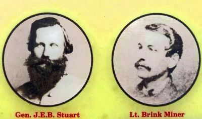
On September 5, 1862, only Lt. Brinkerhoff “Brink” Miner and his aide Pvt. A.H. Cook manned the signal station. After signaling the invasion of the Confederate army to Darnestown and Point of Rocks, they made a hasty retreat down the mountain but decided to return the next morning. They ran headfirst into the 1st North Carolina Cavalry and took advantage of mutual surprise to turn around and escape, capturing a Confederate courier who had ridden out ahead of the troopers.
Later, the Confederates caught up with the group four miles toward Urbana at the home of a young woman friend of Miner. As they were dragged outside and searched, Gen. J.E.B. Stuart rode up and told the Federal prisoners, “Good morning, gentlemen. I am very happy to see you.” Miner replied, “Good morning, General, we are sorry we cannot return the compliment.”
(Sidebar) Quarters were probably located below the summit on the west side near where a small stone fort (constructed in the 1930s) is located today. The station itself was located below the stone fort where the road to the summit meets the loop road at a circle.
Erected by Maryland Civl War Trails.
Topics and series. This historical marker is listed in this topic list: War, US Civil. In addition, it is included in the Maryland Civil War Trails series list. A significant historical month for this entry is September 1864.
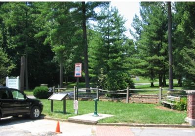
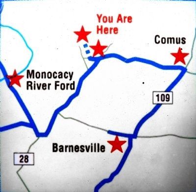
Location. 39° 15.098′ N, 77° 23.602′ W. Marker is in Dickerson, Maryland, in Frederick County. Marker is at the intersection of Comus Road (Maryland Route 95) and Sugarloaf Mountain Road, on the right on Comus Road. Adjacent to the entrance to Sugarloaf Mountain Park. Touch for map. Marker is at or near this postal address: 7901 Comus Road, Dickerson MD 20842, United States of America. Touch for directions.
Other nearby markers. At least 8 other markers are within 3 miles of this marker, measured as the crow flies. Sugar Loaf Mountain (within shouting distance of this marker); Barnesville (approx. 2.2 miles away); a different marker also named Barnesville (approx. 2.2 miles away); 1862 Antietam Campaign
(approx. 2.3 miles away); Mount Ephraim Crossroads (approx. 2.3 miles away); Comus Inn (approx. 2.3 miles away); a different marker also named 1862 Antietam Campaign (approx. 2˝ miles away); Gettysburg Campaign (approx. 2˝ miles away). Touch for a list and map of all markers in Dickerson.
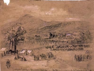
More about this marker. The marker features a drawing of an encampment at the base of Sugarloaf Mountain, along with portraits of Gen. J.E.B. Stuart and Lt. Brink Miner. An Antietam campaign map details unit movements and other Civil War Trails sites.
Also see . . .
1. The Flag That Talks – The U.S. Signal Corps in the Civil War. The National Museum of Civil War Medicine website entry (Submitted on March 11, 2022, by Larry Gertner of New York, New York.)
2. Stronghold on Sugarloaf Mountain. Website homepage (Submitted on March 11, 2022, by Larry Gertner of New York, New York.)
Additional commentary.
1. Stronghold, Incorporated
The park is maintained by Stronghold, Incorporated, a non-profit organization
Photographed By Craig Swain, January 28, 2007
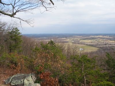
3. From the Summit Looking East
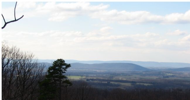
Darnestown, Gaithersburg and Rockville lay in the distance. On a very clear day it is possible to see Washington, D.C. More than any other vista from the top, the view to the east demonstrates the commanding elevation of Sugarloaf.
— Submitted July 17, 2007, by Craig Swain of Leesburg, Virginia.
2. Might Have Been.....
President Franklin Delano Roosevelt once had an eye to acquire the mountain as a presidential retreat, but was unable to secure an agreement. Instead he chose a location on South Mountain, near Thurmont, MD which he named Shangri-La, and has become popularly known as Camp David from the 1950s onward.
— Submitted July 17, 2007, by Craig Swain of Leesburg, Virginia.
Photographed By Craig Swain, January 28, 2007
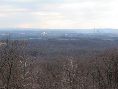
4. From the Summit Looking South
The smoke stack is a power plant very close to the historical White's Ford crossing site. Beyond which lies Leesburg, Virginia. The mountains on the horizon behind the smokestack are the Catoctins. On the far left are the northern most heights of the Bull Run Mountains. A large portion of the Civil War played out within view of Sugarloaf.
Credits. This page was last revised on May 30, 2022. It was originally submitted on July 17, 2007, by Craig Swain of Leesburg, Virginia. This page has been viewed 6,156 times since then and 128 times this year. Last updated on March 22, 2020, by Bradley Owen of Morgantown, West Virginia. Photos: 1, 2, 3, 4, 5. submitted on July 17, 2007, by Craig Swain of Leesburg, Virginia. 6, 7, 8, 9, 10. submitted on June 3, 2013, by Allen C. Browne of Silver Spring, Maryland. 11. submitted on March 7, 2021, by Bradley Owen of Morgantown, West Virginia. • Bill Pfingsten was the editor who published this page.
