Tannersville in Greene County, New York — The American Northeast (Mid-Atlantic)
Tannersville
The Painted Village In The Sky
— Historic Tannersville: Tanneries & Tourism —
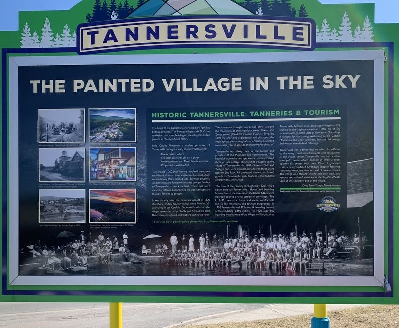
The heart of the Catskills, Tannersville, New York has been aptly called "The Painted Village in the Sky” due to the fact that most buildings in the village have been painted in cheery, vibrant colors.
Milo Claude Moseman, a tireless promoter of Tannersville during the early to mid 1900's wrote:
The skies are bluer, the air is purer,
And sometimes said Men's hearts are truer.
Progress-the watchword.
Tannersville's 200-year history involved numerous small hemlock-tree tanneries (hence, the name) which created many forest related jobs. Sawmills, gristmills, woolen mills, and furniture factories brought families to Tannersville to work its land. These jobs were invariably difficult, but provided the income necessary to allow families to prosper.
It was shortly after the tanneries opened in 1820 that the legendary Rip Van Winkle woke from his 20-year sleep in the Catskills. So when thunder hits the village, remember, it's probably just Rip and the little Dutchmen playing nine pins that are causing the noise.
The tanneries brought work, but they stripped the mountains of their hemlock trees. Roland Van Zandt stated (Catskill Mountain House, 1991), "By 1890 the unbridled exploitation had destroyed the virgin forest, the tanning industry collapsed, and the mountains grew up again to the hardwoods of today."
Tannersville was always one of the busiest and proudest of the Mountain Top communities. The beautiful mountains and spectacular vistas attracted three private cottage communities adjacent to the village of Tannersville. In 1887, Onteora Park and Twilight Park were established, followed three years later by Elka Park. All three parks have contributed greatly to Tannersville with financial contributions, employment, and culture.
The turn of the century through the 1920's was a boom time for Tannersville. Hotels and boarding houses dotted the streets and the Ulster & Delaware Railroad opened a train station in the village. The U & D created a faster and more comfortable trip to the mountains and tourism burgeoned. In 1902 Tannersville had 52 hotels & boarding houses, accommodating 2,350 guests. In 1920 over 100 boarding houses were in the village and its outskirts.
Tannersville became an incorporated village in 1895, making it the highest elevation (1900 ft.) of any mountain village in the state of New York. Our village is famous for the spring awakening of the Catskill Mountains, the cool summers, fantastic fall foliage, and winter wonderland offerings.
Tannersville has a great deal to offer. In addition to the many retail establishments and restaurants in the village center, Tannersville also has a nine-hole golf course which opened in 1929, a cross country ski center with over 35 km of groomed trails, a newly updated Orpheum Theater featuring renowned musicians, dancers, and of course movies. The village also features hiking and bike trails, and various recreational activities at the Rip Van Winkle Lake at the southern end of the village.
Dede Terns-Thorpe, Town Historian
To view all kiosk panels online please visit: http://tannersville.com/info
Photo Captions (staring top left and going clockwise)
- Afternoon passenger trains at Kaaterskill Junction in 1899.
- Tannersville, New York, “The Painted Village in the Sky”
- The Village is known for its vibrant and colorful buildings
- Rip Van Winkle Lake, at the southern edge of the Village, offers various recreational activites.
- View of Rip Van Winkle Lake from the Depot in 1906.
- The JW. Mason Chair Factory, circa 1890, used the Schoharie Creek to provide power to its new furniture plant.
Background photo: The Tannersville Boathouse on Rip Van Winkle Lake.
Topics. This historical marker is listed in this topic list: Settlements & Settlers. A significant historical year for this entry is 1895.
Location. 42° 11.728′ N, 74° 9.059′ W. Marker is in Tannersville, New York, in Greene County. Marker is at the intersection of New York State Route 23A and Raspberry Lane, on the left when traveling east on State Route 23A. Touch for map. Marker is at or near this postal address: 6372 NY-23A, Tannersville NY 12485, United States of America. Touch for directions.
Other nearby markers. At least 8 other markers are within 3 miles of this marker, measured as the crow flies. Town of Hunter World War Memorial (approx. 0.7 miles away); Tannersville School Ground Improvements (approx. 0.7 miles away); a different marker also named Tannersville (approx. 1˝ miles away); Rip Van Winkle (approx. 2.2 miles away); State Land (approx. 2.9 miles away); Haines Falls Honor Roll (approx. 3 miles away); Haines Falls (approx. 3 miles away); Welcome to the Kaaterskill Rail Trail (approx. 3 miles away). Touch for a list and map of all markers in Tannersville.
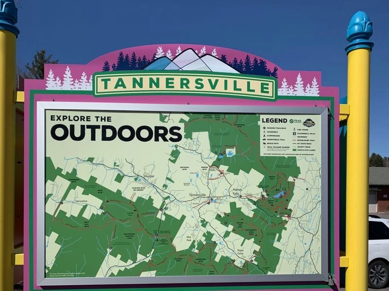
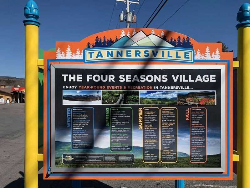
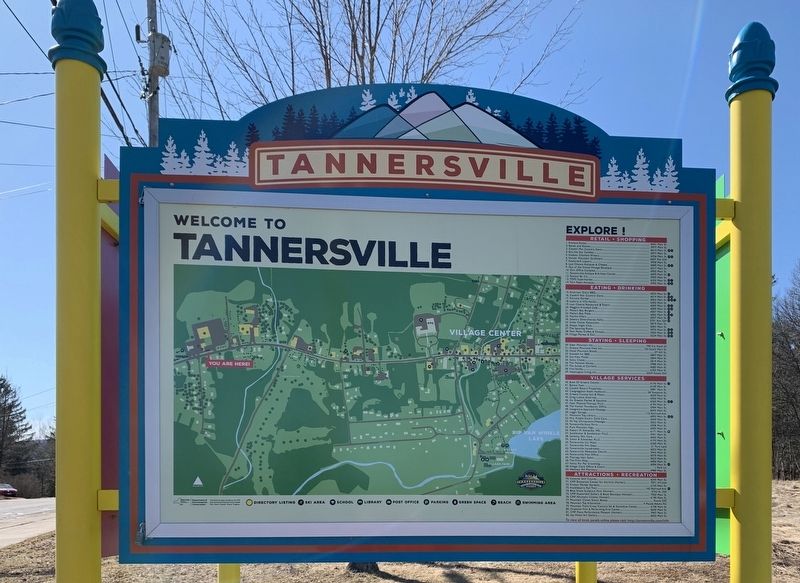
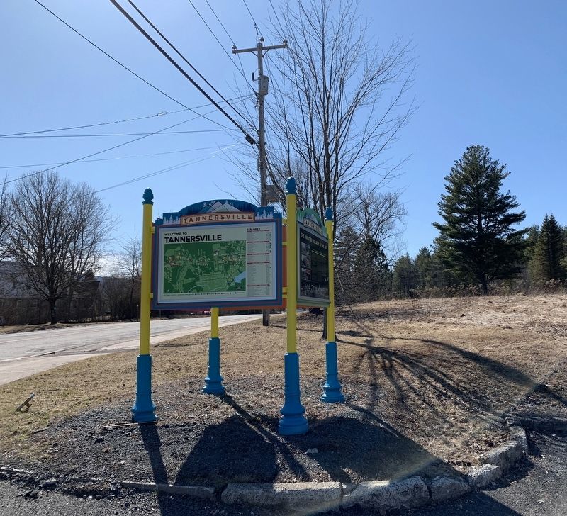
More about this marker. The marker has four sides, but only the northern panel has historical information. The East and west panels are maps, and the south face lists seasonal activities.
Also see . . .
1. Tannersville. (Submitted on March 23, 2020, by Steve Stoessel of Niskayuna, New York.)
2. Tannersville, New York (Wikipedia). (Submitted on March 25, 2020, by Michael Herrick of Southbury, Connecticut.)
Credits. This page was last revised on March 25, 2020. It was originally submitted on March 23, 2020, by Steve Stoessel of Niskayuna, New York. This page has been viewed 299 times since then and 59 times this year. Photos: 1, 2, 3, 4, 5. submitted on March 23, 2020, by Steve Stoessel of Niskayuna, New York. • Michael Herrick was the editor who published this page.
