Puerta de Tierra in San Juan in Municipio de San Juan, Puerto Rico — The Caribbean (The West Indies)
Fort San Antonio
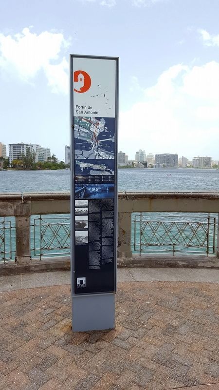
Fortín de San Antonio
Inscription.
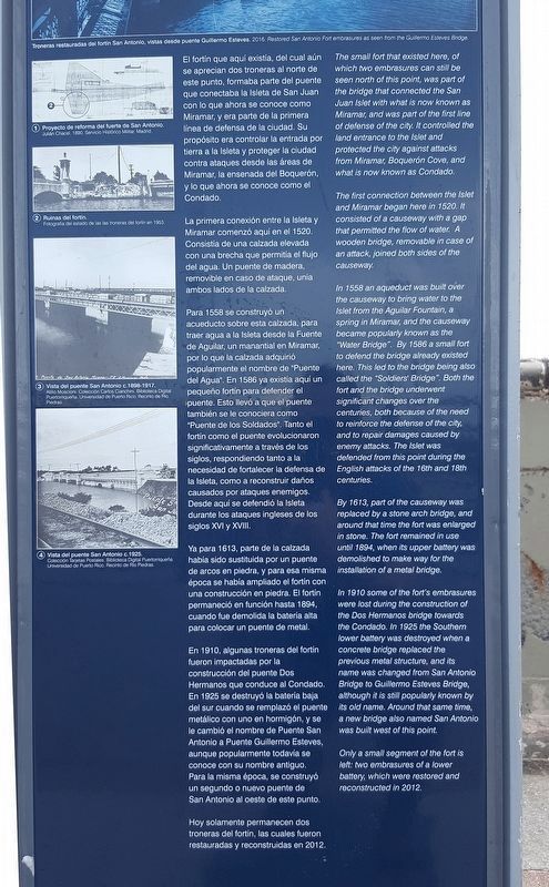
The small fort that existed here, of which two embrasures can still be seen north of this point, was part of the bridge that connected the San Juan Islet with what is now known as Miramar, and was part of the first line of defense of the city. It controlled the land entrance to the Islet and protected the city against attacks from Miramar, Boquerón Cove, and what is now known as Condado.
The first connection between the Islet and Miramar began here in 1520. It consisted of a causeway with a gap that permitted the flow of water. A wooden bridge, removable in case of an attack, joined both sides of the causeway.
In 1558 an aqueduct was built over the causeway to bring water to the Islet from the Aguilar Fountain, a spring in Miramar, and the causeway became popularly known as the “Water Bridge.” By 1586 a small fort to defend the bridge already existed here. This led to the bridge being also called the “Soldiers’ Bridge.” Both the fort and the bridge underwent significant changes over the centuries, both because of the need to reinforce the defense of the city, and to repair damages caused by enemy attacks. The Islet was defended from this point during the English attacks of the 16th and 18th centuries.
By 1613, part of the causeway was replaced by a stone arch bridge, and around that time the fort was enlarged in stone. The fort remained in use until 1894, when its upper battery was demolished to make way for the installation of a metal bridge.
In 1910 some of the fort's embrasures were lost during the construction of the Dos Hermanos bridge towards the Candado. In 1925 the Southern lower battery was destroyed when a concrete bridge replaced the previous metal structure, and its name was changed from San Antonio Bridge to Guillermo Esteves Bridge, although it is still popularly known by its old name. Around that same time, a new bridge also named San Antonio was built west of this point.
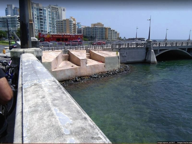
Only a small segment of the fort is left: two embrasures of a lower battery, which were restored and reconstructed in 2012.
Caption: 2016. Restored San Antonio Fort embrasures as seen from the Guillermo Esteves Bridge.
El fortin que aquí existía, del cual aún se aprecian dos troneras al norte de este punto, formaba parte del puente que conectaba la Isleta de San Juan con lo que ahora se concoe como Miramar, y era parte de la primera línea de defensa
de la ciudad. Su propósito era controlar la entrada por tierra a la Isleta y proteger la ciudad contra ataques desde las áreas de Miramar, la ensenada del Boquerón, y lo que ahora se conoce como el Condado.
La primera conexión entre la Isleta y Miramar comenzó aquí en el 1520. Consistía de una calzada elevada con una brecha que permitía el flujo del agua. Un puente de madera, removible en caso de ataque, unía ambos lados de la calzada.
Para 1558 se construyó un acueducto sobre esta calzada, para traer agua a la Isleta desde la Fuente de Aguilar, un manantial en Miramar, por lo que la calzada adquirió popularmente el nombre de “Puente del Agua”. En 1586 ya existía aquí un pequeño fortín para defender el puente. Esto llevó a que el puente también se le conociera como “Puente de los Soldados”. Tanto el fortín como el puente evolucionaron significativamente a través de los siglos, respondiendo tanto a la necesidad de fortalecer la defensa de la Isleta, como a reconstruir daños causados por ataques enemigos. Desde aquí se defendió la Isleta durante los ataques ingleses de los siglos XVI y XVIII.
Ya para 1613, parte de la calzada había sido sustituida por un puente de arcos en piedra, y para esa misma época se había ampliado el fortín con una construcción en piedra. El fortín permaneció en función hasta 1894, cuando fue demolida la batería

Photographed By Ivan Reyes, July 1, 2017
3. Fortín de San Antonio
Pictured is the last surviving remnant of Fort San Antonio. It was restored and reconstructed in 2012. It is located at the northeast corner of Puente Guillermo Esteves (Guillermo Esteves Bridge), a short distance north of the featured historical marker.
En 1910, algunas troneras del fortín fueron impactadas por la construcción del puente Dos Hermanos que conduce al Condado. En 1925 se destruyó la batería baja del sur cuando se remplazó el puente metálico con uno en hormigón, y se le cambió el nombre de Puente San Antonio a Puente Guillermo Esteves, aunque popularmente todavia se conoce con su nombre antiguo. Para la misma época, se construyó un segundo o nuevo puente de San Antonio al oeste de este punto
Hoy solamente permanecen dos troneras del fortín, las cuales fueron restauradas y reconstruidas en 2012.
Pie de fotos:
Troneras restuaradas del fortín San Antonio, vistas desde puente Guillermo Esteves.
1 Proyecto de reforma del fuerte de San Antonio.
Julián Chacel. 1890. Servicio Histórico Militar, Madrid.
2 Ruinas del fortín.
Fotografía del estado de las troneras del fortín en 1953.
3 Vista del puente San Antonio c. 1898-1917.
Atilio Moscioni. Colección Carlos Cianchini. Biblioteca Digital Puertorriqueña. Universidad de Puerto Rico, Recinto de Río Piedras.
4 Vista del puente San Antonio c. 1925.
Colección Tarjetas Postales. Biblioteca Digital Puertorriqueña. Universidad de Puerto Rico, Recinto de Río Piedras.
Erected by Paseo Puerta de Tierra.
Topics. This historical marker is listed in these topic lists: Bridges & Viaducts • Forts and Castles. A significant historical year for this entry is 1520.
Location. 18° 27.572′ N, 66° 5.175′ W. Marker is in San Juan in Municipio de San Juan, Puerto Rico. It is in Puerta de Tierra. Marker is on PR-1, on the right when traveling north. Touch for map. Marker is in this post office area: San Juan PR 00907, United States of America. Touch for directions.
Other nearby markers. At least 8 other markers are within walking distance of this marker. Guillermo Esteves Bridge (within shouting distance of this marker); Ataques a la Isleta (about 400 feet away, measured in a direct line); First Line of Defense (about 500 feet away); Capilla Nuestra Señora de Lourdes (approx. 0.4 kilometers away); Polvorín de San Jerónimo (approx. 0.7 kilometers away); Memorial de Pulse (Pulse Memorial) (approx. 0.7 kilometers away); Palma real (approx. one kilometer away); Segunda línea de defensa (approx. 1.2 kilometers away). Touch for a list and map of all markers in San Juan.
Credits. This page was last revised on February 16, 2023. It was originally submitted on March 29, 2020, by Douglass Halvorsen of Klamath Falls, Oregon. This page has been viewed 211 times since then and 14 times this year. Photos: 1, 2, 3. submitted on March 30, 2020, by Douglass Halvorsen of Klamath Falls, Oregon. • J. Makali Bruton was the editor who published this page.

