Old Ellicott City in Howard County, Maryland — The American Northeast (Mid-Atlantic)
Fells Lane Community
Photographed by Allen C. Browne, December 18, 2017
1. Fells Lane Community Marker
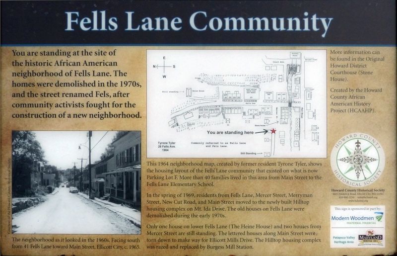
You are standing at the site of the historic African American neighborhood of Fells Lane. The homes were demolished n the 1970s, and the street renamed Fels, after community activists fought for the construction of a new neighborhood.
This 1964 neighborhood map, created by former resident Tyrone Tyler, shows the housing layout of the Fells Lane community that existed on what is now Parking Lot F. More than 40 families lived in this area from Main street to the Fells Lane Elementary School.
In the spring of 1969, residents from Fells Lane, Mercer Street, Merryman Street, New Cut Road, and Main Street moved to the newly built Hilltop housing complex on Mt. Ida Drive. The old houses on Fells Lane were demolished during the early 1970s.
Only one house on lower Fells Lane (The Heine House) and two houses from Mercer Street are still standing. The lettered housed along Main Street were torn down to make way for Ellicott Mills Drive. the Hilltop housing complex was razed and replaced by Burgess Mill Station. [Captions:]
The neighborhood as it looked in the 1960s. Facing south from 41 Fells Lane toward Main Street,
this page online
More information can be found in the Original Howard District Courthouse (Stone House).
Erected by Howard County African American History Project (HCAAPHP).
Topics. This historical marker is listed in these topic lists: African Americans • Notable Places. A significant historical year for this entry is 1964.
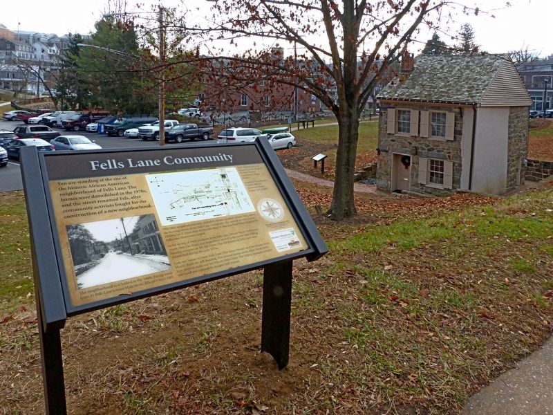
Location. This marker has been replaced by another marker nearby. It was located near 39° 16.149′ N, 76° 48.063′ W. Marker was in Ellicott City, Maryland, in Howard County. It was in Old Ellicott City. It was at the intersection of Ellicotts Mills Drive and Main Street (Maryland Route 144), on the right when traveling north on Ellicotts Mills Drive. Touch for map. Marker was at or near this postal address: 8394 Main St, Ellicott City MD 21043, United States of America. Touch for directions.

Regionally, this marker was in the Baltimore Metro Region and in Central Maryland. It was also in the American Mid-Atlantic and on the Eastern Seaboard. Globally, it was in the North Atlantic Region, North America, the Western Hemisphere, the Western World, and the Anglosphere. Historically, it
Photographed by Allen C. Browne, December 18, 2017
2. Fells Lane Community Marker
Other nearby markers. At least 8 other markers are within walking distance of this location: A different marker also named Fells Lane Community (here, next to this marker); The National Road (within shouting distance of this marker); Ellicott’s Mills (within shouting distance of this marker); Fire House Annex (within shouting distance of this marker); New Fire Station & Transit Terminal (within shouting distance of this marker); Ellicott City Volunteer Fire Department (about 300 feet away, measured in a direct line); Jonathan Ellicott Building (about 300 feet away); Disney’s Tavern (about 600 feet away). Touch for a list and map of all markers in Ellicott City.
Other markers no longer nearby. Old Court House, 1840: (was a few steps from this marker but has been confirmed missing); MaryLandscapes (was within shouting distance of this marker but has been permanently removed); The Road to Prosperity (was within shouting distance of this marker but has been confirmed missing).
Related marker. Click here for another marker that is related to this marker. This marker has been replaced with the linked marker.
Credits. This page was last revised on July 18, 2026. It was originally submitted on December 23, 2017, by Allen C. Browne of Silver Spring, Maryland. This page has been viewed 1,924 times since then and 131 times this year. Last updated on March 31, 2020, by Bruce Guthrie of Silver Spring, Maryland. Photos: 1, 2. submitted on December 23, 2017, by Allen C. Browne of Silver Spring, Maryland. • Bill Pfingsten was the editor who published this page.
