Tahawus in Essex County, New York — The American Northeast (Mid-Atlantic)
Heavy Construction
Photographed by Steve Stoessel, March 28, 2020
1. Heavy Construction Marker
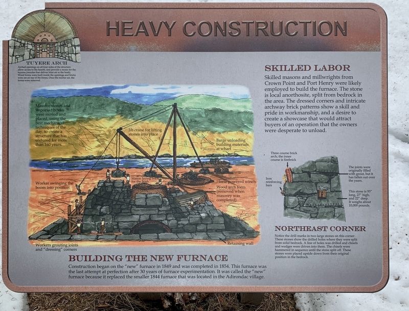
Building The New Furnace
Construction began on the "new” furnace in 1849 and was completed in 1854. This furnace was the last attempt at perfection after 30 years of furnace experimentation. It was called the "new" furnace because it replaced the smaller 1844 furnace that was located in the Adirondac village.
Massive stones and imported bricks were moved and placed using the best mechanical techniques of the day, to create a structure that has endured for more than 160 years.
• Jib crane for lifting stones into place
• Workers grouting joints and "dressing" corners
• Barge unloading building materials at wharf
• Mason laying brick for the bosh
• Horse powered winch
Skilled Labor
Skilled masons and millwrights from Crown Point and Port Henry were likely employed to build the furnace. The stone is local anorthosite, split from bedrock in the area. The dressed corners and intricate archway brick patterns show a skill and pride in workmanship, and a desire to create a showcase that would attract buyers of an operation that the owners were desperate to unload.
Erected by Open Space Institute.
this page online
Topics. This historical marker is listed in this topic list: Industry & Commerce. A significant historical year for this entry is 1849.
Location. 44° 4.74′ N, 74° 3.401′ W. Marker is in Tahawus, New York, in Essex County. It is on Upper Works Road (County Route 25) 9.1 miles north of Blue Ridge Road, on the left when traveling north. Marker is part of the McIntyre Iron Works. It is on top of the embankment built for the charging bridge approximately 20 yards west and up from the road. Touch for map. Marker is in this post office area: Newcomb NY 12879, United States of America. Touch for directions.

Regionally, this marker is in Upstate New York, in the Adirondacks & North Country, and in the Champlain Valley. It is also in the American Northeast and in the Mid-Atlantic. Globally, it is in North America, the Great North Woods, the Western Hemisphere, the Western World, and the Anglosphere. Historically, it finds itself in what was once the Viceroyalty of New France, New Netherland, and one of the original Thirteen Colonies.
Other nearby markers. At least 8 other markers are within walking distance of this marker: An Iron Making Complex
Photographed by Steve Stoessel, March 28, 2020
2. Northeast Corner Inset
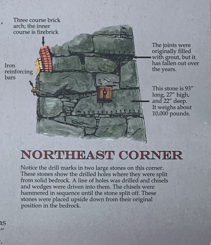
Notice drill marks in two large stones on this corner.
These stones show the drilled holes where they were split
from solid bedrock. A line of holes was drilled and chisels
and wedges were driven into them. The chisels were
hammered in sequence until the stone split off. These
stones were placed upside down from their original
position in the bedrock.
Also see . . . Open Space Institute. (Submitted on April 6, 2020, by Michael Herrick of Southbury, Connecticut.)
Photographed by Steve Stoessel, March 28, 2020
3. Tuyere Arch Inset
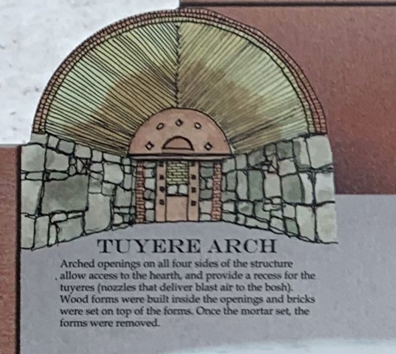
Arched openings on all four sides of the structure allow access to the hearth, and provide a recess for the
tuyeres (nozzles that deliver blast air to the bosh).
Wood forms were built inside the openings and bricks
were set on top of the forms. Once the mortar set, the
forms were removed.
Photographed by Steve Stoessel, March 28, 2020
4. McIntyre Iron Works
Credits. This page was last revised on April 6, 2020. It was originally submitted on April 1, 2020, by Steve Stoessel of Niskayuna, New York. This page has been viewed 200 times since then and 16 times this year. Photos: 1. submitted on April 1, 2020, by Steve Stoessel of Niskayuna, New York. 2, 3, 4. submitted on April 2, 2020, by Steve Stoessel of Niskayuna, New York. • Michael Herrick was the editor who published this page.
