Near Morven in Brooks County, Georgia — The American South (South Atlantic)
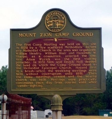
Mount Zion Camp Ground
Erected 1956 by Georgia Historical Commission. (Marker Number 014-3.)
Topics and series. This historical marker is listed in this topic list: Churches & Religion. In addition, it is included in the Georgia Historical Society series list. A significant historical year for this entry is 1828.
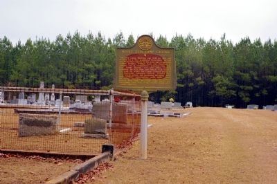
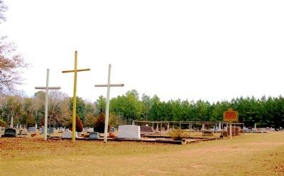
Location. 30° 57.621′ N, 83° 29.957′ W. Marker is near Morven, Georgia, in Brooks County. Marker is on Campground Road, 0 miles east of Adel Highway (Georgia Route 76), on the left when traveling south. Touch for map. Marker is in this post office area: Morven GA 31638, United States of America. Touch for directions.
Other nearby markers. At least 8 other markers are within 9 miles of this marker, measured as the crow flies. Old Coffee Road (approx. ¼ mile away); The Old Morven School (approx. 1.2 miles away); Barney Colored Elementary School (approx. 3.2 miles away); a different marker also named Old Coffee Road (approx. 5.6 miles away); Hahira Veterans Memorial (approx. 7.7 miles away); Bethel Primitive Baptist Church (approx. 7.9 miles away); Hahira High School (approx. 8.1 miles away); a different marker also named Old Coffee Road (approx. 8.8 miles away). Touch for a list and map of all markers in Morven.
Credits. This page was last revised on January 26, 2020. It was originally submitted on December 27, 2008, by David Seibert of Sandy Springs, Georgia. This page has been viewed 2,151 times since then and 23 times this year. Photos: 1. submitted on December 27, 2008, by David Seibert of Sandy Springs, Georgia. 2, 3. submitted on January 11, 2012, by David Seibert of Sandy Springs, Georgia. • Kevin W. was the editor who published this page.


