Blackstone in Nottoway County, Virginia — The American South (Mid-Atlantic)
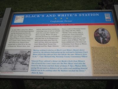
Black’s and White’s Station
Confederate Detour
— Wilson–Kautz Raid —
In June 1864, to deny Gen. Robert E. Lee the use of the South Side R.R. and the Richmond and Danville R.R., Gen. Ulysses S. Grant sent Gen. James H. Wilson and Gen. August V. Kautz south of Petersburg on a cavalry raid to destroy track and rolling stock. Kautz's force passed here on June 23 on the way to Burkeville. Wilson’s force, close behind, destroyed three warehouses containing cotton as well as railroad track, ties, and other supplies here. Before leaving, Wilson was given incorrect directions by a local citizen who sent him on the Hungarytown Road several miles away from the main rail line, which was along the Court House Road. Former Congressman and Gen. Roger Atkinson Pryor, a native of Nottoway County, was riding with Gen. W.H.F. “Rooney” Lee’s cavalry when it arrived here. Pryor directed the Confederates to a shortcut at Hardy’s Fork to allow Lee’s cavalry to get in front of Wilson. The two forces collided just a few miles east of Nottoway Court House as Wilson tried to regain the road.
“Having nothing to destroy at Black’s and White’s [Kautz's force] moved on, the advance body going up the railroad to Nottoway Court House which they did not burn but left for the rear (Wilson’s) force to do.” - Capt. Richard Irby, Nottoway County Commissary Officer
“General Pryor advised a detour [at Hardy’s Fork] from Wilson’s line of march by a near route over to the Poor House road onto the Grove by the house and late home of James T. Epes [Walnut Hill], saving the pursuers a distance of two miles and enabling General [W.H.F.] Lee to be waiting when the Yankees reached the Grove.” - Peter B. Epes
[Sidebar:]
Lt. Col. Banastre Tarleton
Eighty-three years before the Wilson-Kautz Raid, in July 1781 during the Revolutionary War, Schwartz’s Tavern and several other sites were the subjects of another cavalry raid. British Gen. Charles Cornwallis ordered Lt. Col. Banastre Tarleton and 300 cavalrymen from Cobham (site of the present Jamestown Ferry) to Bedford County to destroy Continental supply and ammunition depots at Amelia Court House and Prince Edward Court House. Tarleton's command passed through Prince George, Burkeville, Meherrin (then Moore’s Ordinary), Charlotte Court House, Flat Creek, Blackstone, and Smokey Ordinary, all of which figured in the Wilson-Kautz Raid. During Tarleton's raid, his men had the famous fight with Peter Francisco at Benjamin Ward's Tavern on West Creek, just outside of present day Crewe. In addition to supplies destroyed, Tarleton's expedition tied up more than 2,000 Virginia militia and Continental troops who might otherwise have reinforced Gen. Nathanael Greene in North Carolina.
Erected by Virginia Civil War Trails.
Topics and series. This historical marker is listed in this topic list: War, US Civil. In addition, it is included in the Virginia Civil War Trails series list. A significant historical month for this entry is June 1864.
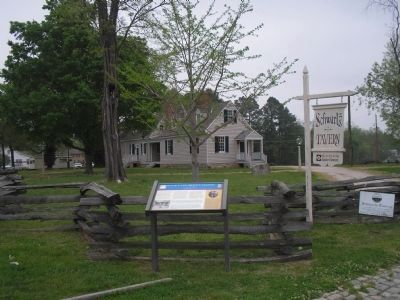
Location. 37° 4.883′ N, 77° 59.777′ W. Marker is in Blackstone, Virginia, in Nottoway County. Marker is on Tavern Street, on the right when traveling west. Marker is located in front of Schwartz Tavern. Touch for map. Marker is in this post office area: Blackstone VA 23824, United States of America. Touch for directions.
Other nearby markers. At least 8 other markers are within walking distance of this marker. Veterans Memorial (within shouting distance of this marker); The Blackstone Hotel (within shouting distance of this marker); Dodge Brothers Dealership (within shouting distance of this marker); 108 North Main Street (about 400 feet away, measured in a direct line); L.B. Spencer Drug Company (about 500 feet away); The L.C. Tucker Building, 101 S. Main Street (about 500 feet away); First National Bank of Blackstone, VA. (about 500 feet away); Blackstone (approx. 0.3 miles away). Touch for a list and map of all markers in Blackstone.
More about this marker. The bottom left of the marker contains an etching by Edwin Forbes of Union soldiers ripping up rail lines. The sidebar also features a portrait of British

Photographed By Devry Becker Jones (CC0), September 24, 2021
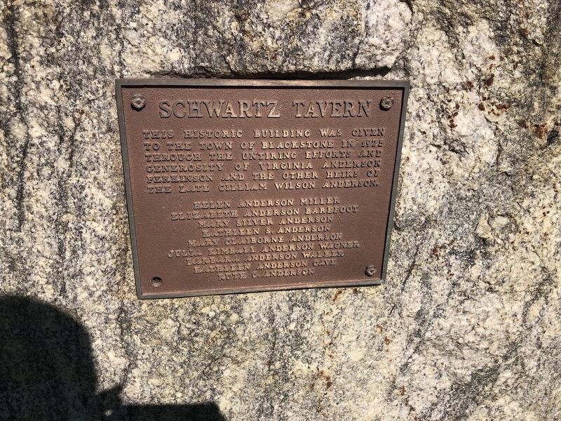
3. Nearby dedication plaque for Schwartz Tavern
Regarding Black’s and White’s Station. Schwartz Tavern was originally operated by John A. Schwartz. Since Schwartz is German for Black, his tavern was known as Black's. Another tavern in Blackstone was operated by a man named White. The crossroads stop for stagecoaches was called Black's and White's after the two rival tavern keepers. The name remained the same until 1886 when citizens adopted the name of the noted English jurist, Blackstone.
Also see . . . Southside Virginia & Lee's Retreat. Wilson-Kautz Raid. Civil War Traveler website. (Submitted on December 27, 2008, by Bill Coughlin of Woodland Park, New Jersey.)

Photographed By Devry Becker Jones (CC0), September 24, 2021
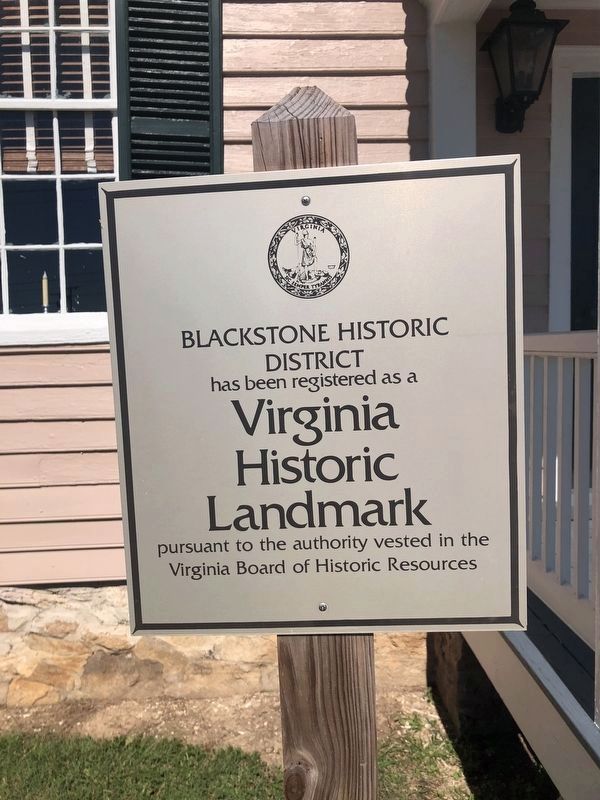
4. Virginia Historic Landmark plaque for Schwartz Tavern
Credits. This page was last revised on September 26, 2021. It was originally submitted on December 27, 2008, by Bill Coughlin of Woodland Park, New Jersey. This page has been viewed 2,051 times since then and 68 times this year. Photos: 1, 2. submitted on December 27, 2008, by Bill Coughlin of Woodland Park, New Jersey. 3, 4. submitted on September 26, 2021, by Devry Becker Jones of Washington, District of Columbia.

