Hermitage in Davidson County, Tennessee — The American South (East South Central)
Stone Hall / Eversong
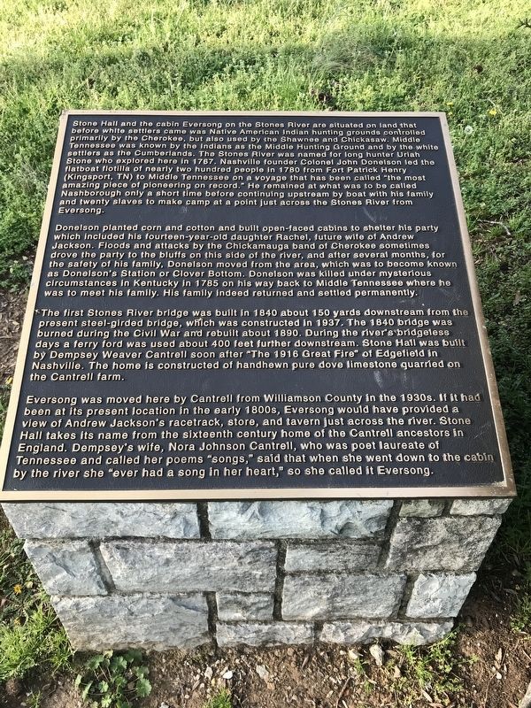
Stone Hall and the cabin Eversong on the Stones River are situated on land that before white settlers came was Native American Indian hunting grounds controlled primarily by the Cherokee, but also used by the Shawnee and Chickasaw. Middle Tennessee was known by the Indians as the Middle Hunting Ground and by the white settlers as the Cumberlands. The Stones River was named for long hunter Uriah Stone who explored here in 1767. Nashville founder Colonel John Donelson led the flatboat flotilla of nearly two hundred people in 1780 from Fort Patrick Henry (Kingsport, TN) to Middle Tennessee on a voyage that has been called “the most amazing piece of pioneering on record.” He remained at what was to be called Nashborough only a short time before continuing upstream by boat with his family and twenty slaves to make camp at a point just across the Stones River from Eversong.
Donelson planted corn and cotton and built open-faced cabins to shelter his party which included his fourteen-year-old daughter Rachel, future wife of Andrew Jackson. Floods and attacks by the Chickamauga band of Cherokee sometimes drove the party to the bluffs on this side of the river, and after several months, for the safety of his family, Donelson moved from the area, which was to become known as Donelson's Station or Clover Bottom. Donelson was killed under mysterious circumstances in Kentucky in 1785 on his way back to Middle Tennessee where he was to meet his family. His family indeed returned and settled permanently.
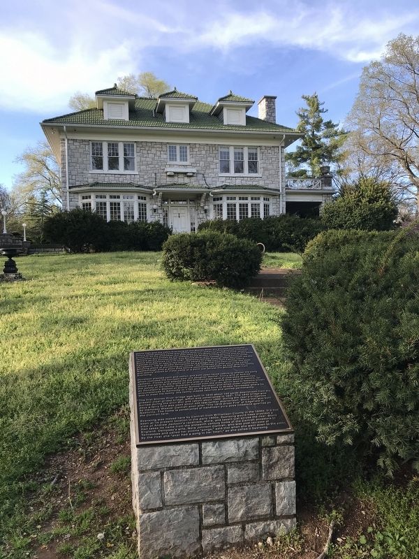
The first Stones River bridge was built in 1840 about 150 yards downstream from the present steel-girded bridge, which was constructed in 1937. The 1840 bridge was burned during the Civil War and rebuilt about 1890. During the river's bridgeless days a ferry ford was used about 400 feet further downstream. Stone Hall was built by Dempsey Weaver Cantrell soon after "The 1916 Great Fire” of Edgefield in Nashville. The home is constructed of handhewn pure dove limestone quarried on the Cantrell farm.
Eversong was moved here by Cantrell from Williamson County in the 1930s. If it had been at its present location in the early 1800s, Eversong would have provided a view of Andrew Jackson's racetrack, store, and tavern just across the river. Stone Hall takes its name from the sixteenth century home of the Cantrell ancestors in England. Dempsey's wife, Nora Johnson Cantrell, who was poet laureate of Tennessee and called her poems "songs,” said that when she went down to the cabin by the river she "ever had a song in her heart,” so she called it Eversong.
Erected by Metropolitan Nashville Board of Parks and Recreation.
Topics and series. This historical marker is listed in these topic lists: Architecture • Arts, Letters, Music • Colonial Era • Settlements & Settlers. In addition, it is included in the Former U.S. Presidents: #07 Andrew Jackson series list. A significant historical year for this entry is 1767.
Location. 36° 11.269′ N, 86° 37.971′ W. Marker is in Hermitage, Tennessee, in Davidson County. Marker can be reached from Lebanon Pike (U.S. 70) near Stones River Greenway, on the right when traveling west. The marker is accessible via a driveway in front of Stone Hall or by foot from Stones River Greenway parking lot. Touch for map. Marker is at or near this postal address: 1014 Stones River Road, Nashville TN 37214, United States of America. Touch for directions.
Other nearby markers. At least 8 other markers are within 2 miles of this marker, measured as the crow flies. Horse Barn, c. 1890s (approx. 1˝ miles away); Carriage House, c. 1850s (approx. 1˝ miles away); Slave Cabins, c. 1858 (approx. 1.6 miles away); Clover Bottom Farm (approx. 1.6 miles away); Chicken House, c. 1920s (approx. 1.6 miles away); Clover Bottom Mansion (approx. 1.6 miles away); Dodson School (approx. 1.6 miles away); The Hermitage (approx. 1.7 miles away). Touch for a list and map of all markers in Hermitage.
Credits. This page was last revised on February 7, 2023. It was originally submitted on April 5, 2020, by Duane and Tracy Marsteller of Murfreesboro, Tennessee. This page has been viewed 1,445 times since then and 266 times this year. Photos: 1, 2. submitted on April 5, 2020, by Duane and Tracy Marsteller of Murfreesboro, Tennessee. • J. Makali Bruton was the editor who published this page.

