High Falls in Ulster County, New York — The American Northeast (Mid-Atlantic)
High Falls War Memorial
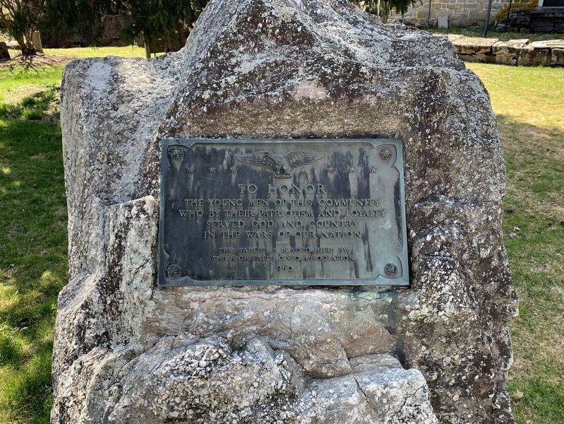
Photographed by Steve Stoessel, April 4, 2020
1. High Falls War Memorial
To honor the young men of this community who by their patriotism and loyalty served God and country in the wars of our nation this tablet is placed here by the High Falls Civic Association.
Erected 1960 by High Falls Civic Assocation.
Topics. This memorial is listed in this topic list: Military.
Location. 41° 49.627′ N, 74° 7.645′ W. Memorial is in High Falls, New York, in Ulster County. It is at the intersection of Second Street and Main Street (New York State Route 213), on the right when traveling south on Second Street. Marker is in front of the Old Depuy House. Touch for map. Memorial is in this post office area: High Falls NY 12440, United States of America. Touch for directions.

Regionally, this memorial is in Upstate New York and in the Hudson Valley. It is also in the American Northeast, in the Mid-Atlantic, and on the Eastern Seaboard. Globally, it is in the North Atlantic Region, North America, the Western Hemisphere, the Western World, and the Anglosphere. Historically, it finds itself in what was once New Netherland and also one of the
this page online
Other nearby markers. At least 8 other markers are within walking distance of this marker: Delaware and Hudson Canal (a few steps from this marker); Old Depuy House (a few steps from this marker); Old Stone Aqueduct (a few steps from this marker); Hoggees (a few steps from this marker); Canal Aqueduct (a few steps from this marker); Telegraph Office (a few steps from this marker); Roebling Aqueduct Abutment Trail (within shouting distance of this marker); Discovery of Cement (about 300 feet away, measured in a direct line). Touch for a list and map of all markers in High Falls.
Credits. This page was last revised on June 22, 2026. It was originally submitted on April 6, 2020, by Steve Stoessel of Niskayuna, New York. This page has been viewed 216 times since then and 21 times this year. Photo 1. submitted on April 6, 2020, by Steve Stoessel of Niskayuna, New York. • Michael Herrick was the editor who published this page.
Editor’s want-list for this marker. A wide angle photo of the marker and its surroundings. • Can you help?
