Near Salem in Roanoke County, Virginia — The American South (Mid-Atlantic)
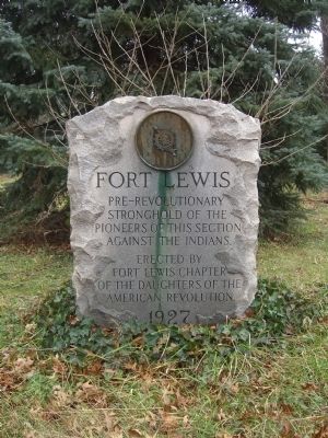
Fort Lewis
Erected 1927 by Fort Lewis Chapter, Daughters of the American Revolution.
Topics and series. This historical marker is listed in these topic lists: Colonial Era • Forts and Castles. In addition, it is included in the Daughters of the American Revolution series list.
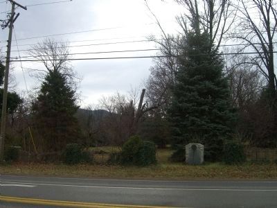
Location. 37° 16.747′ N, 80° 7.293′ W. Marker is near Salem, Virginia, in Roanoke County. Marker is at the intersection of West Main Street (U.S. 11) and Hawley Drive, on the right when traveling north on West Main Street. Touch for map. Marker is in this post office area: Salem VA 24153, United States of America. Touch for directions.
Other nearby markers. At least 8 other markers are within 4 miles of this marker, measured as the crow flies. A different marker also named Fort Lewis (a few steps from this marker); Colonial Mansion Site (within shouting distance of this marker); 9-11-2001 Memorial (approx. 1.2 miles away); Roanoke College (approx. 1.6 miles away); Preston Place (approx. 1.8 miles away); Roanoke College Administration Building (approx. 3.8 miles away); Roanoke County Confederate Monument (approx. 3.8 miles away); World War 1917 - 1919 Memorial (approx. 3.8 miles away). Touch for a list and map of all markers in Salem.
Credits. This page was last revised on June 2, 2017. It was originally submitted on December 28, 2008, by Kevin W. of Stafford, Virginia. This page has been viewed 1,909 times since then and 99 times this year. Photos: 1, 2. submitted on December 28, 2008, by Kevin W. of Stafford, Virginia.

