Mount Vernon in Fairfax County, Virginia — The American South (Mid-Atlantic)
Commerce and Transportation
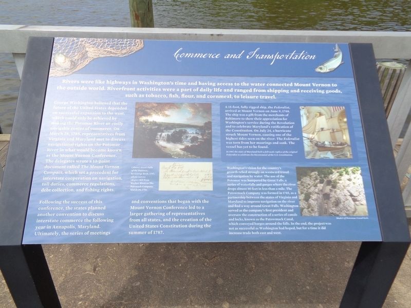
Rivers were like highways in Washington's time and having access to the water connected Mount Vernon to the outside world. Riverfront activities were a part of daily life and ranged from shipping and receiving goods, such as tobacco, fish, flour, and cornmeal, to leisure travel.
George Washington believed that the future of the United States depended on successful expansion to the west, which could only be achieved by making the Potomac River an easily navigable center of commerce. On March 28, 1785, representatives from Virginia and Maryland met to discuss navigational rights on the Potomac River in what would become known as the Mount Vernon Conference. The delegates wrote a 13-point document called The Mount Vernon Compact, which set a precedent for interstate cooperation on navigation, toll duties, commerce regulations, debt collection, and fishing rights.
Following the success of this conference, the states planned another convention to discuss interstate commerce the following year in Annapolis, Maryland. Ultimately, the series of meetings and conventions that began with the Mount Vernon Conference led to a larger gathering of representatives from all states, and the creation of the United States Constitution during the summer of 1787.
(top sidebar)
A 15-foot, fully rigged ship, the Federalist, arrived at Mount Vernon on June 9, 1788. The ship was a gift from the merchants of Baltimore to show their appreciation for Washington's service during the Revolution and to celebrate Maryland's ratification of the Constitution. On July 24, a hurricane struck Mount Vernon, causing one of the highest tides seen on the river. The Federalist was torn from her moorings and sank. The vessel has yet to be found.
In 1987, the state of Maryland built a full-scale replica of the original Federalist to celebrate the bicentennial of the U.S. Constitution.
(bottom sidebar)
Washington's vision for the country's growth relied strongly on westward travel and navigation by water. The use of the Potomac was hampered by Great Falls, a series of waterfalls and gorges where the river drops almost 80 feet in less than a mile. The Patowmack Company was formed in 1785, as a partnership between the states of Virginia and Maryland to improve navigation on the river and find a way around great Falls. Washington served as the company's first president and oversaw the construction of a series of canals and locks, known as the Patowmack Canal, which conveyed barges around the falls. In the end, the project was not as successful as Washington had hoped, but for a time it did increase trade both east and west.
Topics. This historical
marker is listed in these topic lists: Industry & Commerce • Waterways & Vessels.
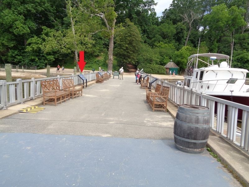
Location. 38° 42.301′ N, 77° 5.292′ W. Marker is in Mount Vernon, Virginia, in Fairfax County. Marker can be reached from Mount Vernon Highway (Virginia Route 235) near George Washington Memorial Highway. Marker is located at the Mount Vernon Wharf, which is on the grounds of George Washington's Mount Vernon estate. Touch for map. Marker is at or near this postal address: 3200 Mount Vernon Hwy, Alexandria VA 22309, United States of America. Touch for directions.
Other nearby markers. At least 8 other markers are within walking distance of this marker. History of the Wharf (here, next to this marker); Preserving the Viewshed (a few steps from this marker); War at our Doorstep (a few steps from this marker); Home of George and Martha Washington / See Mount Vernon From The Water! (a few steps from this marker); The Potomac Watershed (a few steps from this marker); George Washington's Fisheries (a few steps from this marker); The Mount Vernon Wharf (within shouting distance of this marker); Visionary Farmer (within shouting distance of this marker). Touch for a list and map of all markers in Mount Vernon.
Credits. This page was last revised on July 17, 2023. It was originally submitted on April 13, 2020, by Jason Voigt of Glen Carbon, Illinois. This page has been viewed 136 times since then and 11 times this year. Photos: 1, 2. submitted on April 13, 2020, by Jason Voigt of Glen Carbon, Illinois. • Bernard Fisher was the editor who published this page.

