Marker Logo
THE HISTORICAL
MARKER DATABASE
“Bite-Size Bits of Local, National, and Global History”
Near Spotsylvania Courthouse in Spotsylvania County, Virginia — The American South (Mid-Atlantic)
 

John J. Wright School
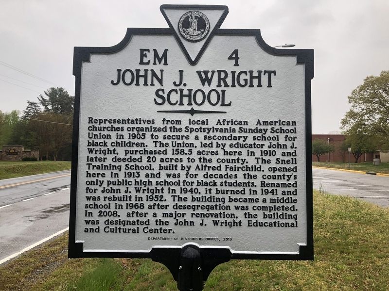
 
 
John J. Wright School Marker image. Click for full size.
Photographed by Devry Becker Jones (CC0), April 18, 2020
1. John J. Wright School Marker
Inscription. Representatives from local African American churches organized the Spotsylvania Sunday School Union in 1905 to secure a secondary school for black children. The Union, led by educator John J. Wright, purchased 158.5 acres here in 1910 and later deeded 20 acres to the county. The Snell Training School, built by Alfred Fairchild, opened here in 1913 and was for decades the only public high school for black students. Renamed for John J. Wright in 1940, it burned in 1941 and was rebuilt in 1952. The building became a middle school in 1968 after desegregation was completed. In 2008, after a major renovation, the building was designated the John J. Wright Educational and Cultural Center.
 
Erected 2019 by Department of Historic Resources. (Marker Number EM-4.)
 
Topics and series. This historical marker is listed in these topic lists: African AmericansEducationReligion & Religious Structures. In addition, it is included in the Virginia Department of Historic Resources (DHR) series list. A significant historical year for this entry is 1905.
 
Location. 38° 9.301′ N, 77° 36.015′ W. Marker is near Spotsylvania Courthouse,
Paid Advertisement
Click or scan to see
this page online
Virginia, in Spotsylvania County. It is on Courthouse Road (Virginia Route 208) just south of Warwick Plantation Lane, on the left when traveling south. Touch for map. Marker is at or near this postal address: 7565 Courthouse Rd, Spotsylvania VA 22551, United States of America. Touch for directions.

Regionally, this marker is in the Washington Metropolitan Area, in Northern Virginia, and in the Piedmont. It is also in the American South, specifically in the Upper South, in the Mid-Atlantic, and on the Eastern Seaboard. Globally, it is in the North Atlantic Region, North America, the Western Hemisphere, the Western World, and the Anglosphere. Historically, it finds itself in what was once the territory of the Mississippian Culture, one of the original Thirteen Colonies, one of the Confederate States of America, and the Antebellum South.

Other nearby markers. At least 8 other markers are within 3 miles of this marker, measured as the crow flies: Secondary Education for African American Children (within shouting distance of this marker); Spotsylvania Sunday School Union Parksite (within shouting distance of this marker);
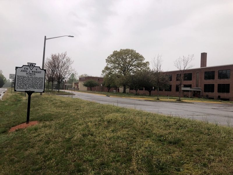
John J. Wright School Marker image. Click for full size.
Photographed by Devry Becker Jones (CC0), April 18, 2020
2. John J. Wright School Marker
John J. Wright Parksite (about 700 feet away, measured in a direct line); Third Spotsylvania County Courthouse Site (approx. 2.2 miles away); Penny’s Tavern Site (approx. 2.3 miles away); Batter Up: Spotsylvania Yellow Jackets (approx. 2.6 miles away); Civil War Veterans at Rest in Zion's Cemetery (approx. 2.8 miles away); Zion Methodist Church (approx. 2.8 miles away). Touch for a list and map of all markers in Spotsylvania Courthouse.
 
Another marker is no longer nearby. Civil War Veterans at rest in Zion's Cemetery (was approx. 2.8 miles away but has been replaced with another marker now near it).
 
 
Credits. This page was last revised on March 1, 2024. It was originally submitted on April 19, 2020, by Devry Becker Jones of Washington, District of Columbia. This page has been viewed 595 times since then and 54 times this year. Photos:   1, 2. submitted on April 19, 2020, by Devry Becker Jones of Washington, District of Columbia.

m=148423

CeraNet Cloud Computing sponsors the Historical Marker Database.
This website earns income from purchases you make after using our links to Amazon.com. We appreciate your support.
Paid Advertisement
Jul. 22, 2026
