Fredericksburg, Virginia — The American South (Mid-Atlantic)
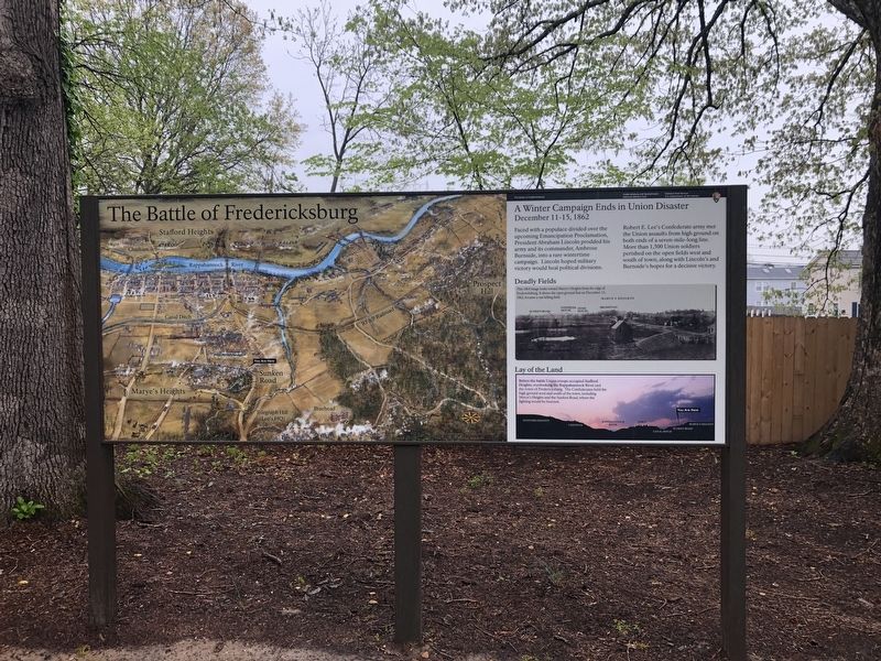
A Winter Campaign Ends in Union Disaster
December 11-15, 1862
— The Battle of Fredericksburg, Fredericksburg and Spotsylvania National Military Park —

Photographed By Devry Becker Jones (CC0), April 18, 2020
1. A Winter Campaign Ends in Union Disaster Marker
Faced with a populace divided over the upcoming Emancipation Proclamation, President Abraham Lincoln prodded his army and its commander, Ambrose Burnside, into a rare wintertime campaign. Lincoln hoped military victory would heal political divisions.
Robert E. Lee's Confederate army met the Union assaults from high ground on both ends of a seven-mile-long line. More than 1,500 Union soldiers perished on the open fields west and south of town, along with Lincoln's and Burnside's hopes for a decisive victory.
[Captions:]
Deadly Fields
This 1864 image looks toward Marye's Heights from the edge of Fredericksburg. It shows the open ground that on December 13, 1862, became a vast killing field.
Lay of the Land
Before the battle Union troops occupied Stafford Heights, overlooking the Rappahannock River and the town of Fredericksburg. The Confederates held the high ground west and south of the town, including Marye's Heights and the Sunken Road, where fighting would be heaviest.
Erected by National Park Service, U.S. Department of the Interior.
Topics. This historical marker is listed in this topic list: War, US Civil. A significant historical date for this entry is December 11, 1862.
Location. 38° 17.643′ N, 77° 28.033′ W. Marker is in Fredericksburg, Virginia. Marker is on Sunken Road, 0.1 miles north of Lafayette Boulevard, on the right when traveling north. Touch for map. Marker is in this post office area: Fredericksburg VA 22401, United States of America. Touch for directions.
Other nearby markers. At least 8 other markers are within walking distance of this marker. A Segregated Park Service (a few steps from this marker); Fredericksburg and Spotsylvania National Military Park (within shouting distance of this marker); Fredericksburg Battlefield (within shouting distance of this marker); Fredericksburg National Cemetery (within shouting distance of this marker); The Sunken Road (within shouting distance of this marker); Sunken Road Walking Trail (about 300 feet away, measured in a direct line); The Fifth Corps, Army of the Potomac (about 400 feet away); Field of Battle (about 400 feet away). Touch for a list and map of all markers in Fredericksburg.
Credits. This page was last revised on February 2, 2023. It was originally submitted on April 19, 2020, by Devry Becker Jones of Washington, District of Columbia. This page has been viewed 316 times since then and 31 times this year. Photo 1. submitted on April 19, 2020, by Devry Becker Jones of Washington, District of Columbia.