Spokane in Spokane County, Washington — The American West (Northwest)
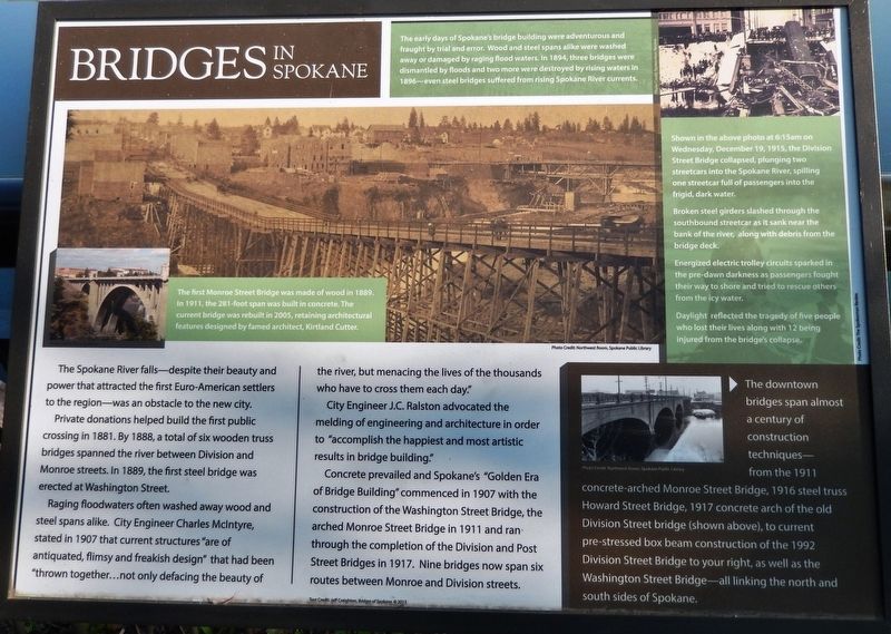
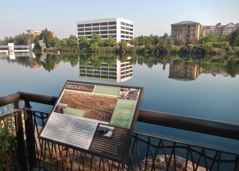
Bridges in Spokane
Private donations helped build the first public crossing in 1881. By 1888, a total of six wooden truss bridges spanned the river between Division and Monroe streets. In 1889, the first steel bridge was erected at Washington Street.
Raging floodwaters often washed away wood and steel spans alike. City Engineer Charles McIntyre, stated in 1907 that current structures “are of antiquated, flimsy and freakish design” that had been “thrown together...not only defacing the beauty of the river, but menacing the lives of the thousands who have to cross them each day.”
City Engineer J.C. Ralston advocated the melding of engineering and architecture in order to “accomplish the happiest and most artistic results in bridge building.”
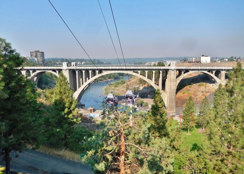
Concrete prevailed and Spokane's “Golden Era of Bridge Building” commenced in 1907 with the construction of the Washington Street Bridge, the arched Monroe Street Bridge in 1911 and ran through the completion of the Division and Post Street Bridges in 1917. Nine bridges now span six routes between Monroe and Division streets.
The early days of Spokane’s bridge building were adventurous and fraught by trial and error. Wood and steel spans alike were washed away or damaged by raging flood waters. In 1894, three bridges were dismantled by floods and two more were destroyed by rising waters in 1896 — even steel bridges suffered from rising Spokane River currents.
Topics. This historical marker is listed in these topic lists: Architecture • Bridges & Viaducts • Disasters. A significant historical year for this entry is 1889.
Location. 47° 39.717′ N, 117° 24.726′ W. Marker is in Spokane, Washington, in Spokane County. Marker can be reached from the intersection of North Division Street (U.S. 395) (U.S. 2) and East Olive Avenue, on the left when traveling north. Marker is located along the Centennial Trail, overlooking the Spokane River, just west of North Division Street. Touch for map. Marker is in this post office area: Spokane WA 99201, United States of America. Touch for directions.
Other nearby markers. At least 8 other markers are within walking distance of this marker. How the River Became Home for Sqelix — Spokane Tribe (within shouting distance of this marker); What's in the Water (within shouting distance of this marker); An Evolving Shoreline (about 500 feet away, measured in a direct line); Industry on the Spokane River (about 600 feet away); A Legacy of Railroads
Courtesy Northwest Room, Spokane Public Library
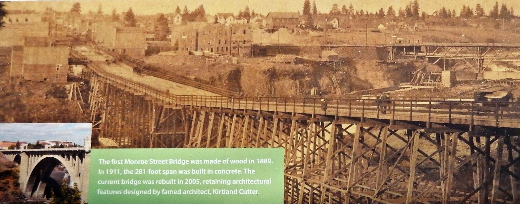
2. Marker detail: First Monroe Street Bridge
The first Monroe Street Bridge was made of wood in 1889. In 1911, the 281-foot span was built in concrete. The current bridge was rebuilt in 2005, retaining architectural features designed by famed architect, Kirtland Cutter.
Related markers. Click here for a list of markers that are related to this marker. Monroe Street Bridge
Also see . . .
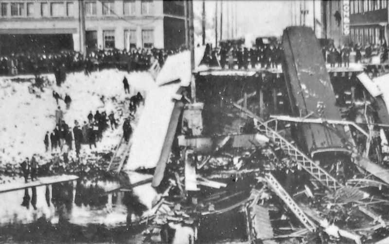
1. Division Street Bridge History (Wikipedia). The original bridge was a wooden truss structure built in 1882, which was replaced in 1892 by the steel bridge. The bridge was designed with two streetcar tracks, roadbed for horse and wagon (and, later, automobile) traffic, and pedestrian sidewalks. On December 18, 1915, two Washington Water Power trolley cars were crossing the steel bridge, one headed north and the other south, when the beams gave way. The northbound streetcar had nearly reached the far side and its snow scrapers snagged on debris on the north side, preventing it from rolling back into the river. All the fatalities and injuries came from the southbound car, which was heading downtown with 15 to 17 passengers, and close to the middle of the span when it fell. (Submitted on April 20, 2020, by Cosmos Mariner of Cape Canaveral, Florida.)
Courtesy Spokesman-Review
3. Marker detail: Division Street Bridge Collapse • 1915
Shown in the above photo at 6:15am on Wednesday, December 19, 1915, the Division Street Bridge collapsed, plunging two streetcars into the Spokane River, spilling one streetcar full of passengers into the frigid, dark water.
Broken steel girders slashed through the southbound streetcar as it sank near the bank of the river, along with debris from the bridge deck.
Energized electric trolley circuits sparked in the pre-dawn darkness as passengers fought their way to shore and tried to rescue others from the icy water.
Daylight reflected the tragedy of five people who lost their lives along with 12 being injured from the bridge's collapse.
2. Monroe Street Bridge History (Wikipedia). The current bridge of 1911 is the third in this location. The first, a rather rickety wooden structure, was built in 1889. It was closed for a time due to arguments in the city over rights of passage and ownership, and burned down in 1890. The second was a steel bridge that opened in 1892. It vibrated badly and had a noticeable dip in the center. The design of the third bridge was largely copied from the Rocky River Bridge in Cleveland, Ohio, but was built one foot longer to make it the largest concrete arch in the U.S. at the time. (Submitted on April 20, 2020, by Cosmos Mariner of Cape Canaveral, Florida.)
Courtesy Northwest Room, Spokane Public Library
4. Marker detail: “Old” Division Street Bridge • 1917
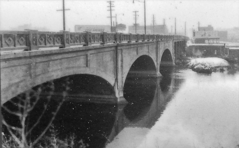
The downtown bridges span almost a century of construction techniques — from the 1911 concrete-arched Monroe Street Bridge, 1916 steel truss Howard Street Bridge, 1917 concrete arch of the old Division Street bridge (shown above), to current pre-stressed box beam construction of the 1992 Division Street Bridge to your right, as well as the Washington Street Bridge — all linking the north and south sides of Spokane.
Credits. This page was last revised on April 21, 2020. It was originally submitted on April 20, 2020, by Cosmos Mariner of Cape Canaveral, Florida. This page has been viewed 341 times since then and 45 times this year. Photos: 1, 2, 3, 4, 5, 6. submitted on April 20, 2020, by Cosmos Mariner of Cape Canaveral, Florida.
