Spokane in Spokane County, Washington — The American West (Northwest)
The First Bridges
Yesterday's Crossings
—E.T. Coman, president of the Spokane Chamber of Commerce, at the dedication of the Monroe Street Bridge in 1911.
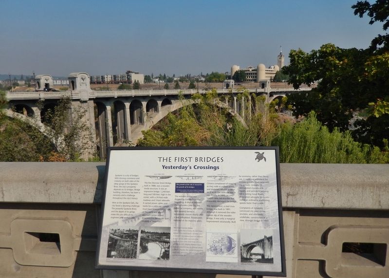
Spokane is a city of bridges. With thriving commerce and industry on both sides of the deep gorge of the Spokane River, the city's prosperity depends on its bridges. Bridge building, therefore, has been a necessity and a challenge throughout the city's history.
Here at the Spokane Falls, the city faced a daunting challenge. The powerful Spokane River, and the depth of its gorge, make this site difficult for engineers and workers alike.
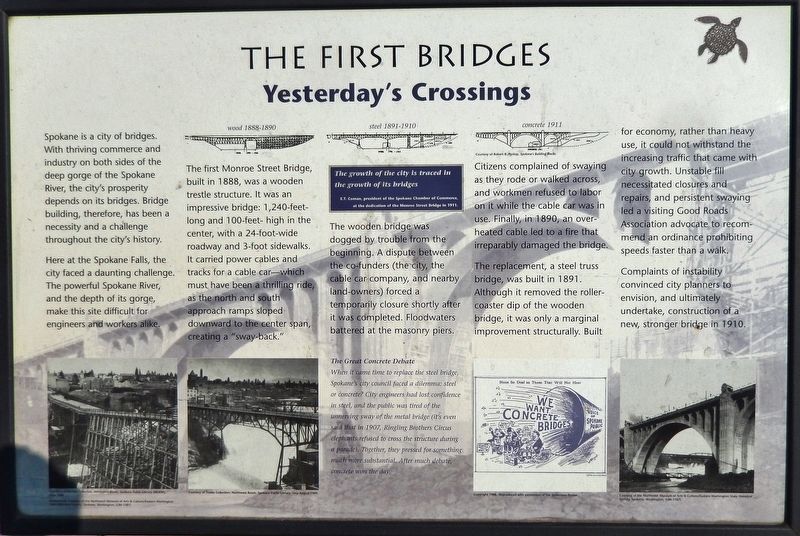
The first Monroe Street Bridge, built in 1888, was a wooden trestle structure. It was an impressive bridge: 1,240-feet-long and 100-feet-high in the center, with a 24-foot-wide roadway and 3-foot sidewalks. It carried power cables and tracks for a cable car — which must have been a thrilling ride, as the north and south approach ramps sloped downward to the center span, creating a “sway-back.”
The wooden bridge was dogged by trouble from the beginning. A dispute between the co-funders (the city, the cable car company, and nearby land-owners) forced a temporary closure shortly after it was completed. Floodwaters battered at the masonry piers.
Citizens complained of swaying as they rode or walked across, and workmen refused to labor on it while the cable car was in use. Finally, in 1890, an over-heated cable led to a fire that irreparably damaged the bridge.
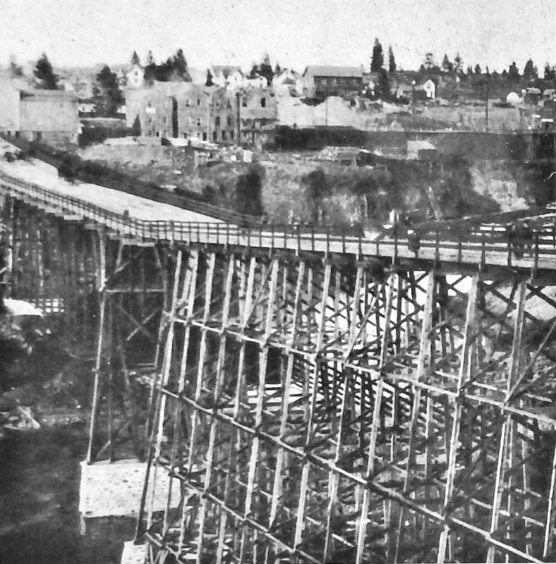
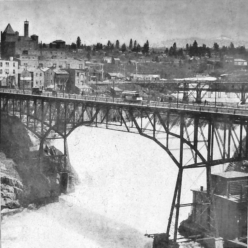
The replacement, a steel truss bridge, was built in 1891. Although it removed the roller-coaster dip of the wooden bridge, it was only a marginal improvement structurally. Built for economy, rather than heavy use, it could not withstand the increasing traffic that came with city growth. Unstable fill necessitated closures and repairs, and persistent swaying led a visiting Good Roads Association advocate to recommend an ordinance prohibiting speeds faster than a walk.
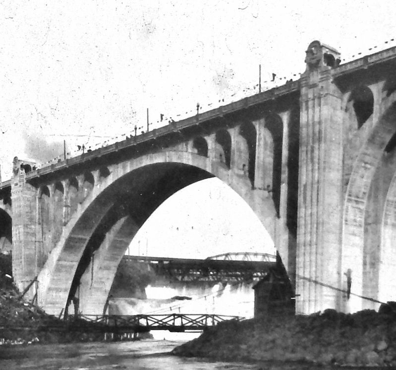
Complaints of instability convinced city planners to envision, and ultimately undertake, construction of a new, stronger bridge in 1910.
The Great Concrete Debate
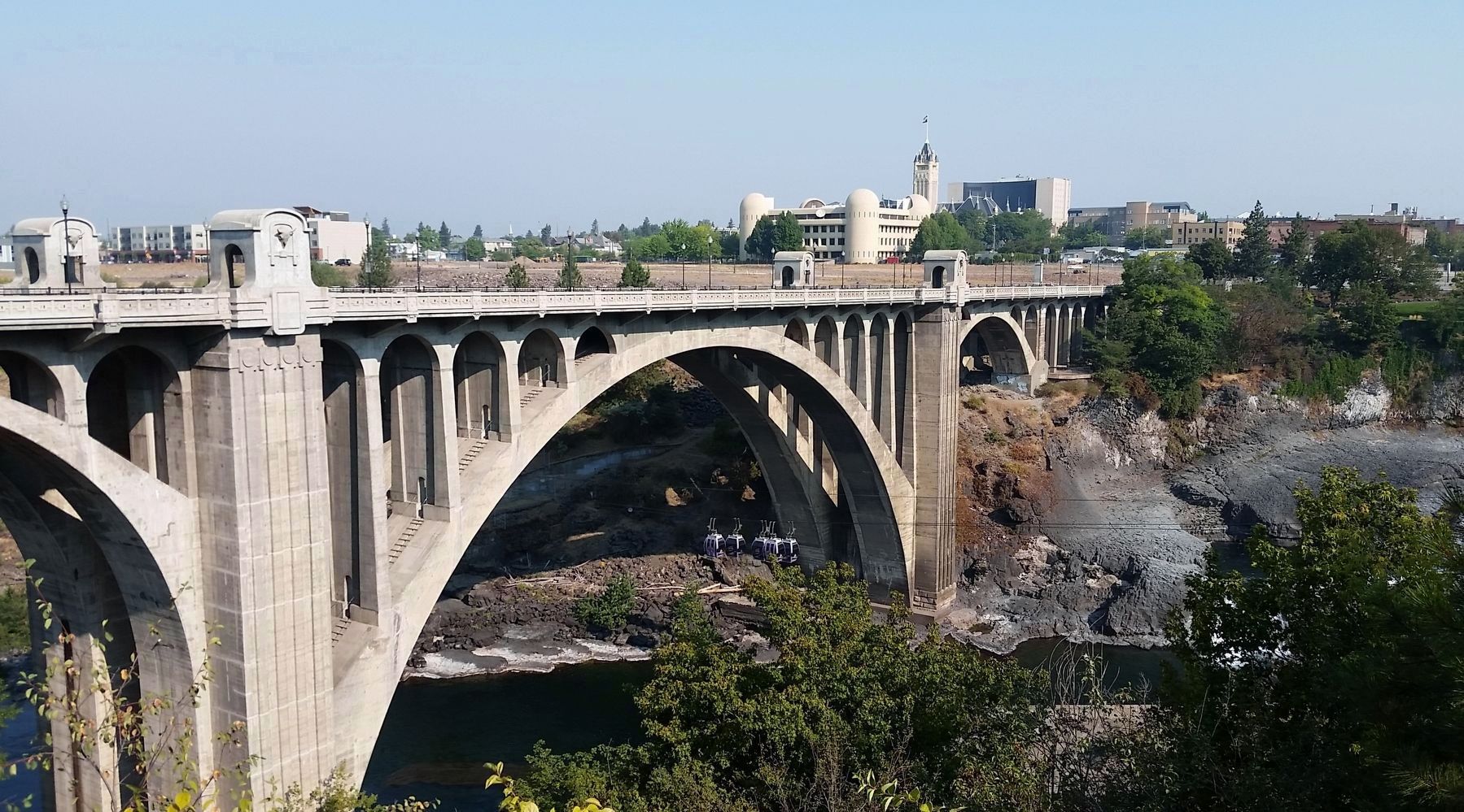
When it came time to replace the steel bridge, Spokane's city council faced a dilemma: steel or concrete? City engineers had lost confidence in steel, and the public was tired of the unnerving sway of the metal bridge (it's even said that in 1907, Ringling Brothers Circus elephants refused to cross the structure during a parade). Together, they pressed for something much more substantial. After much debate, concrete won the day.
Topics. This historical marker is listed in these topic lists: Architecture
• Bridges & Viaducts.
Location. 47° 39.595′ N, 117° 25.533′ W. Marker is in Spokane, Washington, in Spokane County. Marker is on West Spokane Falls Boulevard west of North Lincoln Street, on the right when traveling west. Marker is located beside the sidewalk, overlooking the Monroe Street Bridge. Touch for map. Marker is in this post office area: Spokane WA 99201, United States of America. Touch for directions.
Other nearby markers. At least 8 other markers are within walking distance of this marker. Symbol of Spokane (a few steps from this marker); Spokane River (a few steps from this marker); Monroe Street Bridge (within shouting distance of this marker); Abraham Lincoln (about 300 feet away, measured in a direct line); City Hall (about 500 feet away); Monroe Bridge (about 500 feet away); John Robert Monaghan (about 600 feet away); Spokane's Electric Streetcars (about 600 feet away). Touch for a list and map of all markers in Spokane.
Regarding The First Bridges. National Register of Historic Places #76001920.
Related markers. Click here for a list of markers that are related to this marker. Monroe Street Bridge
Credits. This page was last revised on April 21, 2020. It was originally submitted on April 21, 2020, by Cosmos Mariner of Cape Canaveral, Florida. This page has been viewed 169 times since then and 7 times this year. Photos: 1, 2, 3, 4, 5, 6. submitted on April 21, 2020, by Cosmos Mariner of Cape Canaveral, Florida.
