Near Watrous in Mora County, New Mexico — The American Mountains (Southwest)
The End of the Road
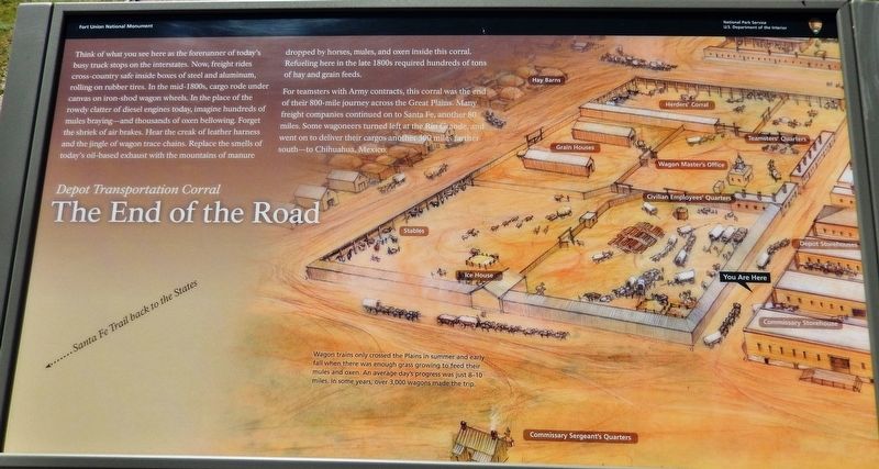
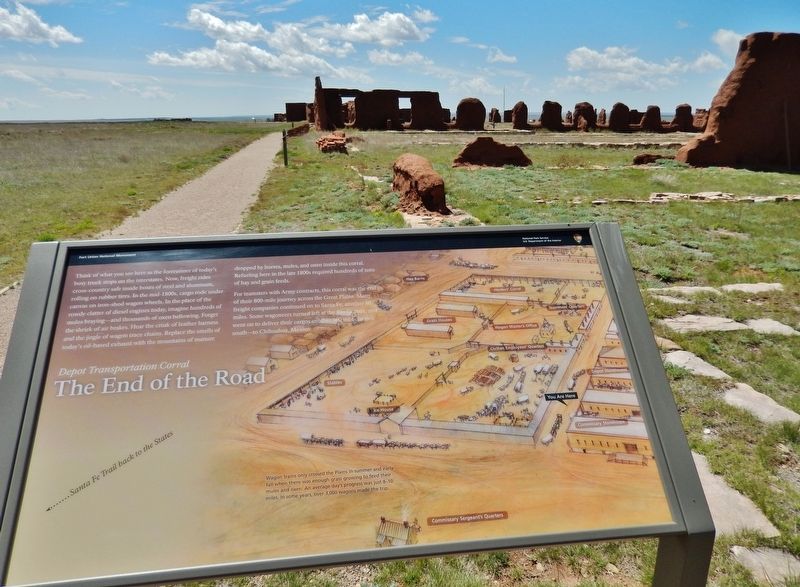
Depot Transportation Corral
— Fort Union National Monument —
For teamsters with Army contracts, this corral was the end of their 800-mile journey across the Great Plains. Many freight companies continued on to Santa Fe, another 80 miles. Some wagoneers turned left at the Rio Grande, and went on to deliver their cargos another 500 miles farther south — to Chihuahua, Mexico.
Wagon trains only crossed the Plains in summer and early fall when there was enough grass growing to feed their mules and oxen. An average day’s progress was just 8-10 miles. In some years, over 3,000 wagons made the trip.
Erected by National Park Service, U.S. Department of the Interior.
Topics and series. This historical marker is listed in these topic lists: Forts and Castles • Industry & Commerce • Roads & Vehicles. In addition, it is included in the Santa Fe Trail series list.
Location. 35° 54.578′ N, 105° 0.875′ W. Marker is near Watrous, New Mexico, in Mora County. Marker can be reached from New Mexico Route 161, 7˝ miles north of CanAm Highway (Interstate 25). Marker is located along the park trail at Fort Union National Monument. Touch for map. Marker is at or near this postal address: 3115 New Mexico Route 161, Watrous NM 87753, United States of America. Touch for directions.
Other nearby markers. At least 8 other markers are within walking distance of this marker. Commissary Storehouse (within shouting distance of this marker); Enough to Feed an Army (within shouting distance of this marker); Separate Worlds (about 300 feet away, measured in a direct line); Keep the Wagons Rolling (about 300 feet away); Depot Officers' Quarters (about 300 feet away); Transportation Corral (about 400 feet away); Quartermaster Clerks' Office (about 500 feet away); Big Business for New Mexico (about 500 feet away). Touch for a list and map of all markers in Watrous.
Related markers. Click here for a list of markers that are related to this marker. Fort Union National Monument
Also see . . .
A History of Fort Union. Transportation officers supervised wagon parks, mule corrals, and up to 200 wagonmasters and teamsters. Blacksmiths, wheelwrights, farriers, painters, tinsmiths, carpenters, and plasterers kept buildings, wagons, and draught animals in repair. Where possible, quartermaster and subsistence needs were procured by local contract. Forage for animals, beef cattle, heating fuel, flour, lumber, and vegetables were all procured locally, providing federal dollars for everyone from the small grower to the large contractor. (Submitted on May 1, 2020, by Cosmos Mariner of Cape Canaveral, Florida.)
Credits. This page was last revised on September 29, 2020. It was originally submitted on April 27, 2020, by Cosmos Mariner of Cape Canaveral, Florida. This page has been viewed 114 times since then and 6 times this year. Photos: 1, 2, 3, 4. submitted on May 1, 2020, by Cosmos Mariner of Cape Canaveral, Florida.


