Chalmette in St. Bernard Parish, Louisiana — The American South (West South Central)
Denis de La Ronde Site
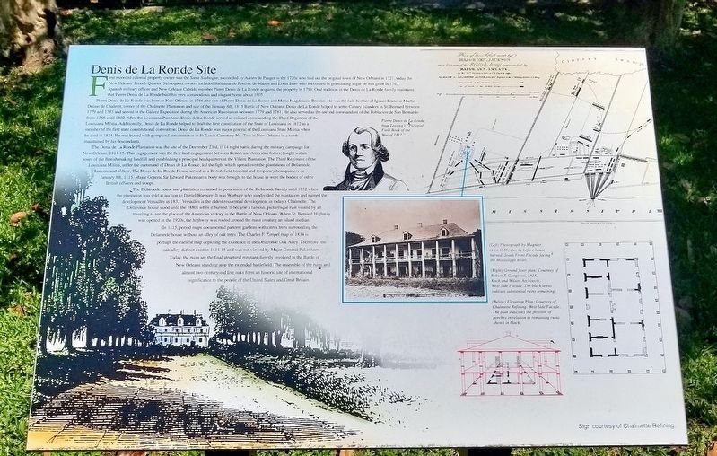
First recorded colonial property owner was the Sieur Saubugne, succeeded by Adrien de Pauger in the 1720s who laid out the original town of New Orleans in 1721, today the New Orleans' French Quarter. Subsequent owners included Balthazar de Ponfrac de Mazan and Louis Bore who succeeded in granulating sugar on this grant in 1763. Spanish military officer and New Orleans Cabildo member Pierre Denis de La Ronde acquired the property in 1799. Oral tradition in the Denis de La Ronde family maintains that Pierre Denis de La Ronde built his very commodious and elegant home about 1805.
Pierre Denis de La Ronde was born in New Orleans in 1766, the son of Pierre Denis de La Ronde and Marie Magdelaine Broutin. He was the half-brother of Ignace Francois Martin Delino de Chalmet, owner of the Chalmette Plantation and site of the January 8th, 1815 Battle of New Orleans. Denis de La Ronde helped to settle Canary Islanders in St. Bernard between 1779 and 1783 and served in the Galvez Expedition during the American Revolution between 1779 and 1781. He also served as the second commandant of the Poblacion de San Bernardo from 1788 until 1802. After the Louisiana Purchase, Denis de La Ronde served as colonel commanding the Third Regiment of the Louisiana Militia. Additionally, Denis de La Ronde helped to draft the first constitution of the State of Louisiana in 1812 as a member of the first state constitutional convention. Denis de La Ronde was major general of the Louisiana State Militia when he died in 1824. He was buried with pomp and circumstance in St. Louis Cemetery No. Two in New Orleans in a tomb maintained by his descendants.
The Denis de La Ronde Plantation was the site of the December 23rd, 1814 night battle during the military campaign for New Orleans, 1814-15. This engagement was the first land engagement between British and American forces, fought within hours of the British making landfall and establishing a principal headquarters at the Villere Plantation. The Third Regiment of the Louisiana Militia, under the command of Denis de La Ronde, led the fight which spread over the plantations of Delaronde, Lacoste and Villere. The Denis de La Ronde House served as a British field hospital and temporary headquarters on January 8th, 1815. Major General Sir Edward Pakenham's body was brought to the house as were the bodies of other British officers and troops.
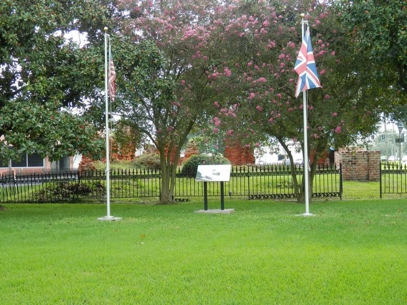
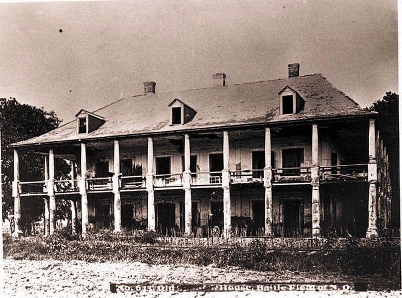
The Delaronde house and plantation remained in possession of the Delaronde family until 1832 when the plantation was sold at auction to Daniel Warburg. It was Warburg who subdivided the plantation and named the development Versailles in 1832. Versailles is the oldest residential development in today's Chalmette. The Delaronde house stood until the 1880s when it burned. It became a famous, picturesque ruin visited by all traveling to see the place of the American victory in the Battle of New Orleans. When St. Bernard Highway was opened in the 1920s, the highway was routed around the ruins creating an island median.
In 1815, period maps documented parterre gardens with citrus trees surrounding the Delaronde house without an alley of oak trees. The Charles F. Zimpel map of 1834 is perhaps the earliest map depicting the existence of the Delaronde Oak Alley. Therefore, the oak alley did not exist in 1814-15 and was not viewed by Major General Pakenham. Today, the ruins are the final structural remnant directly involved in the Battle of New Orleans standing atop the extended battlefield. The ensemble of the ruins and almost two-century-old live oaks form an historic site of international significance to the people of the United States and Great Britain.
Photo captions:
(Left) Photograph by Mugnier, circa 1885, shortly before house burned. South Front Facade facing the Mississippi River.
(Right) Ground floor plan: Courtesy of Robert T. Cangelosi, FAIA, Koch and Wilson Architects. West Side Facade. The black areas indicate substantial ruins remaining.
(Below) Elevation Plan: Courtesy of Chalmette Refining. West Side Facade. The plan indicates the position of porches in relation to remaining ruins shown in black.
(Portrait) Pierre Denis de La Ronde, from Lossing's "Pictorial Field Book of the War of 1812."
Erected by Chalmette Refining.
Topics. This historical marker is listed in these topic lists: Notable Buildings • War of 1812. A significant historical date for this entry is January 8, 1815.
Location. 29° 56.257′ N, 89° 58.071′ W. Marker is in Chalmette, Louisiana, in St. Bernard Parish. Marker is on West St Bernard Highway (Louisiana Route 46) east of Fenelon Street, in the median. Touch for map. Marker is in this post office area: Chalmette LA 70043, United States of America. Touch for directions.
Other nearby markers. At least 8 other markers are within 2 miles of this marker, measured as the crow flies. The Chalmette Plantations (a few steps from this marker); Plantation of Pierre Denis De La Ronde (within shouting distance of this marker); Versailles Oaks (within shouting distance of this marker); Lacoste Plantation (approx. 0.8 miles away); Chalmette Plantation (approx. 1.2 miles away); Serving Those Who Saved Us (approx. 1.2 miles away); Here We Honor Veterans Who Served Their Country (approx. 1.2 miles away); Chalmette National Cemetery (approx. 1.2 miles away). Touch for a list and map of all markers in Chalmette.
Also see . . . Delaronde Project. Restoration website homepage (Submitted on December 5, 2021, by Larry Gertner of New York, New York.)
Credits. This page was last revised on December 5, 2021. It was originally submitted on May 1, 2020, by Mark Hilton of Montgomery, Alabama. This page has been viewed 882 times since then and 113 times this year. Photos: 1. submitted on May 1, 2020, by Mark Hilton of Montgomery, Alabama. 2. submitted on December 18, 2020, by Cajun Scrambler of Assumption, Louisiana. 3. submitted on May 1, 2020, by Mark Hilton of Montgomery, Alabama.


