Ephraim Kirby's Grave
— Mount Vernon History Trail —
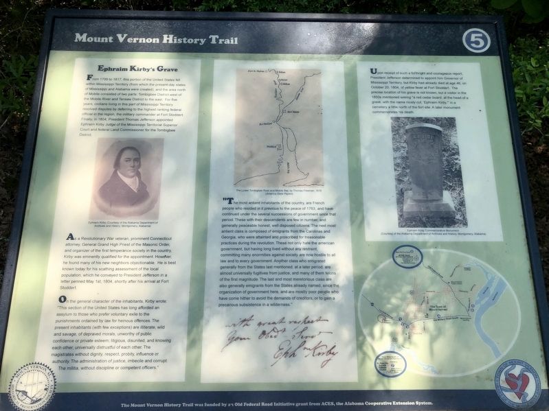
From 1799 to 1817, this portion of the United States fell. within Mississippi Territory (from which the present-day states of Mississippi and Alabama were created), and the area north of Mobile consisted of two parts: Tombigbee District west of the Mobile River and Tensaw District to the east. For five years, civilians living in this part of Mississippi Territory resolved disputes by deferring to the highest ranking federal official in the region, the military commander at Fort Stoddert. Finally, in 1804, President Thomas Jefferson appointed Ephraim Kirby Judge of the Mississippi Territorial Superior Court and federal Land Commissioner for the Tombigbee District.
As a Revolutionary War veteran, prominent Connecticut attorney, General Grand High Priest of the Masonic Order; and organizer of the first temperance society in the country, Kirby was eminently qualified for the appointment. However, he found many of his new neighbors objectionable. He is best known today for his scathing assessment of the local population, which he conveyed to President Jefferson in a letter penned May 1st, 1804, shortly after his arrival at Fort Stoddert.
On the general character of the inhabitants, Kirby wrote: "This section of the United States has long afforded an assylum to those who prefer voluntary exile to the punishments
ordained by law for heinous offences. The present inhabitants (with few exceptions) are illiterate, wild and savage, of depraved morals, unworthy of public confidence or private esteem; litigious, disunited, and knowing each other, universally distrustful of each other. The magistrates without dignity, respect, probity, influence or authority. The administration of justice, imbecile and corrupt. The militia, without discipline or competent officers.""The most antient inhabitants of the country, are French people who resided in it previous to the peace of 1763, and have continued under the several successions of government since that period. These with their descendents are few in number, and generally peaceable honest, well disposed citizens. The next most antient class is composed of emigrants from the Carolinas and Georgia, who were attainted and proscribed for treasonable practices during the revolution. These not only hate the american government, but having long lived without any restraint, committing many enormities against society are now hostile to all law and to every government. Another class who emigrated generally from the States last mentioned, at a later period, are almost universally fugitives from justice, and many of them felons of the first magnitude. The last and most meretorious class are also generally emigrants from the States
already named, since the organization of government here, and are mostly poor people who have come hither to avoid the demands of creditors, or to gain a precarious subsistence in a wilderness."Upon receipt of such a forthright and courageous report, President Jefferson determined to appoint him Governor of Mississippi Territory, but Kirby had already died at age 46, on October 20, 1804, of yellow fever at Fort Stoddert. The precise location of his grave is not known, but a visitor in the 1850s mentioned seeing "a red cedar board, at the head of a grave, with the name nicely cut, 'Ephraim Kirby,'" in a cemetery a little north of the fort site. A later monument commemorates his death.
Photo captions:
[Left] Ephraim Kirby (Courtesy of the Alabama Department of Archives and History, Montgomery, Alabama)
[Middle] The Lower Tombigbee River and Mobile Bay, by Thomas Freeman, 1816 (America State Papers)
[Right] Ephraim Kirby Commemorative Monument (Courtesy of the Alabama Department of Archives and History, Montgomery, Alabama)
Erected by Town of Mount Vernon. (Marker Number 5.)
Topics and series. This historical marker is listed in this topic list: Government & Politics. In addition, it is included in the Former U.S. Presidents: #03 Thomas Jefferson
Location. 31° 5.475′ N, 87° 58.889′ W. Marker is in Mt. Vernon, Alabama, in Mobile County. Marker is on Old Military Road East (Alabama Route 96) 0.1 miles north of Old Military Road South, on the right when traveling north. Touch for map. Marker is in this post office area: Mount Vernon AL 36560, United States of America. Touch for directions.
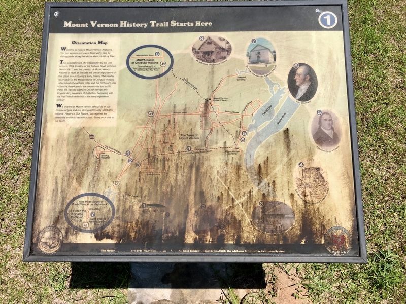
Other nearby markers. At least 8 other markers are within 5 miles of this marker, measured as the crow flies. Fort Stoddert (here, next to this marker); Old Military Road and Old Federal Road (approx. ¾ mile away); Mount Vernon Historical Museum and Train Depot (approx. 2 miles away); a different marker also named Fort Stoddert (approx. 2.1 miles away); Mt. Vernon Federal Highway (approx. 2.1 miles away); Mt. Vernon Arsenal and Barracks/Searcy Hospital (approx. 2½ miles away); Mount Vernon Arsenal (approx. 2½ miles away); St. Peter the Apostle Catholic Church (approx. 4.4 miles away). Touch for a list and map of all markers in Mt. Vernon.
Also see . . . Wikipedia article on Ephraim Kirby (February 23, 1757 – October 4, 1804). (Submitted on May 3, 2020, by Mark Hilton of Montgomery, Alabama.)
Credits. This page was last revised on November 17, 2020. It was originally submitted on May 3, 2020, by Mark Hilton of Montgomery, Alabama. This page has been viewed 535 times since then and 33 times this year. Photos: 1, 2, 3. submitted on May 3, 2020, by Mark Hilton of Montgomery, Alabama.


