Mobile in Mobile County, Alabama — The American South (East South Central)
The Shepard House
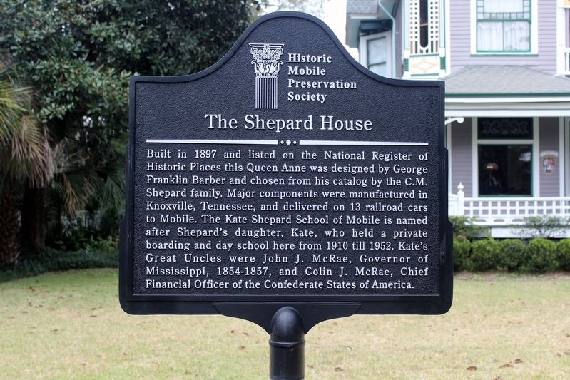
Photographed by Tim Fillmon, December 17, 2019
1. The Shepard House Marker
Erected by Historic Mobile Preservation Society.
Topics. This historical marker is listed in this topic list: Architecture. A significant historical year for this entry is 1897.
Location. 30° 41.052′ N, 88° 4.448′ W. Marker is in Mobile, Alabama, in Mobile County. It is at the intersection of Monterey Place and South Catherine Street, on the right when traveling west on Monterey Place. Touch for map. Marker is at or near this postal address: 1552 Monterey Place, Mobile AL 36604, United States of America. Touch for directions.

Regionally, this
this page online
Other nearby markers. At least 8 other markers are within walking distance of this marker: Grace Lutheran Church (approx. 0.4 miles away); Memorial Park (approx. 0.6 miles away); Trinity Episcopal Church (approx. 0.7 miles away); Springhill Avenue Temple Congregation (approx. ¾ mile away); Magnolia Cemetery (approx. ¾ mile away); Michael Donald (approx. 0.8 miles away); Oakleigh (approx. 0.9 miles away); The Mitchell Home (approx. 0.9 miles away). Touch for a list and map of all markers in Mobile.
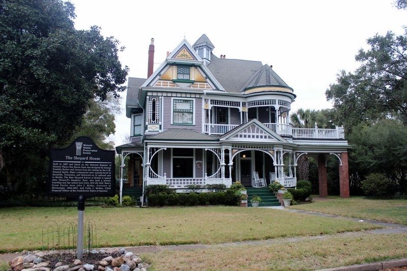
Photographed by Tim Fillmon, December 17, 2019
2. The Shepard House and Marker
Credits. This page was last revised on May 4, 2020. It was originally submitted on May 3, 2020, by Tim Fillmon of Webster, Florida. This page has been viewed 539 times since then and 34 times this year. Photos: 1, 2. submitted on May 3, 2020, by Tim Fillmon of Webster, Florida. • Mark Hilton was the editor who published this page.
