Duxbury in Plymouth County, Massachusetts — The American Northeast (New England)
Reynolds-Maxwell Garden
Photographed by Brian Connors, May 1, 2020
1. Reynolds-Maxwell Garden Marker
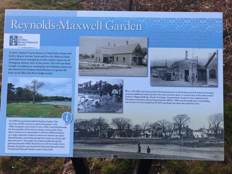
Reynolds-Maxwell Garden
Around 1800, this area of the Blue Fish River was thriving with shipyards, wharves, saw pits, mills and warehouses. By 1900, Duxbury Village (as it was known then) was Duxbury's main commercial district with livery stables, a garage, grocery and general stores and a restaurant.
In 1906, Antone P. Lucas (known as Tony) built a house and barber shop at this site. Lucas and his wife, Rebecca Doyle, were both recent immigrants to this country. Lucas was of Portuguese descent, born in the Azores. His wife was from Canada. In addition to running his own business, Lucas was also hired by the Duxbury Rural Society, to operate the locks on the Blue Fish River bridge nearby.
From 1910-1950, the Duxbury Rural Society (precursor to the Duxbury Rural & Historical Society) acquired additional marsh parcels in this area and tore down or moved many of the deteriorated Duxbury Village buildings, all part of a larger improvement project for the neighborhood. This piece of property was purchased by the DRHS in 1943 and eventually the Lucas building was moved. It is now situated at 39 Old Cove Road, just down the
this page online
The DRHS has partnered with the Duxbury Garden Club since the mid 20th century to care for this garden. In the 1980s, the garden was named in honor of Mrs. Frank (Ella) Maxwell, the first president of the Duxbury Garden Club and the Club's labors continue to be appreciated. In 2018, the DRHS embarked on a major restoration project to restore and raise the sea wall at Maxwell Garden, preventing damage from wash over during high tides and storms. This project was made possible through the generous bequest of Mary Reynolds and with the Garden Club's blessing, the garden was renamed the Reynolds Maxwell Garden. The Reynolds Maxwell Garden is open to the public.
Erected by The Duxbury Rural & Historical Society.
Topics. This historical marker is listed in this topic list: Industry & Commerce. A significant historical year for this entry is 1906.
Location. 42° 2.817′ N, 70° 40.324′ W. Marker is in Duxbury, Massachusetts, in Plymouth County. It is on Washington Street, on the right when traveling south. Touch for map. Marker is at or near this postal address: 661 Washington Street, Duxbury MA 02332, United States of America.
Photographed by Brian Connors, May 1, 2020
2. Reynolds-Maxwell Garden and Marker
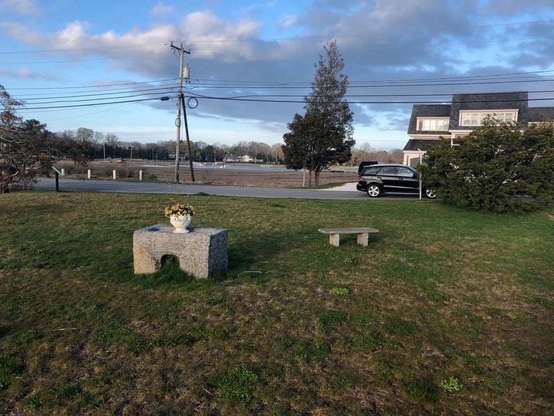
The marker is far to the left near the road in this view of the garden.

Regionally, this marker is on the South Shore. It is also in the American Northeast, in New England, and on the Eastern Seaboard. Globally, it is in the North Atlantic Region, North America, the Western Hemisphere, the Western World, and the Anglosphere. Historically, it finds itself in what was once one of the original Thirteen Colonies.
Other nearby markers. At least 8 other markers are within walking distance of this marker: Site of Tide Grist Mills (within shouting distance of this marker); Shipyard Center (about 400 feet away, measured in a direct line); Philip Delano (approx. 0.4 miles away); Site of Point School (approx. 0.4 miles away); Bumpus Park (approx. 0.4 miles away); Ezra Weston (approx. 0.4 miles away); Nathaniel Winsor, Jr. House (approx. half a mile away); Alden House Historic Site (approx. 0.6 miles away). Touch for a list and map of all markers in Duxbury.
Photographed by Brian Connors, May 1, 2020
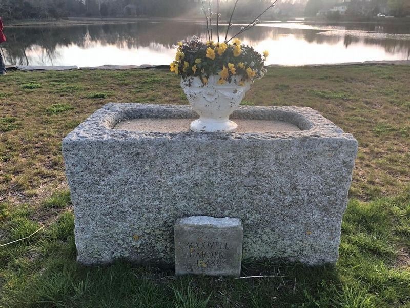
3. Maxwell Garden monument from 1948

Photographed by Brian Connors, May 1, 2020
4. The Blue Fish River Bridge near the Reynolds-Maxwell Garden
Credits. This page was last revised on May 5, 2020. It was originally submitted on May 5, 2020, by J. Makali Bruton of Washington, District of Columbia. This page has been viewed 316 times since then and 24 times this year. Photos: 1, 2, 3, 4. submitted on May 5, 2020, by J. Makali Bruton of Washington, District of Columbia.
