Pleasant Grove in Utah County, Utah — The American Mountains (Southwest)
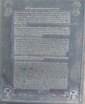
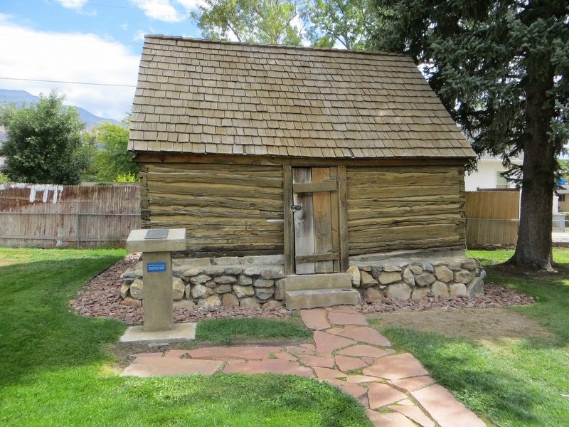
Jeppa and Anna Nelson Granary
Jeppa and Anna Nelson arrived in Pleasant Grove in 1873. 'They lived in a dugout until spring when a one room house was built:' "I remember the old cellar on the farm when I was a child, and Dad told us this was his first home." (History of Swen John Nelson written by his daughter, Zelda Nelson Freeman.)
In addition to Jeppa's regular granary, this smaller one, thought to be the one-room house built over his original house, a dugout, was set right by the street. One day a fellow Scandinavian commented, " Bro. Nelson, that is a poor place to have a granary, and besides you are liable to have your grain stolen." Jeppa replied, "the purpose of putting the granary there and having it unlocked is so people who need the grain may take it with no embarrassment. They are welcome to it." The friend concluded, "now that is what I call a trusting good man." (Memories of Grandpa and Grandma Nelson, by Zelda Freeman.)
Years after the Nelson family arrived in Pleasant Grove, Jeppa looked back and wrote of his settlement here.
"And as fast as I was somewhat acquainted I received work. But there was no money to be had, but I earned wheat and other things which I could use in the family. I could do many different kinds of work and I took on anything they wanted me to do. I rented a couple of rooms until I had dug out a basement (dugout). I bought 10 acres of land, and in between working for other people, I dug the dugout, and lined it with brick and rock inside. So I had a good room ready at Christmas so I could move in - Then I went around during the winter and did some slaughtering, made wooden shoes, went to the mountains for timber for a chicken coop. I had no timber the first year. I didn't have much of my land tilled, but worked for others most of the time - then I bought a pair of oxen, an old wagon, and ten acres more land and leased five acres. Then it started to go well for me in working on the land, and I harvested wheat and potatoes and lucerne, and I bought until I had 30 acres. Then I had all I could do to take care of it..." (Journal of Jeppa Nelson)
Topics. This historical marker is listed in this topic list: Agriculture. A significant historical date for this entry is March 2, 1993.
Location. 40° 21.768′ N, 111° 44.303′ W. Marker is in Pleasant Grove, Utah, in Utah County. Marker is on South 100 East, on the right when traveling north. Touch for map. Marker is at or near this postal address: 73 South 100 East, Pleasant Grove UT 84062, United States of America. Touch for directions.
Other nearby markers. At least 8 other markers are within walking distance of this marker. Pioneer Flour Mill (within shouting distance of this marker); Pioneer Relic Hall (within shouting distance of this marker); Pleasant Grove Town Hall (within shouting distance of this marker); Winter Corral (about 300 feet away, measured in a direct line); Civil War Skirmish at Pleasant Grove (about 300 feet away); Utah’s First Indian Battle (about 700 feet away); Old Pleasant Grove Fort (approx. 0.2 miles away); a different marker also named Old Pleasant Grove Fort (approx. ¼ mile away). Touch for a list and map of all markers in Pleasant Grove.
Credits. This page was last revised on May 9, 2020. It was originally submitted on May 9, 2020, by Bill Kirchner of Tucson, Arizona. This page has been viewed 147 times since then and 3 times this year. Photos: 1, 2. submitted on May 9, 2020, by Bill Kirchner of Tucson, Arizona.

