Marker Logo HMdb.org THE HISTORICAL
MARKER DATABASE
“Bite-Size Bits of Local, National, and Global History”
Downtown in Roanoke, Virginia — The American South (Mid-Atlantic)
 

Roanoke City Market


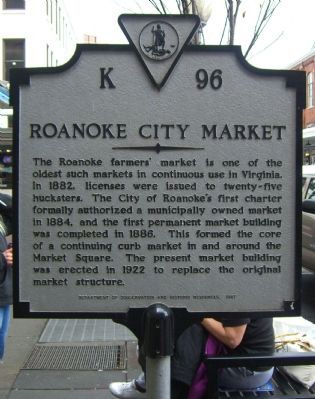
Roanoke City Market Marker image. Click for full size.
Photographed By Kevin W., December 28, 2008
1. Roanoke City Market Marker
Inscription. The Roanoke farmers' market is one of the oldest such markets in continuous use in Virginia. In 1882, licenses were issued to twenty-five hucksters. The City of Roanoke's first charter formally authorized a municipally owned market in 1884, and the first permanent market building was completed in 1886. This formed the core of a continuing curb market in and around the Market Square. The present market building was erected in 1922 to replace the original market structure.
 
Erected 1987 by Department of Convservation and Historic Resources. (Marker Number K-96.)
 
Topics and series. This historical marker is listed in these topic lists: Industry & CommerceNotable Places. In addition, it is included in the Virginia Department of Historic Resources (DHR) series list. A significant historical year for this entry is 1882.
 
Location. 37° 16.298′ N, 79° 56.362′ W. Marker is in Roanoke, Virginia. It is in Downtown. Marker is on Campbell Avenue (U.S. 11) near Wall Street, on the right when traveling east. Marker is located in the Market Street parking. Touch for map. Marker is in this post office area: Roanoke VA 24011, United States of America. Touch for directions.
 
Other nearby markers. At least 8 other markers are within walking distance of this marker. Welcome to Historic Roanoke City Market (within shouting distance of this marker); The Wigmore Building (about
Paid Advertisement
Click on the ad for more information.
Please report objectionable advertising to the Editor.
Click or scan to see
this page online
300 feet away, measured in a direct line); Colonial National Bank Building (about 300 feet away); First National Bank (about 500 feet away); Fire Station No. 1 (about 500 feet away); Norfolk and Western Passenger Station (about 500 feet away); The Market Square Walkway (about 500 feet away); Today's Rail Traffic (about 500 feet away). Touch for a list and map of all markers in Roanoke.
 
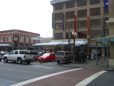
Roanoke City Market and Marker image. Click for full size.
Photographed By Kevin W., December 28, 2008
2. Roanoke City Market and Marker
Marker is to the right of the picture.
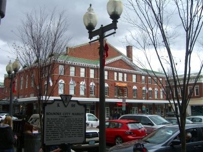
Roanoke City Market Building and Marker image. Click for full size.
Photographed By Kevin W., December 28, 2008
3. Roanoke City Market Building and Marker
In the background is the present market building, erected in 1922.
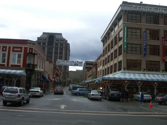
Roanoke City Market image. Click for full size.
Photographed By Kevin W., December 28, 2008
4. Roanoke City Market
A look down Market Street from the Roanoke Market Building.
 
 
Credits. This page was last revised on February 1, 2023. It was originally submitted on January 2, 2009, by Kevin W. of Stafford, Virginia. This page has been viewed 975 times since then and 21 times this year. Photos:   1, 2, 3, 4. submitted on January 2, 2009, by Kevin W. of Stafford, Virginia.
Share this page.  
Share on Tumblr
m=14962

CeraNet Cloud Computing sponsors the Historical Marker Database.
This website earns income from purchases you make after using our links to Amazon.com. We appreciate your support.
Paid Advertisement
Apr. 24, 2024