Claremont in Los Angeles County, California — The American West (Pacific Coastal)
The Claremont Depot
Photographed by Craig Baker, May 4, 2020
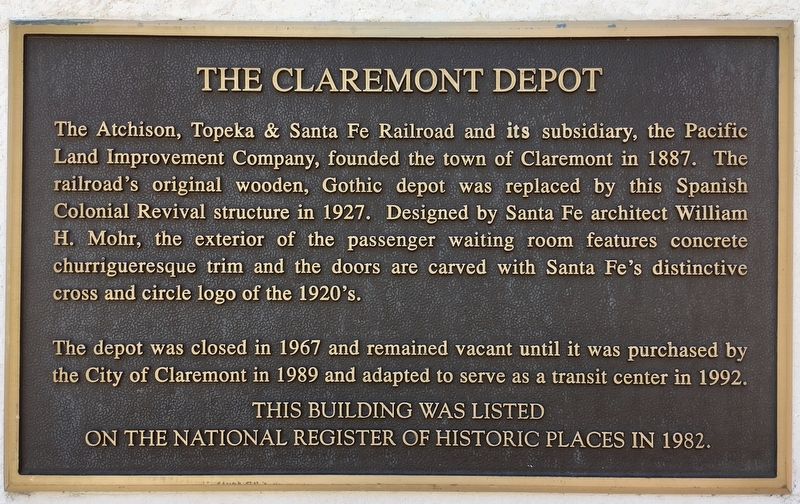
1. Claremont Depot Marker
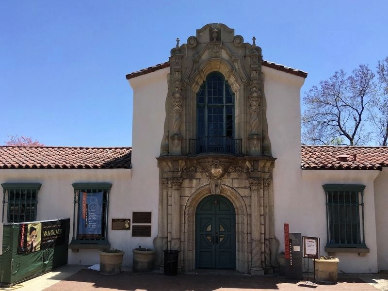
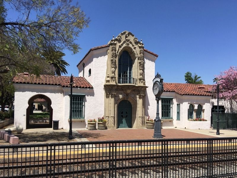
The Atchison, Topeka & Santa Fe Railroad and its subsidiary, the Pacific Land Improvement Company, founded the town of Claremont in 1887. The railroad's original wooden, Gothic depot was replaced by this Spanish Colonial Revival structure in 1927. Designed by Santa Fe architect William H. Mohr, the exterior of the passenger waiting room features concrete churrigueresque trim and the doors are carved with Santa Fe's distinctive cross and circle logo of the 1920's.
The depot was closed in 1967 and remained vacant until it was purchased by the City of Claremont in 1989 and adapted to serve as a transit center in 1992.
This building was listed on the National Register of Historic Places in 1982.
Topics. This historical marker is listed in these topic lists: Architecture • Railroads & Streetcars • Settlements & Settlers.
Location. 34° 5.652′ N, 117° 43.006′ W. Marker is in Claremont, California, in Los Angeles County. It is at the intersection of 1st Street and Harvard Avenue, on the left when traveling west on 1st Street. Touch for map. Marker is
this page online

Regionally, this marker is in Greater Los Angeles and in the Transverse Ranges. It is also on the American Pacific Coast. Globally, it is in North America, on the Ring of Fire, on the Pacific Rim, in the Western Hemisphere, in the Western World, and in the Anglosphere. Historically, it finds itself in what was once New Spain and also Mexico’s Alta California.
Other nearby markers. At least 8 other markers are within walking distance of this marker: Judy C. Wright (here, next to this marker); Claremont’s First Fire Station (about 600 feet away, measured in a direct line); Claremont City Hall (about 600 feet away); Helen Goodwin Renwick (approx. 0.2 miles away); Peace Pole (approx. 0.2 miles away); Shelton Park (approx. 0.2 miles away); College Park (approx. ¼ mile away); Mallows Park (approx. 0.4 miles away). Touch for a list and map of all markers in Claremont.
Photographed by Craig Baker, May 4, 2020
2. Claremont Depot and Marker
Photographed by Craig Baker, May 4, 2020
3. Claremont Depot
Credits. This page was last revised on April 11, 2025. It was originally submitted on May 10, 2020, by Craig Baker of Sylmar, California. This page has been viewed 1,286 times since then and 100 times this year. Photos: 1, 2, 3. submitted on May 10, 2020, by Craig Baker of Sylmar, California. • Syd Whittle was the editor who published this page.
