Near Thompson's Station in Williamson County, Tennessee — The American South (East South Central)
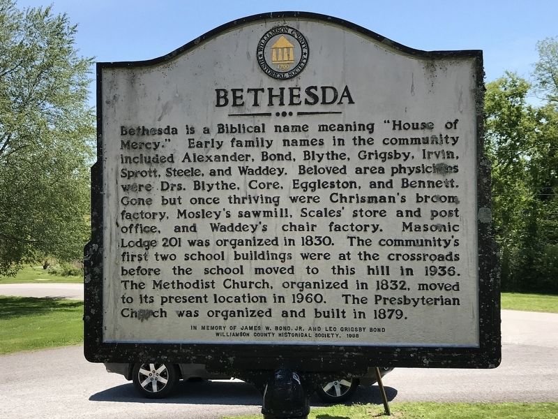
Bethesda
Erected 1998 by Williamson County Historical Society in memory of James W. Bond, Jr. and Leo Grigsby Bond.
Topics and series. This historical marker is listed in this topic list: Settlements & Settlers. In addition, it is included in the Tennessee – Williamson County Historical Society series list. A significant historical year for this entry is 1830.
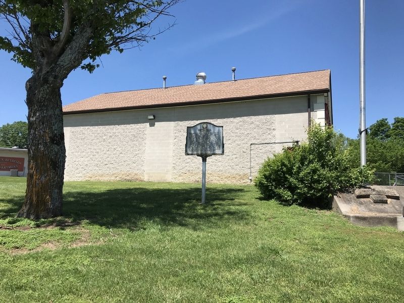
Location. 35° 45.935′ N, 86° 47.925′ W. Marker is near Thompson's Station, Tennessee, in Williamson County. Marker can be reached from Bethesda Road, half a mile Bethesda-Duplex Road, on the left when traveling north. Marker is located next to a Williamson County Fire/Rescue station. Touch for map. Marker is at or near this postal address: 4911 Bethesda Road, Thompsons Station TN 37179, United States of America. Touch for directions.
Other nearby markers. At least 8 other markers are within 5 miles of this marker, measured as the crow flies. Cross Keys (approx. 2.1 miles away); Mount Carmel/Duplex (approx. 2.3 miles away); Sam and Kirk McGee (approx. 2.9 miles away); New Hope Presbyterian Church (approx. 3.2 miles away); Rucker Cemetery (approx. 3˝ miles away); The Cove (approx. 3˝ miles away); Peytonsville (approx. 3.8 miles away); Moses Steele Cemetery (approx. 4.1 miles away).
Credits. This page was last revised on May 11, 2020. It was originally submitted on May 10, 2020, by Duane and Tracy Marsteller of Murfreesboro, Tennessee. This page has been viewed 343 times since then and 28 times this year. Photos: 1, 2. submitted on May 10, 2020, by Duane and Tracy Marsteller of Murfreesboro, Tennessee. • Devry Becker Jones was the editor who published this page.

