Charlottetown in Queens County, Prince Edward Island — The Atlantic Provinces (North America)
Open Green Spaces in the City
Les espaces verts au cœur de la ville
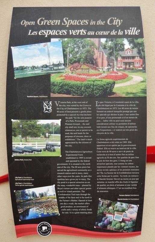
Victoria Park, at the west end of the city, was vested by the Crown to the City of Charlottetown in 1873. The 40 acres of land presents a gentle place protected by a special Act that declares the park "for the sole purpose of a Park, Promenade and Pleasure Ground… the said city shall not, on any account whatsoever, use or permit to be used, the said lands for the purposes of circuses, show or exhibitions." The land is much appreciated by the citizens of the city.
The Charlottetown Agriculture Experimental Farm established in 1909 is owned and operated by the federal government. It is situated to the north east of the city. The 80 acre piece has served the agricultural community as a research station and in many, many other ways over the years. Its park-like qualities have given joy to many. The lily pond is a special attraction as are the many wonderful trees — planted by Royal visitors and other special guests as well as Island premiers. The Confederation Trail runs through the middle of the farm and to the north is the Farmer's Market. Opened at least one day a week, the market offers good produce, an assortment of crafts and a variety of ethnic foods for sale. It is a great meeting place.
(photo captions)
• Rochford Square, Charlottetown
• Battery Point, Victoria Park
• Lilly Pond at Charlottetown Agricultural Experimental Farm
• Farmers Market Charlottetown
Le parc Victoria, à l'extrémité ouest de la ville, a été légué par la Couronne à la ville de Charlottetown en 1873. Les 40 acres de terrain forment un endroit tranquille protégé par une loi spéciale qui déclare le parc « aux seules fins d'un parc, d'une promenade et d'un terrain de jeux… ladite ville ne peut sous aucune considération utiliser ou permettre d'utiliser ledit terrain aux fins de cirques, de spectacles ou d'expositions. » L'endroit est très prisé des citoyens de la ville.
La ferme agricole expérimentale de Charlottetown a été créée en 1909. Elle appartient et est opérée par le gouvernement fédéral. Elle se trouve au nord-est de la ville. Cette terre de 80 acres a servi de poste de recherche et à bien d'autres fins au milieu agricole au fil des ans. Ses qualités de parc font la joie de bien des gens. L'étang est une attraction spéciale, tout comme les arbres majestueux plantés par les visiteurs royaux, les autres invités spéciaux et les premiers ministres de l'Île. Le Sentier de la Confédération traverse cette ferme par le centre. Au nord, on retrouve le Marché fermier. Ouvert au moins un jour par semaine, ce marché offre des fruits et légumes de qualité, un choix d'artisanat et une variété d'aliments ethniques. C'est un excellent lieu de rencontre.
Erected by Historic Charlottetown.
Topics. This historical marker is listed in this topic list: Parks & Recreational Areas. A significant historical year for this entry is 1873.
Location. 46° 14.473′ N, 63° 6.885′ W. Marker is in Charlottetown, Prince Edward Island, in Queens County. Marker is at the intersection of Grafton Street and Water Street (Prince Edward Island Route 1), on the right when traveling east on Grafton Street. Marker is located in the "Welcome to Charlottetown" plaza at the southwest corner of the intersection. Touch for map. Marker is in this post office area: Charlottetown PE C1A 1M1, Canada. Touch for directions.
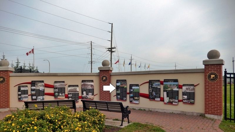
Other nearby markers. At least 8 other markers are within walking distance of this marker. Keeping the City Green (here, next to this marker); Preserving Our History (here, next to this marker); Choices For Higher Education (here, next to this marker); Transportation from Tip-to-Tip (here, next to this marker); The Once Great Island Railroad (here, next to this marker); A River of Importance (here, next to this marker); Beginnings of a Settlement (here, next to this marker); Making History in 1864 (within shouting distance of this marker). Touch for a list and map of all markers in Charlottetown.
Related markers. Click here for a list of markers that are related to this marker. Historic Charlottetown, Prince Edward Island
Also see . . .
1. Victoria Park, Charlottetown (Wikipedia). Victoria Park was established in 1789 by Governor Edmund Fanning as a 100-acre parcel for the use of the colonial administrator for St. John's Island (renamed Prince Edward Island in 1799). This property is located immediately west of Charlottetown's original "500 lots." It was envisioned that the property would be used to provide farmland for the governor and a site for an official residence. Public pressure began to build for access to the property and in 1869, the colonial government of the day stated that 30 acres was "quite sufficient for Government House" and that the remainder should be procured for the public. (Submitted on May 14, 2020, by Cosmos Mariner of Cape Canaveral, Florida.)
2. Charlottetown Research and Development Centre. The Charlottetown Research and Development Centre was established in 1909 in Charlottetown, Prince Edward Island. The Centre has an office-laboratory complex in Charlottetown and a research farm in Harrington, PEI, where it conducts research trials on a variety of crops and cropping systems. The main office-laboratory complex in Charlottetown has 65 hectares of land and over 7000 square meters of lab and office space; the Harrington Research Farm, located 11 kilometres north of Charlottetown, has 330 hectares of land and a state-of-the-art greenhouse facility (Submitted on May 14, 2020, by Cosmos Mariner of Cape Canaveral, Florida.)
Credits. This page was last revised on May 17, 2020. It was originally submitted on May 13, 2020, by Cosmos Mariner of Cape Canaveral, Florida. This page has been viewed 72 times since then and 2 times this year. Photos: 1, 2. submitted on May 14, 2020, by Cosmos Mariner of Cape Canaveral, Florida.

