Near Athens in Clark County, Missouri — The American Midwest (Upper Plains)
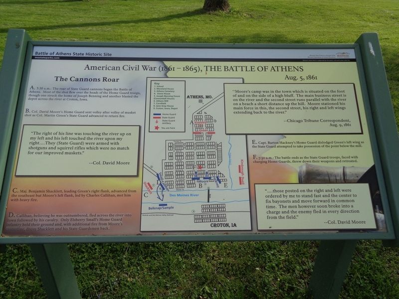
The Cannons Roar
American Civil War (1861-1865), The Battle of Athens
— Battle of Athens State Historic Site —
B. Col. David Moore's Home Guard sent volley after volley of musket shot as Col. Martin Green's State Guard advanced to return fire.
C. Maj. Benjamin Shacklett, leading Green's right flank, advanced from the southeast but Moore's left flank, led by Charles Callihan, met him with heavy fire.
D. Callihan, believing he was outnumbered, fled across the river into Iowa followed by his cavalry. Only Elsberry Small's Home Guard infantry held their ground and, with additional fire from Moore's centerline, drove Shacklett and his State Guardsmen back.
E. Capt. Barton Hackney's Home Guard dislodged Green's left wing as the State Guard attempted to take possession of the point below the mill.
F. 7:30 a.m.: The battle ends as the State Guard troops, faced with charging Home Guards, threw down their weapons and retreated.
(sidebar quotes)
"The right of his line was touching the river up on my left and his left touched the river upon my right….They (State Guard) were armed with shotguns and squirrel rifles which were no match for our improved muskets."
--Col. David Moore
"Moore's camp was in the town which is situated on the foot of and on the side of a high bluff. The main business street is on the river and the second street runs parallel with the river on a beach a short distance up the hill. Moore stationed his main force in this, the second street, his right and left wings extending back to the river."
--Chicago Tribune Correspondent, Aug. 9, 1861
"….those posted on the right and left were ordered by me to stand fast and the center to fix bayonets and move forward in common time. The men however soon broke into a charge and the enemy fled in every direction from the field."
--Col. David Moore
Erected by Missouri State Parks.
Topics. This historical marker is listed in this topic list: War, US Civil. A significant historical date for this entry is August 5, 1861.
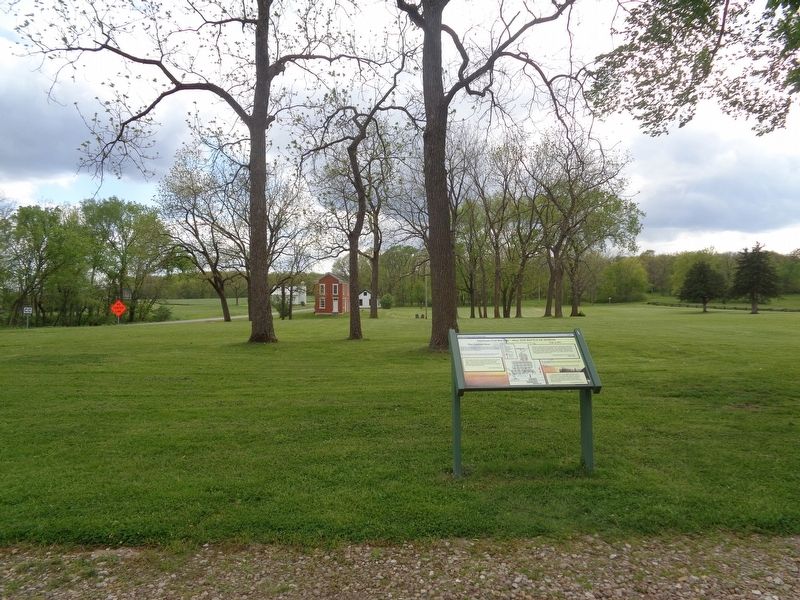
Location. 40° 35.088′ N, 91° 41.808′ W. Marker is near Athens, Missouri, in Clark County. Marker is at the intersection of State Highway CC and County Road 81, on the left when traveling north on State Highway CC. Marker is on the grounds of Battle of Athens State Historic Site, in front of the parking lot. Touch for map. Marker is at or near this postal address: 23153 State Hwy CC, Revere MO 63465, United States of America. Touch for directions.
Other nearby markers. At least 8 other markers are within walking distance of this marker. The Athens General Store (within shouting distance of this marker); Businesses in Athens, circa 1853-1860 (within shouting distance of this marker); Athens and Missouri - a Town and State Divided by Civil War (within shouting distance of this marker); Battle of Athens (within shouting distance of this marker); Missouri State Guard Defends Southern Rights (within shouting distance of this marker); Aftermath of the Battle (about 400 feet away, measured in a direct line); First Northeast Missouri Home Guard Defends the Union (about 500 feet away); The Benning House (about 500 feet away). Touch for a list and map of all markers in Athens.
Credits. This page was last revised on May 14, 2020. It was originally submitted on May 13, 2020, by Jason Voigt of Glen Carbon, Illinois. This page has been viewed 122 times since then and 18 times this year. Photos: 1, 2. submitted on May 13, 2020, by Jason Voigt of Glen Carbon, Illinois. • Bernard Fisher was the editor who published this page.

