Near Huron in Erie County, Ohio — The American Midwest (Great Lakes)
The Firelands
Photographed by J. J. Prats, February 15, 2020
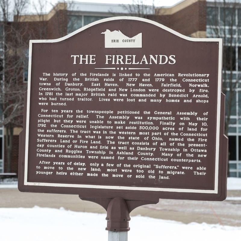
1. The Firelands Marker
The history of the Firelands is linked to the American Revolutionary War. During the British raids of 1777 and 1779 the Connecticut towns of Danbury, East Haven, New Haven, Fairfield, Norwalk, Greenwich, Groton, Ridgefield and New London were destroyed by fire. In 1781 the last major British raid was commanded by Benedict Arnold, who had turned traitor. Lives were lost and many homes and shops were burned.
For ten years the townspeople petitioned the General Assembly of Connecticut for relief. The Assembly was sympathetic with their plight but they were unable to make restitution. Finally on May 10, 1792 the Connecticut legislature set aside 500,000 acres of land for the sufferers. The tract was In the western most part of the Connecticut Western Reserve in what is now the state of Ohio, named the Fire Sufferers Land or Fire Land. The tract consists of all of the present-day counties of Huron and Erie as well as Danbury Township in Ottawa County and Ruggles Township in Ashland County. Many of the new Firelands communities were named for their Connecticut counterparts.
After years of delay, only a few of the original “Sufferers” were able to move
this page online
Erected by the Erie County Historical Society.
Topics. This historical marker is listed in these topic lists: Settlements & Settlers • War, US Revolutionary. A significant historical date for this entry is May 10, 1792.
Location. 41° 23.836′ N, 82° 35.686′ W. Marker is near Huron, Ohio, in Erie County. It can be reached from the intersection of University Drive and Rye Beach Road (County Route 122). It is at Bowling Green State University Firelands Campus, between Foundation Hall, George Mylander Hall and Cedar Point Center. Touch for map. Marker is at or near this postal address: 1 University Dr, Huron OH 44839, United States of America. Touch for directions.

Regionally, this marker is on the Lake Erie Shore and in the Western Reserve. It is also in the American Midwest and in the Corn Belt. Globally, it is in North America, on the Great Lakes, in the Western Hemisphere, in the Western World, and in the Anglosphere. Historically, it finds itself in what was once the Haudenosaunee (Iroquois) Confederacy, the territory of the Mississippian Culture, and the Northwest
Photographed by J. J. Prats, February 15, 2020
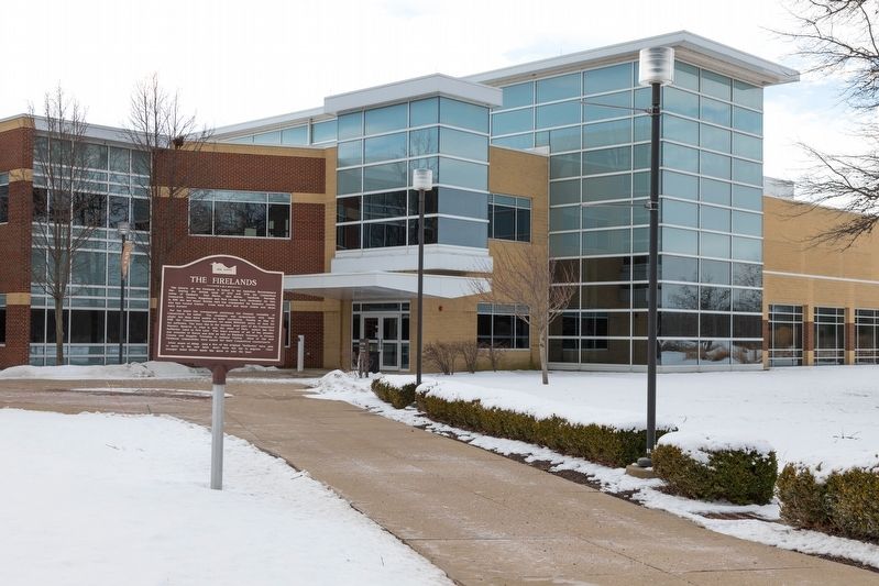
2. The Firelands Marker
This view is of the Cedar Point Conference Center building.
Other nearby markers. At least 8 other markers are within 2 miles of this marker, measured as the crow flies: Historic Roadway (approx. 0.9 miles away); First Cedar Point Road (approx. 0.9 miles away); Ohio Department of Natural Resources Division of Natural Areas and Preserves (approx. 0.9 miles away); Huron’s First Inhabitants (approx. 1.2 miles away); Electric Interurban Railways / Lake Shore Electric Railway (approx. 1½ miles away); World War II (approx. 1.9 miles away); The Huron Playhouse (approx. 1.9 miles away); Christ Episcopal Church (approx. 2.1 miles away). Touch for a list and map of all markers in Huron.
Related marker. Click here for another marker that is related to this marker. It is an identical marker at the Firelands Regional Medical Center in Sandusky.
Also see . . . Wikipedia entry for Firelands. Excerpt:
It is not known if any of the actual “Sufferers” eventually settled in the Firelands. Prior to any settlement here, land speculators had purchased all of the original claims for re-sale. On April 15, 1803, the investor proprietors formed a corporation to manage the lands to which they were entitled in the newly formed state of Ohio The land was later divided into 30 five-mile (8 km) square survey townships, which were further subdivided into 120 quarters, each containing 4,000 acres. ... A drawing was held to determine which land each individual investor shareholder would receive.(Submitted on May 15, 2020.)
Credits. This page was last revised on September 28, 2021. It was originally submitted on May 15, 2020, by J. J. Prats of Springfield, Virginia. This page has been viewed 617 times since then and 44 times this year. Photos: 1, 2. submitted on May 15, 2020, by J. J. Prats of Springfield, Virginia. • J. J. Prats was the editor who published this page.
