Canyon in Randall County, Texas — The American South (West South Central)
Randall County

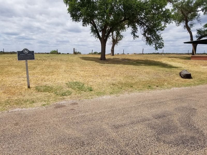
Photographed by Allen Lowrey, May 17, 2020
1. Randall County Marker
Created 1876; named for Confederate General Horace Randal. Settled 1877 by rancher Leigh Dyer, brother-in-law of Chas. Goodnight, man who brought first cattle to Panhandle. Organized in 1889. County seat: Canyon, home of West Texas State University, Panhandle-Plains Historical Museum, Palo Duro State Park, Buffalo Lake.
Erected 1965 by State Historical Survey Committee. (Marker Number 22691.)
Topics. This historical marker is listed in this topic list: Political Subdivisions.
Location. 34° 57.693′ N, 101° 55.201′ W. Marker is in Canyon, Texas, in Randall County. It is on 23rd Street, on the right when traveling south. The marker is on a small, unnamed road that runs parallel to the west of 23rd Street. Touch for map. Marker is in this post office area: Canyon TX 79015, United States of America. Touch for directions.

Regionally, this marker is on the Texas Panhandle. It is also on the American Great Plains, specifically on the Southern Plains, and specifically on the High Plains. Globally, it is in North America, a Gulf of Mexico state, the Western Hemisphere,
this page online
Other nearby markers. At least 8 other markers are within 2 miles of this marker, measured as the crow flies: Civil War Veterans Reunions (approx. 0.8 miles away); Randall County World War II Memorial (approx. 0.8 miles away); Site of Conner Dugout (approx. one mile away); W. F. Heller, Pioneer Farmer (approx. 1.1 miles away); Shirley House (approx. 1.2 miles away); Roof with Snow / Kimbrough House (approx. 1.2 miles away); Neblett Hospital and Clinic (approx. 1.2 miles away); The Sad Monkey Railroad (approx. 1.2 miles away). Touch for a list and map of all markers in Canyon.
Photographed by Allen Lowrey, May 17, 2020
2. Randall County Marker
Credits. This page was last revised on May 18, 2020. It was originally submitted on May 18, 2020, by Allen Lowrey of Amarillo, Texas. This page has been viewed 267 times since then and 24 times this year. Photos: 1, 2. submitted on May 18, 2020, by Allen Lowrey of Amarillo, Texas. • J. Makali Bruton was the editor who published this page.
