Central Business District in Sacramento in Sacramento County, California — The American West (Pacific Coastal)
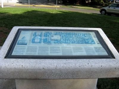
California State Capitol Park
HISTORY
When Spanish governors ruled the California territory, its capitol was moved from town to town between San Diego and Monterey.
San Jose had already been designated the capitol by the time California was granted statehood in 1850. In the next four years, Vallejo and Benicia took turns at that honor. In 1854 Sacramento became the home of the legislature.
Though several cities were vying to become the permanent capitol, Sacramento’s claim was made secure in 1860 when the legislature accepted an offer of four city blocks for the Capitol site.
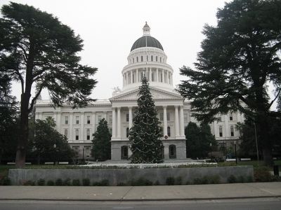
By the year’s end, ground had been broken for a magnificent Capitol building, 320 feet long, 164 feet wide, and 120 feet high. Designed by architect M.F. Butler, the building was in the popular classical revival style that reflected the young nation’s idealistic admiration of Greek democracy and Roman republicanism.
In 1869 the new Capitol was ready for the legislature’s first meeting, although construction continued until 1874. Throughout the years, the interior was often remodeled to meet the legislatures’ needs for even more space. At last the structure could no longer accommodate the lawmakers of the rapidly growing state. Between 1918 and 1951, the East Wing was added to house the governor’s suite and other legislative offices, and the original building became known as the “Old Capitol.”
An edifice should be constructed…satisfactory of the grandeur of the coming time…surrounded by grounds…with a beauty and luxuriousness that no other capitol can boast.”
Governor Leland Stanford, 1863
CAPITOL RESTORATION
The architects of the Capitol designed an interior in harmony with its exterior. Both the Roman-Corinthian façade and the Renaissance-Revival chambers were intended to remind legislators and visitors of the lofty political ideals of earlier centuries.
In 1906, the interior underwent its first remodeling, approved by legislators desperate for space and more concerned with function than symbolism. By the 1930s, after successive remodeling projects, the Capitol interior had become a hive of small undistinguished offices.
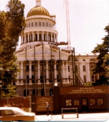
Then in 1972 the Old Capitol was found structurally unsafe and, rather than approve construction of a new structure, legislators voted for a complete restoration. Between 1976 and 1982, the Capitol was rebuilt from the walls in. For six years, researchers, architects, artisans, and skilled workers rehabilitated the exterior and reconstructed the interior as it had been between 1900 and 1910. Painstakingly, they revived old crafts of mural painting, plaster decoration, mosaic tile setting, and metal work.
In addition to restored legislative chambers and offices, the project produced an exhibit documenting Capitol history and a 9-room museum where visitors can view executive offices as they appeared around the turn of the century.
Two free tours, one of historic offices and one of the Capitol building, are available every day except Thanksgiving, Christmas, and New Years Day.
CAPITOL PARK
Capitol Park is considered one of the most beautiful state capitol grounds in the nation. Covering 40 acres, it contains species of plant life from nearly every part of the globe.
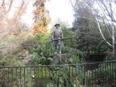
Park beautification began in 1869. During the following years, land was graded, and enriched with silt from the Sacramento River. Eight hundred trees and flowering shrubs were planted, representing over two hundred native, and exotic varieties. The park was laid out in typical Victorian style, with long lanes leading between beds of vivid annuals. Over time, the face of the park has been changed by both historic events and horticultural inspiration. Thus, the Civil War left its imprint in the peaceful Memorial Grove where saplings were transplanted from different battle sites, and enthusiasm of California schoolchildren produced the section containing the cactus garden.
The names of many plants had been forgotten by 1905 when horticulturalists began the task of identifying
and labeling the varieties, thereby establishing a practice which continues today. These labels provide information about the more than 450 varieties of trees, shrubs, and flowers that thrive in Sacramento rich soil and warm climate.
Tickets for free park tours are offered from Mother’s Day to Labor Day and may be obtained in the tour office of the State Capitol Museum.
Topics. This historical marker is listed in these topic lists: Government & Politics • Horticulture & Forestry • Landmarks • Notable Buildings • Notable Places. A significant historical year for this entry is 1850.
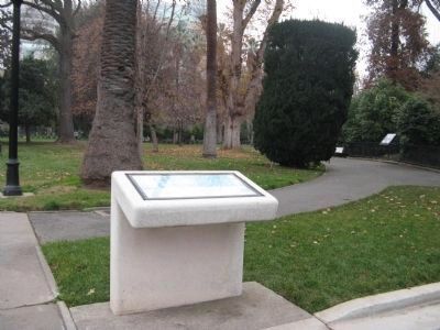
Location. 38° 34.617′ N, 121° 29.681′ W. Marker is in Sacramento, California, in Sacramento County. It is in the Central Business District. Marker can be reached from 10th Street. Marker is located at the front entrance to the State Capitol Park. There is also a twin marker located at the eastern entrance to the State Capitol on the Hiram W. Johnson Memorial Parkway. Touch for map. Marker is in this post office area: Sacramento CA 95814, United States of America. Touch for directions.
Other nearby markers. At least 8 other markers are within walking distance of this marker. California’s Historic Capitol (a few steps from this marker); The California Peace Officers Memorial (within shouting distance of this marker); California Mexican-American War Memorial (within shouting distance of this marker); California State Capitol (about 300 feet away, measured in a direct line); Jesse M. Unruh State Office Building (about 300 feet away); First Sacramento High School (about 400 feet away); Sisters of Mercy (about 500 feet away); a different marker also named Sisters of Mercy (about 500 feet away). Touch for a list and map of all markers in Sacramento.
Regarding California State Capitol Park. Also see: All State Capitol Nearby Markers for additional information.
Also see . . .
1. California State Parks: State Capitol Park. Home of the California Legislature since 1869, the State Capitol underwent a major renovation that restored much of the building's original look. Visitors can tour the restored historic offices of the Secretary of State, Treasurer, and Governor of the State of California. The building features exhibits and tours - and possibly an opportunity to watch the legislators debate a bill or cast a vote. (Submitted on January 3, 2009, by Syd Whittle of Mesa, Arizona.)
2. The California State Capitol Museum. (Submitted on January 3, 2009, by Syd Whittle of Mesa, Arizona.)
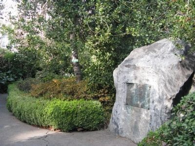
Photographed By Syd Whittle, December 27, 2008
5. The Civil War Memorial Grove
The Grove has trees from the Manassas, Harpers Ferry, Savannah, Five Forks, Yellow Tavern, and Vicksburg battlefields. Some trees come from other Civil War-related sites including the tombs of Presidents McKinley and Lincoln.
Click for more information.
Click for more information.
Credits. This page was last revised on February 7, 2023. It was originally submitted on January 3, 2009, by Syd Whittle of Mesa, Arizona. This page has been viewed 3,320 times since then and 47 times this year. Photos: 1, 2. submitted on January 3, 2009, by Syd Whittle of Mesa, Arizona. 3. submitted on January 4, 2009, by Syd Whittle of Mesa, Arizona. 4. submitted on December 29, 2008, by Syd Whittle of Mesa, Arizona. 5. submitted on January 4, 2009, by Syd Whittle of Mesa, Arizona. 6, 7. submitted on February 5, 2009, by Syd Whittle of Mesa, Arizona. 8. submitted on January 1, 2009, by Syd Whittle of Mesa, Arizona.

