Corinth in Saratoga County, New York — The American Northeast (Mid-Atlantic)
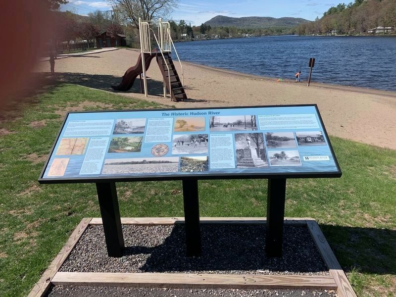
The Historic Hudson River
The Hudson River at Corinth
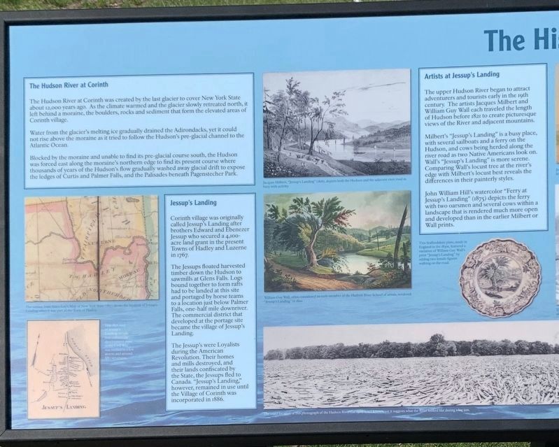
The Hudson River at Corinth was created by the last glacier to cover New York State about 12,000 years ago. As the climate warmed and the glacier slowly retreated north, it left behind a moraine, the boulders, rocks and sediment that form the elevated areas of Corinth village.
Water from the glacier's melting ice gradually drained the Adirondacks, yet it could not rise above the moraine as it tried to follow the Hudson's pre-glacial channel to the Atlantic Ocean.
.Blocked by the moraine and unable to find its pre-glacial course south, the Hudson was forced east along the moraine's northern edge to find its present course where thousands of years of the Hudson's flow gradually washed away glacial drift to expose the ledges of Curtis and Palmer Falls, and the Palisades beneath Pagenstecher Park.
Artists at Jessupís Landing
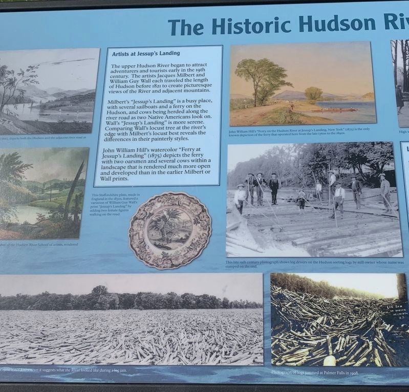
The upper Hudson River began to attract adventurers and tourists early in the 19th century. The artists Jacques Milbert and William Guy Wall each traveled the length of Hudson before 1821 to create picturesque views of the River and adjacent mountains.
,br> Milbert's "Jessup's Landing” is a busy place, with several sailboats and a ferry on the Hudson, and cows being herded along the river road as two Native Americans look on. Wall's "Jessup's Landing” is more serene. Comparing Wall's locust tree at the river's edge with Milbert's locust best reveals the differences in their painterly styles.
,br> John William Hill's watercolor "Ferry at Jessup's Landing” (1875) depicts the ferry with two oarsmen and several cows within a landscape that is rendered much more open and developed than in the earlier Milbert or Wall prints.
Jacques Milbert, "Jessup's Landing” (1816), depicts both the Hudson and the adjacent river road as busy with activity
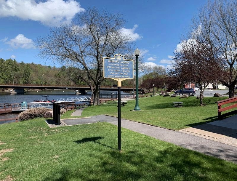
Jessup's Landing
Corinth village was originally called Jessup's Landing after brothers Edward and Ebenezer Jessup who secured a 4,100-acre land grant in the present Towns of Hadley and Luzerne in 1767.
The Jessups floated harvested timber down the Hudson to sawmills at Glens Falls. Logs bound together to form rafts had to be landed at this site and portaged by horse teams to a location just below Palmer Falls, one-half mile downriver. The commercial district that developed at the portage site became the village of Jessup's Landing.
The Jessup's were Loyalists during the American Revolution. Their homes and mills destroyed, and their lands confiscated by the State, the Jessups fled to Canada. "Jessup's Landing," however, remained in use until the Village of Corinth was incorporated in 1886.
Jessup's Landing in the 20th Century
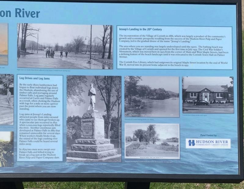
The incorporation of the Village of Corinth in 1886, which was largely a product of the community's growth and economic prosperity resulting from the success of the Hudson River Pulp and Paper Company, led to the gradual disuse of the name "Jessup's Landing."
,br> The area where you are standing was largely undeveloped until the 1920s. The bathing beach was created by the Village of Corinth and opened for the first time in July 1931. The Civil War Soldier's Monument, which was moved here in 1923 from the corner of Main and West Maple Streets, had been a defining feature of the beach landscape until it was relocated to the Corinth Town Hall on Palmer Avenue.
The Corinth Free Library, which had outgrown its original Maple Street location by the end of World War II, moved into its present home adjacent to the beach in 1951.
Log Drives and Log Jams
By the early 180os lumbermen had begun to float individual logs down the Hudson, abandoning the use of timber rafts and portaging around Palmer Falls. Log jams regularly occurred at Curtis and Palmer Falls as a result, often choking the Hudson with logs for a mile or more upriver past the point where you are now standing.
Log-jams at Jessup's Landing attracted people from miles around who came to see them get broken up. A spectacular jam occurred in 1872 when 2,000,000 logs reportedly filled the river. Another enormous jam developed at Palmer Falls in 1882 that remained unmovable for several days. When workers finally broke it up, the sound of the logs crashing over Palmer Falls could be heard several miles away.
In 1879 two men were swept over Palmer Falls and killed trying to break up a log-jam at the Hudson River Pulp and Paper Company dam.
Photo Captions (counterclockwise from far left):
- The section from Amos Lays Map of New York State (1817) shows the location of Jessup's Landing when was part of the Town of Hadley.
- This 1856 map of Jessupís Landing reveals that community development prior to the Civil War was limited to a few streets and around fifty structures.
- Jacques Milbert “Jessupís Landing” (1816) depicits both the Hudson and the adjacent river road as busy with activity.
- William Guy Wall, often considered an early member of the Hudson River School of artists, rendered "Jessup's Landing” in 1820.
- The exact location of this photograph of the Hudson River (ca 1910) isnít known, yet it suggests what the River looked like during a log jam.
- This Staffordshire plate, made in England in the i830s, featured a variation of William Guy Wall's print "Jessup's Landing” by adding two female figures walking on the road.
- Photograph of logs jammed at Palmer Falls in 1908.
- Civil War Soldiers Monument at the Corinth Beach in the 196Os.
- Postcard showing the Corinth beach area before development, (ca. 1923-1930).
- Postcard of Corinth Bathing Beach, (ca. 1930s.
- Corinth Free Library in the early 1950s.
- High water on North Main Street, adjacent to the future Corinth beach (Spring 1913).
- John William Hill's "Ferry on the Hudson River at Jessup's Landing, New York” (1875) is the only known depiction of the ferry that operated here from the late 176os to the 1890s.
- This late 19th century photograph shows log drivers on the Hudson sorting logs by mill owner whose name was stamped on the end.
Topics. This historical marker is listed in this topic list: Settlements & Settlers. A significant historical month for this entry is July 1931.
Location. 43° 14.903′ N, 73° 50.034′ W. Marker is in Corinth, New York, in Saratoga County. Marker is at the intersection of Main Street (New York State Route 9N) and East River Drive, on the right when traveling west on Main Street. Touch for map. Marker is in this post office area: Corinth NY 12822, United States of America. Touch for directions.
Other nearby markers. At least 8 other markers are within 5 miles of this marker, measured as the crow flies. Jessupís Landing (a few steps from this marker); Corinth World Wars Memorial (a few steps
from this marker); Bill Greenfield (approx. half a mile away); Corinth Civil War Memorial (approx. 0.9 miles away); In Memory (approx. 2Ĺ miles away); Gray Cemetery (approx. 3.3 miles away); Site of First Town Board Meeting (approx. 4.1 miles away); Bow Bridge (approx. 4.6 miles away). Touch for a list and map of all markers in Corinth.
Credits. This page was last revised on May 21, 2020. It was originally submitted on May 18, 2020, by Steve Stoessel of Niskayuna, New York. This page has been viewed 480 times since then and 61 times this year. Photos: 1, 2, 3, 4, 5. submitted on May 18, 2020, by Steve Stoessel of Niskayuna, New York. • Michael Herrick was the editor who published this page.
