Gatineau in Communauté-Urbaine-de-l'Outaouais, Québec — Central Canada (French-Canadian)
La Place du Portage / Place du Portage
Unifier la capitale / Uniting the Capital
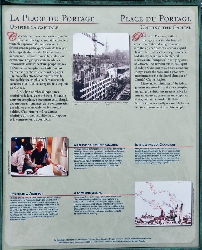
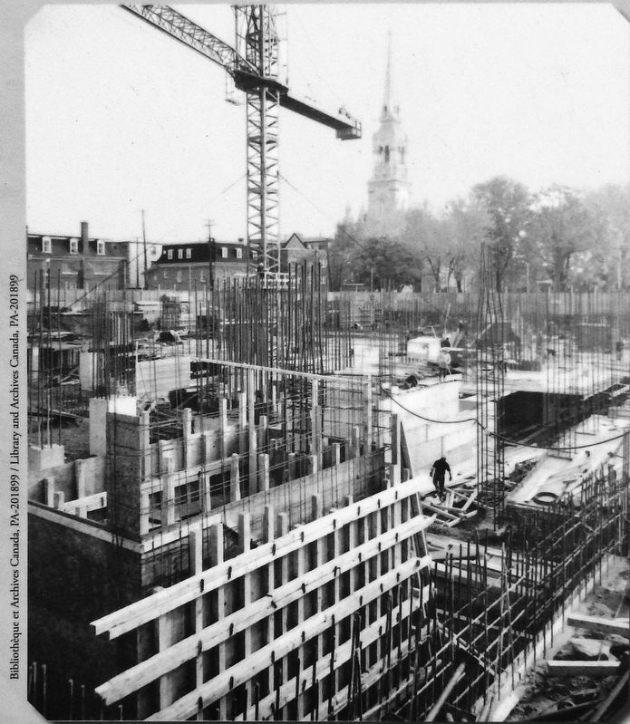
Construite dans les années 1970, la Place du Portage marquait la première véritable expansion du gouvernement fédéral dans la partie québécoise de la région de la capitale du Canada. Une décennie auparavant, l'administration fédérale avait commencé à regrouper certaines de ses installations dans les secteurs périphériques d'Ottawa. Le complexe de Hull (qui fait maintenant partie de Gatineau) déplaçait une nouvelle activité économique vers la rive québécoise en plus de faire ressortir le caractère biculturel de la région de la capitale du Canada.
Ainsi, bon nombre d'importants ministères fédéraux ont été installés dans le nouveau complexe, notamment ceux chargés des ressources humaines, de la consommation des affaires commerciales et des travaux publics. C'est justement à ce dernier ministère que furent confiées la conception et la construction du complexe.
Au service du peuple canadien
Plusieurs milliers de fonctionnaires travaillent dans la région de la capitale du Canada, y compris dans la ville de Gatineau. Année après année, ces hommes et ces femmes assurent des services de toute première importance à la population canadienne. Le travail accompli dans ces immeubles et dans d'autres installations fédérales d'un bout à l'autre du pays couvre une gamme surprenante d'activités allant de l'administration de l'assurance-emploi à la délivrance des passeports.
Des tours á l’horizon
Dans les années 1970, la Place du Portage venait remplacer les cheminées de l'économie d'autrefois. Elle marquait l'arrivée d'un nouveau style de tours de bureaux dans la capitale, caractérisé par des couches géométriques et de grandes surfaces de verre et de béton. L'aménagement de la Place du Portage coïncidait aussi avec une période de transformation : Hull (qui fait maintenant partie de Gatineau), passait d'une activité industrielle fondée sur le bois, à une économie de l'information s'appuyant sur l'informatique.
La Commission de la capitale nationale (CCN), en collaboration avec Travaux publics et Services gouvernementaux Canada
Place du Portage, built in the 1970s, marked the first real expansion of the federal government into the Quebec part of Canada's Capital Region. A decade earlier, the government had already begun to gather federal facilities into "campuses" in outlying areas of Ottawa. The new campus in Hull (part of today's Gatineau) moved new economic energy across the river, and it gave new prominence to the bicultural character of Canada's Capital Region.
Many major ministries of the federal government moved into the new complex, including the departments responsible for human resources, consumer and corporate affairs, and public works. The latter department was actually responsible for the design and construction of this complex.
In the Service of Canadians
Many thousands of public servants work in Canada's Capital Region, including in the City of Gatineau. Year after year, these men and women deliver vital services to Canadians. The work done in these buildings, and at other federal sites across Canada, covers a surprising range — everything from administering employment insurance to issuing Canadian passports.
A Towering Skyline
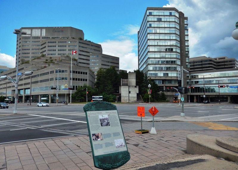
In the 1970s, Place du Portage replaced the smokestacks of an older economy and marked the arrival of a new style of office tower in Canada's Capital Region, a style characterized by geometric layers and massive expanses of glass and concrete. The new towers also ushered in a period of transformation, as Hull (part of today's Gatineau) moved from forest-based industries toward a modern, computer-based information economy.
The National Capital Commission (NCC), in collaboration with Public Works and Government Services Canada
Erected by The National Capital Commission / La Commission de la capitale nationale.
Topics. This historical marker is listed in these topic lists: Architecture • Charity & Public Work. A significant historical year for this entry is 1970.
Location. 45° 25.463′ N, 75° 42.83′ W. Marker is in Gatineau, Québec, in Communauté-Urbaine-de-l'Outaouais. Marker is at the intersection of Portage Bridge (Boulevard Maisonneuve) and Rue Laurier, on the right when traveling north on Portage Bridge (Boulevard Maisonneuve). Marker is located beside the walkway at the southeast corner of the intersection. Touch for map. Marker is in this post office area: Gatineau QC J8X, Canada. Touch for directions.
Other nearby markers. At least 8 other markers are within walking distance of this marker. Le Boulevard de la Confédération / Confederation Boulevard (within shouting distance of this marker); Canada's Discovery Route / La voie de la découverte du Canada (within shouting distance of this marker); L’aménagement de la région de la capitale / Building a Capital Region (about 180 meters away, measured in a direct line); Royal Canadian Naval Monument / Monument De La Marine Royale Canadienne (approx. half a kilometer away in Ontario); The Capital's Forest Heritage / Le patrimoine forestier de la capitale (approx. half a kilometer away in Ontario); La Tour de Lessivage / The Digester Tower (approx.
Photographed By Cosmos Mariner, August 10, 2019
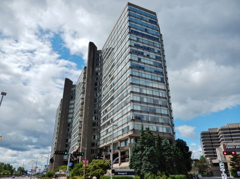
4. Place du Portage III
(from Wikipedia) Place du Portage III consists of 6 connected towers of different heights, spanning both sides of Boulevard Maisonneuve. The tallest section is 18 floors above grade with another 5 below-grade levels. It was completed in 1978. Place du Portage III accommodates approximately 4,500 office workers, mostly Public Services and Procurement Canada staff.
Related markers. Click here for a list of markers that are related to this marker. Confederation Boulevard / Boulevard de la Confédération
Also see . . . Place du Portage (Wikipedia). Place du Portage consists of four phases which were built in different stages during the 1970s and early 80s. The office complex was built in order to revitalize Hull's decaying downtown core and also to increase the proportion of the federal workforce in the overall National Capital Region. The whole complex (Place du Portage I, II, III, IV and Place d'Accueil) accommodates approximately 10,000 office workers. That makes Place du Portage the biggest office complex in the National Capital Region. (Submitted on June 5, 2020, by Cosmos Mariner of Cape Canaveral, Florida.)
Photographed By Cosmos Mariner, August 10, 2019
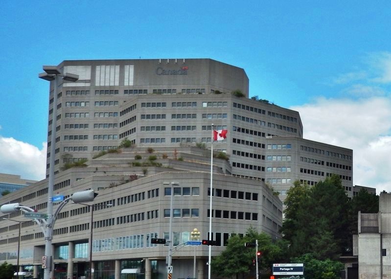
5. Place du Portage IV
(from Wikipedia) Place du Portage IV is the latest phase, completed in 1979. Including underground parking, shopping, mezzanine, and mechanical levels, there are altogether 20 levels in a step-up design. Place du Portage IV accommodates approximately 3,500 office workers, almost exclusively Employment and Social Development Canada staff.
Credits. This page was last revised on June 5, 2020. It was originally submitted on June 3, 2020, by Cosmos Mariner of Cape Canaveral, Florida. This page has been viewed 584 times since then and 96 times this year. Photos: 1, 2, 3. submitted on June 4, 2020, by Cosmos Mariner of Cape Canaveral, Florida. 4, 5. submitted on June 5, 2020, by Cosmos Mariner of Cape Canaveral, Florida.
