New Braunfels in Comal County, Texas — The American South (West South Central)
Carl Heinrich Guenther
(September 9, 1821–April 8, 1870)
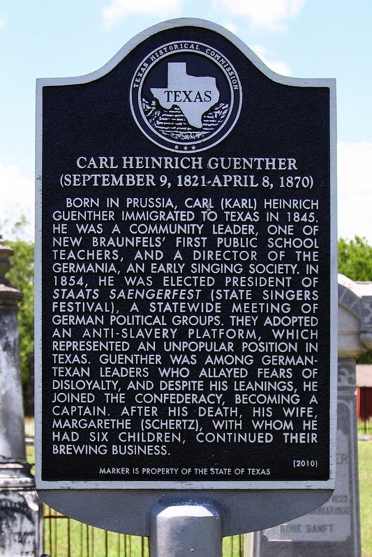
Photographed by Larry D. Moore, June 3, 2020
1. Carl Heinrich Guenther Marker
Erected 2010 by Texas Historical Commission. (Marker Number 16588.)
Topics. This historical marker is listed in this topic list: Settlements & Settlers. A significant historical year for this entry is 1845.
Location. 29° 41.099′ N, 98° 8.37′ W. Marker is in New Braunfels, Texas, in Comal County. It can be reached from North Business Interstate Highway 35 south of Peach Street. Touch for map. Marker is at or near this postal address: 297 S Grape Ave, New Braunfels TX 78130, United States of America. Touch for directions.

Regionally, this marker is in the Hill Country and in the San Antonio Metropolitan Area. It is also in the American South. Globally, it is in North America, a Gulf of Mexico state, the Western Hemisphere, the Western World, and the Anglosphere. Historically, it finds itself in what was once New Spain, the Republic of Texas, and one of the Confederate States of America.
Other nearby markers. At least 8 other markers are within 2 miles of this marker, measured as the crow flies: The New Braunfels Cemetery (within shouting distance of this marker); West End Park and Dance Hall (approx. 0.4 miles
this page online
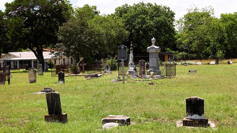
Photographed by Larry D. Moore, June 3, 2020
2. Carl Heinrich Guenther Marker Area
Credits. This page was last revised on June 7, 2020. It was originally submitted on June 7, 2020, by Larry D. Moore of Del Valle, Texas. This page has been viewed 470 times since then and 23 times this year. Photos: 1, 2. submitted on June 7, 2020, by Larry D. Moore of Del Valle, Texas.
