
Brenham in Washington County, Texas — The American South (West South Central)
Germania Mutual Aid Association

Photographed by Larry D. Moore, June 12, 2020
1. Germania Mutual Aid Association Marker
In 1894 Bartlett, Texas, merchant L. A. Niebuhr presented Waco attorney E. W. Hander with a plan to establish a farm mutual aid association to provide farmers insurance against losses due to fire, lightning, and storms. Hander initially dismissed Niebuhr's plan but in 1896 he agreed to draw up a constitution for the association.
The organization of the Germania Mutual Aid Association took place in a schoolhouse in Perry, Texas, on August 31, 1896, with 34 members. Businessman Otto Rau was chosen president; Hander, vice president; and Niebuhr, secretary. By early 1897 the association consisted of 116 members and seven local chapters. Niebuhr moved to Brenham and established the association's office in a building on his property in 1898. The association, which had grown to 160 local chapters insuring 9,349 members by 1926, erected a new office building in 1927.
Insurance coverage for hail hazards was added in 1934, gas explosions in 1938, theft in 1967, and vandalism in 1970. Stock companies were organized in 1979 and 1983 to write liability and life insurance.
The association's name was changed to Germania Farm Mutual Aid Association in 1960 and Germania Farm Mutual Insurance Association in 1982. By the end of 1994 the association's membership stood at 144,918.
Erected 1995 by Texas Historical Commission. (Marker Number 8337.)
Topics. This historical marker is listed in this topic list: Industry & Commerce. A significant historical date for this entry is August 31, 1896.
Location. 30° 8.605′ N, 96° 23.14′ W. Marker is in Brenham, Texas, in Washington County. It is on Highway 290 East Feeder Road west of Stringer Street, on the right when traveling west. Touch for map. Marker is at or near this postal address: 507 Hwy 290 E, Brenham TX 77833, United States of America. Touch for directions.

Regionally, this
this page online
Other nearby markers. At least 8 other markers are within one mile of this marker, measured as the crow flies: 100th Anniversary Brenham "Banner-Press" (approx. 0.2 miles away); Giddings Stone Mansion 1870 (approx. 0.6 miles away); Giddings-Stone House (approx. 0.6 miles away); St. Peter’s Episcopal Church (approx. 0.6 miles away); City of Brenham (approx. 0.7 miles away); William H. Watson (approx. ¾ mile away); Milroy's Garden and Orchard (approx. ¾ mile away); Brenham (approx. one mile away). Touch for a list and map of all markers in Brenham.
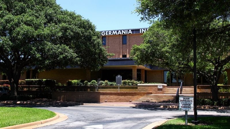
Photographed by Larry D. Moore, June 12, 2020
2. Germania Mutual Aid Association Marker Area
Credits. This page was last revised on August 31, 2021. It was originally submitted on June 13, 2020, by Larry D. Moore of Del Valle, Texas. This page has been viewed 728 times since then and 33 times this year. Photos: 1, 2. submitted on June 13, 2020, by Larry D. Moore of Del Valle, Texas.
