Myers Park in Tallahassee in Leon County, Florida — The American South (South Atlantic)
Myers Park Historic District

Photographed by Tim Fillmon, June 16, 2016
1. Myers Park Historic District Marker Side 1
The Myers Park Historic District is near the remains of Hernando De Soto’s winter encampment (1539-40) in the Apalachee capital of Anhaica, and was the site of the 17th century Spanish mission La Purificación de Tama. The residential district includes Country Club Estates, parts of Woodland Drives and other subdivisions, Chapman Pond, Old Fort Park, Myers Park, and the Capital City Country Club and golf course. Reflective of the early 20th century City Beautiful Movement, the suburban setting and municipal green spaces create a park-like environment that has been home to civic and business leaders, Florida Supreme Court justices, cabinet members, state employees, college faculty and administrators, doctors, lawyers, and local officials. The low density neighborhood was carved largely from Lakeland Plantation, owned by the Edward Houston family. A portion of that land had belonged to Florida’s first territorial governor, William Pope DuVal, whose home was near the modern tennis courts in Myers Park. Other acreage is from the Flavius and Lula Coles Farm, whose house from the late 19th century still stands on Oakland
this page online

Photographed by Tim Fillmon, June 16, 2016
2. Myers Park Historic District Marker Side 2
Erected 2014 by The City of Tallahassee, Tallahassee Trust for Historic Preservation and the Florida Department of State. (Marker Number F-839.)
Topics. This historical marker is listed in these topic lists: Architecture • Sports.
Location. 30° 25.951′ N, 84° 16.437′ W. Marker is in Tallahassee, Florida, in Leon County. It is in Myers Park. It is at the intersection of Myers Park Drive and East Van Buren Street, on the left when traveling west on Myers Park Drive. Touch for map. Marker is in this post office area: Tallahassee FL 32301, United States of America. Touch for directions.

Regionally, this marker is in North Florida. It is also in the American South and specifically in the Deep South. Globally, it is in the North Atlantic Region, North America, a Gulf of Mexico state, the Western Hemisphere, the Western World, and the Anglosphere. Historically, it finds itself in what was once New Spain, the territory
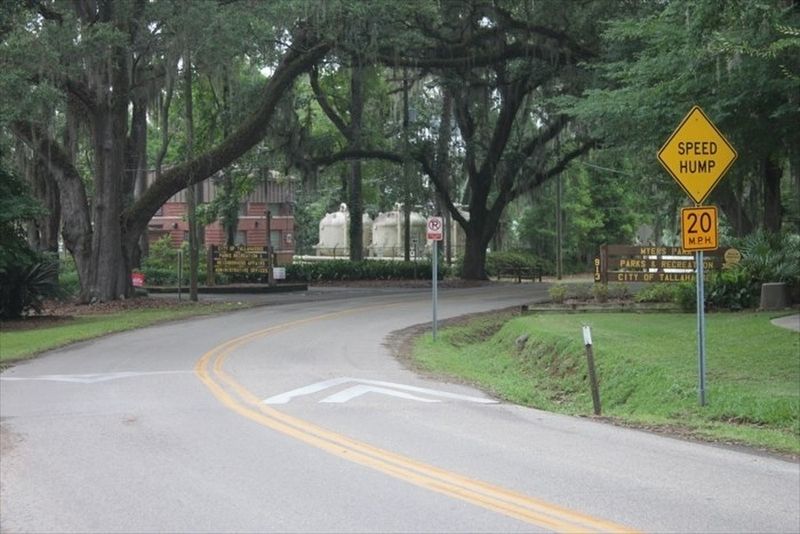
Photographed by Tim Fillmon, June 16, 2016
3. Myers Park Historic District looking west on Myers Park Drive from marker toward Myers Park sign
Other nearby markers. At least 8 other markers are within walking distance of this marker: Anhaica (about 800 feet away, measured in a direct line); Adderley Amphitheater (approx. 0.2 miles away); The Prime Meridian Marker (approx. ¼ mile away); Cascades Waterfall (approx. ¼ mile away); Korean War Memorial (approx. ¼ mile away); Lynching in America / Lynching In Leon County (approx. ¼ mile away); Veterans Memorial (approx. ¼ mile away); The Civil Rights Foot Soldiers of Tallahassee Memorial (approx. 0.3 miles away). Touch for a list and map of all markers in Tallahassee.
Credits. This page was last revised on February 12, 2023. It was originally submitted on June 14, 2020, by Tim Fillmon of Webster, Florida. This page has been viewed 1,474 times since then and 63 times this year. Photos: 1, 2, 3. submitted on June 14, 2020, by Tim Fillmon of Webster, Florida. • Bernard Fisher was the editor who published this page.
