Downtown in Hampton, Virginia — The American South (Mid-Atlantic)
John Mallory Phillips
1920-1988
| — | Old North Hampton | — |
Photographed by Bernard Fisher, June 14, 2020
1. John Mallory Phillips Marker
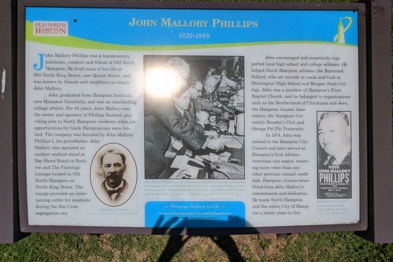
John graduated from Hampton Institute, now Hampton University, and was an outstanding college athlete. For 45 years, John Mallory was the owner and operator of Phillips Seafood, providing jobs to North Hampton residents when job opportunities for black Hamptonians were limited. The company was founded by John Mallory Phillips I, his grandfather. John Mallory also operated an outdoor seafood stand at Bay Shore Beach in Buckroe and The Flamingo Lounge located in Old North Hampton on North King Street. The lounge provided an entertaining outlet for residents during the Jim Crow segregation era.
John encouraged and monetarily supported local high school and college athletes. He helped North Hampton athletes like Raymond Pollard, who set records in track and field at Huntington High School and Morgan State College. John was a member of Hampton's First Baptist Church, and he belonged to organizations
this page online
In 1974, John was elected to the Hampton City Council and later served as Hampton's first African American vice mayor, receiving more votes than any other previous council candidate. Hampton citizens benefited from John Mallory's commitment and dedication. He made North Hampton and the entire City of Hampton a better place to live.
(captions)
John Mallory Phillips I Courtesy of the Hampton History Museum
John Mallory Phillips served on Hampton City Council during a tax hearing at Hampton Coliseum February 10, 1977. Left to right: John Phillips, Charlie Wornom, Tom Waters, Mayor Ann Kilgore, Dr. John Tarver, Melvin Butler, and Martha Allor - Photographed by Willard Owens, Courtesy Daily Press
Hampton City Council campaign poster for John Mallory Phillips Courtesy of the Daily Press
Erected by Bringing History to Life in partnership with Virginia Civil War Terails.
Topics. This historical marker is listed in these topic lists: African Americans • Industry & Commerce. A significant historical date for this entry is February 10, 1977.
Location. 37° 2.193′ N,
Photographed by Bernard Fisher, June 14, 2020
2. John Mallory Phillips Marker

Regionally, this marker is on Virginia’s Peninsula and in Coastal Virginia. It is also in the American South, specifically in the Upper South, in the Tidewater, and on the Eastern Seaboard. Globally, it is in the North Atlantic Region, North America, the Western Hemisphere, the Western World, and the Anglosphere. Historically, it finds itself in what was once the territory of the Mississippian Culture, one of the original Thirteen Colonies, one of the Confederate States of America, and the Antebellum South.
Other nearby markers. At least 8 other markers are within walking distance of this marker: Circle of Life (here, next to this marker); Old North Hampton (here, next to this marker); Community Crossroads (a few steps from this marker); Mary Peake (approx. 0.4 miles away); Mary Smith Kelsey Peake (approx. half a mile away); Federation of Colored Women's Clubs (approx. 0.6 miles away); Virginia State Federation of Colored Women’s Clubs (approx. 0.6 miles away); First Baptist Church (approx. 0.6 miles away). Touch for a list and map of all markers in Hampton.
Credits. This page was last revised on February 1, 2023. It was originally submitted on June 15, 2020, by Bernard Fisher of Richmond, Virginia. This page has been viewed 2,010 times since then and 252 times this year. Photos: 1, 2. submitted on June 15, 2020, by Bernard Fisher of Richmond, Virginia.
