Fox Hill - Grandview in Hampton, Virginia — The American South (Mid-Atlantic)
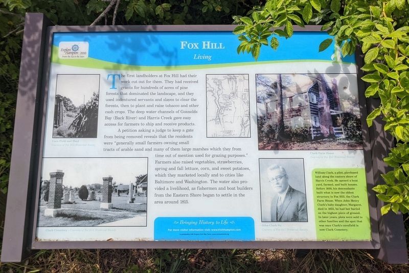
Fox Hill
Living
A petition asking a judge to keep a gate from being removed reveals that the residents were "generally small farmers owning small tracts of arable land and many of them large marshes which they from time out of mention used for grazing purposes." Farmers also raised vegetables, strawberries, spring and fall lettuce, corn, and sweet potatoes, which they marketed locally and to cities like Baltimore and Washington. The water also provided a livelihood, as fishermen and boat builders from the Eastern Shore began to settle in the area around 1815.
(sidebar)
William Clark, a pilot, purchased land along the eastern shore of Harris Creek. He opened a boat yard, farmed, and built houses. Before 1830, his descendants built what is now the oldest structure in Fox Hill, the Clark Farm House. When John Henry Clark's baby daughter, Margaret, died in 1855, he had her buried on the highest piece of ground. In later years, plots were sold to other families and the spot that was once Clark's cornfield is now Clark Cemetery.
(captions)
Corn Field and Shed Courtesy of Fox Hill Historical Society
Clark Cemetery - Courtesy of Fox Hill Historical Society
Clark Farm House Courtesy of Fox Hill Historical Society
John Clark Sr. Courtesy of Fox Hill Historical Society
Erected by Bringing History to Life in partnership with Virginia Civil War Terails.
Topics. This historical marker is listed in these topic lists: Agriculture • Settlements & Settlers.
Location. 37° 4.763′ N, 76° 16.649′ W. Marker is in Hampton, Virginia. It is in Fox Hill - Grandview. Marker can be reached from the intersection of State Park Drive and Adriatic Drive when traveling north. Located in the Grandview Nature Preserve. Touch for map. Marker is in this post office area: Hampton VA 23664, United States of America. Touch for directions.
Other nearby markers. At least 8 other markers are within 3 miles of this marker, measured as the crow flies. A different marker also named Fox Hill (a few steps from this marker); a different marker also named Fox Hill (a few steps from this marker); a different marker also named Fox Hill (a few steps from this marker); a different marker also named Fox Hill (within shouting distance of this marker); Buckroe Beach (approx. 2.8 miles away); Buckroe (approx. 2.8 miles away); Bay Shore Hotel (approx. 3.1 miles away); Virginia Green Book Location (approx. 3.1 miles away). Touch for a list and map of all markers in Hampton.
Credits. This page was last revised on February 1, 2023. It was originally submitted on June 15, 2020, by Bernard Fisher of Richmond, Virginia. This page has been viewed 169 times since then and 29 times this year. Photos: 1, 2. submitted on June 15, 2020, by Bernard Fisher of Richmond, Virginia.

