Salem, Virginia — The American South (Mid-Atlantic)
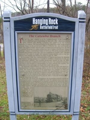
The Catawba Branch
Hanging Rock Battlefield Trail
Photographed by Kevin W., December 28, 2008
1. The Catawba Branch Marker
In November 1908, the Commonwealth of Virginia purchased the Roanoke Red Sulphur Springs property in Catawba to establish a sanatorium for the care of tuberculosis patients. The Catawba Sanatorium opened on July 30, 1909. Because of the poor condition of the roads in the area, the railroad became a crucial link to the
this page online
As continued improvements to local roads allowed for faster and more economical Jitney transport, passenger service on the rail line was discontinued in 1936. The overall construction of the sanatorium was complete by 1939, and supplies moving by rail decreased. In 1943, the approximately four-mile line from Hanging Rock to the end of track in Catawba was abandoned. An additional factor in the closing of the railroad was the critical need of steel for war materials. On the last date of service, July 28, 1943, a work train finished removing the remaining steel track.
At the time the tracks were dismantled, the sanatorium received coal by rail for its power plant. In order to fulfill this need, the railroad constructed a coal unloading facility at Hanging Rock on property owned by the sanatorium. With its small wooden station, the Hanging Rock site became the end of the line until the mid-1990’s. The station was removed in the early 1970s, and in late 1993, Norfolk Southern officially abandoned nearly a
Photographed by Kevin W., December 28, 2008
2. The Catawba Branch Marker
Erected 1999 by County of Roanoke, the City of Salem, and the Hanging Rock Battlefield and Railway Preservation Foundation.
Topics. This historical marker is listed in these topic lists: Railroads & Streetcars • Science & Medicine. A significant historical month for this entry is March 1741.
Location. 37° 19.181′ N, 80° 2.292′ W. Marker is in Salem, Virginia. It can be reached from the intersection of Keesler Mill Drive. Touch for map. Marker is in this post office area: Salem VA 24153, United States of America. Touch for directions.

Regionally, this marker is in Virginia’s Mountain Region, in Southwest Virginia, and in the Blue Ridge Highlands. It is also in the American South and specifically in the Upper South. Globally, it is in North America, the Western Hemisphere, the Western World, and the Anglosphere. Historically, it finds itself in what was once the territory of the Mississippian Culture, one of the original Thirteen Colonies, one of the Confederate States of America, and the Antebellum South.
Other nearby markers. At least 8 other markers are within walking distance of this marker: Two Future Presidents In Wartime Retreat (approx. 0.4 miles away); Hanging Rock (approx. 0.4 miles away); 100th Anniversary of Hanging Rock (approx. 0.4 miles away); The Hanging Rock Coal Trestle (approx. half a mile away); McCausland Attacks (approx. half a mile away); Garst / Kesler Mill (approx. 0.6 miles away); George Morgan Jones (approx. 0.6 miles away); The Battle of Hanging Rock (approx. 0.6 miles away).
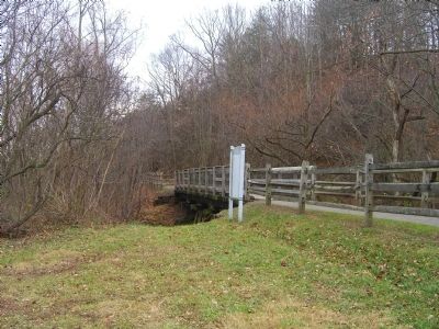
More about this marker. Marker is one of several interpretive signs along the cinder-surfaced, 1.7-mile long Hanging Rock Battlefield Trail that winds along Mason Creek and Kessler Mill Road in Salem, Virginia.
The photo on the marker is of a, "typical scene on the Catawba Branch in the mid-1950s." The photograph was taken by William P. Cecil and provided for use on the marker the Roanoke Chapter National Railway Historical Society Collection.
Credits. This page was last revised on June 16, 2016. It was originally submitted on January 9, 2009, by Kevin W. of Stafford, Virginia. This page has been viewed 1,993 times since then and 75 times this year. Photos: 1, 2. submitted on January 9, 2009, by Kevin W. of Stafford, Virginia.
