Near Tennant in Siskiyou County, California — The American West (Pacific Coastal)
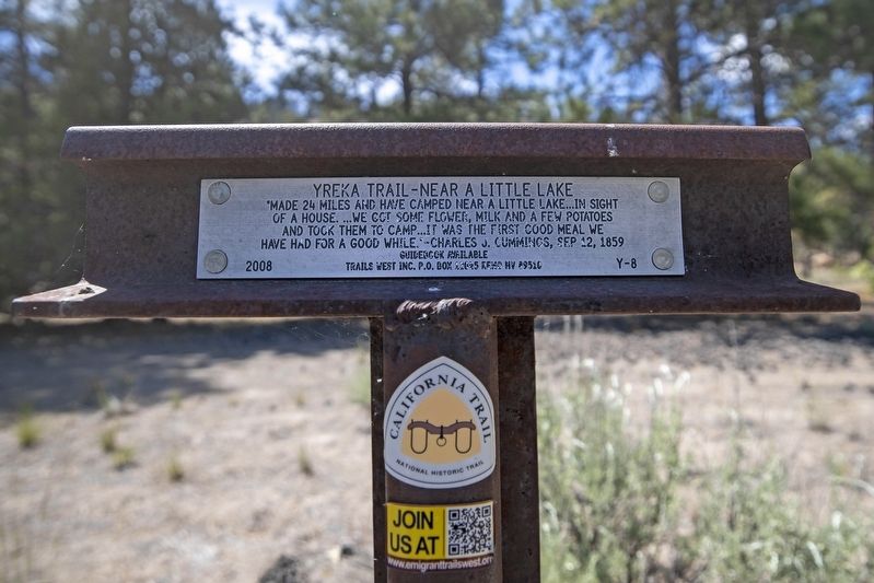
Yreka Trail - Near a Little Lake
of a house. ... we got some flower, milk and a few potatoes
and took them to camp ... it was the first good meal we
have had for a good while." - Charles J. Cummings, Sep 12, 1859
Erected 2008 by Trails West, Inc. (Marker Number Y-8.)
Topics and series. This historical marker is listed in this topic list: Exploration. In addition, it is included in the California Trail, the Trails West Inc., and the Yreka Trail series lists. A significant historical date for this entry is September 12, 1859.
Location. 41° 40.058′ N, 121° 59.555′ W. Marker is near Tennant, California, in Siskiyou County. Touch for map. Marker is in this post office area: Macdoel CA 96058, United States of America. Touch for directions.
Other nearby markers. At least 8 other markers are within 8 miles of this marker, measured as the crow flies. Yreka Trail - Out of Danger (approx. 1˝ miles away); Yreka Trail - Up Butte Creek (approx. 1.9 miles away); Yreka Trail - Are Yet On Butte Creek (approx. 2.4 miles away); Yreka Historic Trail (approx. 3.6 miles away); Yreka Trail - Quite Stony Today (approx. 4.3 miles away); Yreka Trail-Splendid Pine Timber/Yreka Trail-To a Swamp (approx. 4.8 miles away); Yreka Trail - Quite a Stream (approx. 5.8 miles away); Yreka Trail - One Very Steep Stony Hill (approx. 7.2 miles away). Touch for a list and map of all markers in Tennant.
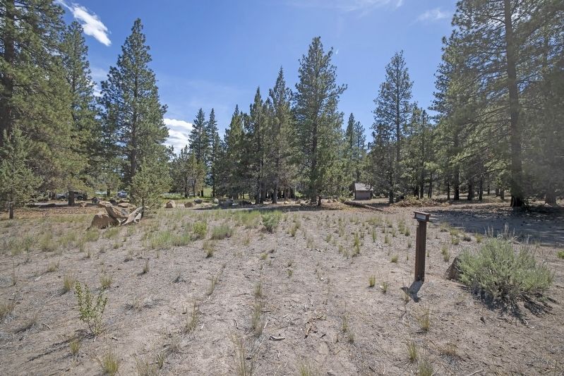
More about this marker. This marker is located within Orr Lake Campground and along the general 1852/1854 trail route which passed through here on its way south and along the west side of Orr Lake. The driving guidebook mentions the part of this merged trail is now underwater along the west side the lake, then emerges at the southwest corner to follow the east side of a sharp ridge and heading west/southwest to Marker Y-9.
Regarding Yreka Trail - Near a Little Lake. Trails West, Inc. sells a driving guidebook titled A Guide to the Yreka Trail which provides maps and additional history on the Yreka Trail as it passed through designated marker locations. Purchasing this guidebook prior to visiting the Yreka Trail markers is highly encouraged to gain a better experience of the history of this historic trail.
Credits. This page was last revised on June 25, 2020. It was originally submitted on June 20, 2020, by Douglass Halvorsen of Klamath Falls, Oregon. This page has been viewed 111 times since then and 6 times this year. Photos: 1, 2. submitted on June 20, 2020, by Douglass Halvorsen of Klamath Falls, Oregon. • J. Makali Bruton was the editor who published this page.

