Dickerson in Montgomery County, Maryland — The American Northeast (Mid-Atlantic)
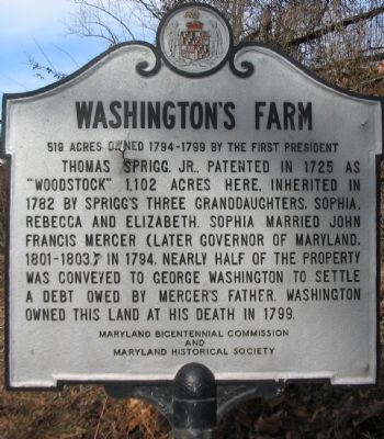
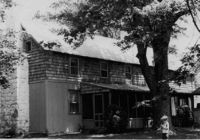
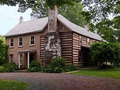
Washington's Farm
519 Acres Owned 1794-1799 by the First President
Erected by Maryland Bicentennial Commission and Maryland Historical Society.
Topics and series. This historical marker is listed in this topic list: Settlements & Settlers. In addition, it is included in the Former U.S. Presidents: #01 George Washington, and the George Washington Slept Here series lists. A significant historical year for this entry is 1725.
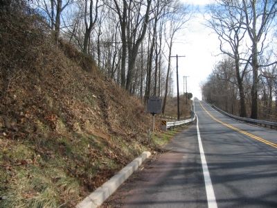
Location. 39° 11.869′ N, 77° 25.714′ W. Marker is in Dickerson, Maryland, in Montgomery County. Marker is on Darnestown Road (State Highway 28) 3 miles south of Martinsburg Road. Touch for map. Marker is at or near this postal address: 20501 Darnestown Road, Dickerson MD 20842, United States of America. Touch for directions.
Other nearby markers. At least 8 other markers are within 2 miles of this marker, measured as the crow flies. Brewer Farmstead (approx. 0.7 miles away); Equestrian Heritage (approx. 0.7 miles away); African American Soldiers from Montgomery County (approx. ¾ mile away); Linden Farm (approx. 1.1 miles away); Seneca Stone Barn (approx. 1.1 miles away); In Loving Memory (approx. 1.4 miles away); The Country Store (approx. 1½ miles away); The Darby Family (approx. 1½ miles away). Touch for a list and map of all markers in Dickerson.
Additional commentary.
1. Previous marker
According to the Maryland Historical Trust Historic Sites Survey, a previous version of the marker read:
1102 acres patented 1725 by Thomas Sprigg, Jr. Three of his grandaughters - one of whom, Sophia, married John Francis Mercer, later Governor of Maryland - inherited it and in 1794 conveyed 319 acres to George Washington.
— Submitted March 4, 2008, by Christopher Busta-Peck of Shaker Heights, Ohio.
Credits. This page was last revised on February 9, 2024. It was originally submitted on February 2, 2008, by Craig Swain of Leesburg, Virginia. This page has been viewed 3,144 times since then and 167 times this year. Last updated on June 22, 2020, by Mary-margaret Boblitt of Dickerson, Maryland. Photos: 1, 2. submitted on February 2, 2008, by Craig Swain of Leesburg, Virginia. 3. submitted on March 4, 2008, by Christopher Busta-Peck of Shaker Heights, Ohio. 4. submitted on June 3, 2013, by Allen C. Browne of Silver Spring, Maryland. 5, 6. submitted on January 31, 2024, by Allen C. Browne of Silver Spring, Maryland. • Bill Pfingsten was the editor who published this page.
