Marker Logo HMdb.org THE HISTORICAL
MARKER DATABASE
“Bite-Size Bits of Local, National, and Global History”
Old Pasadena in Los Angeles County, California — The American West (Pacific Coastal)
 

Mercantile Place


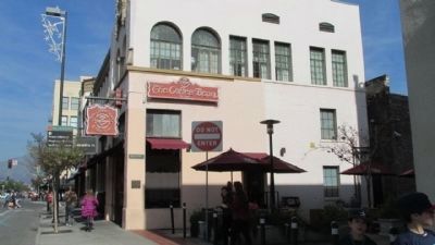
Mercantile Place Marker image. Click for full size.
Photographed By Denise Boose, January 4, 2014
1. Mercantile Place Marker
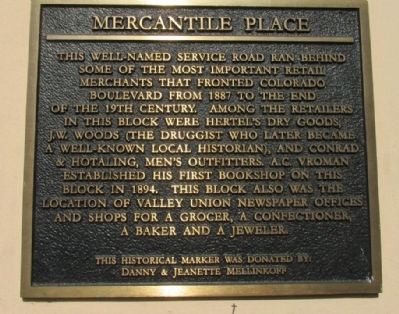
Inscription. This well-named service road ran behind some of the most important retail merchants that fronted Colorado Boulevard from 1887 to the end of the 19th century. Among the retailers in this block were Hertel's Dry Goods, J.W. Woods (The Druggist who later became a well-known local historian), and Conrad & Hotaling, Men's Outfitters. A.C. Vroman established his first bookshop on this block in 1894. This block also was the location of Valley Union Newspaper Offices and shops for a grocer, a confectioner, a baker and a jeweler.
 
Erected by Danny & Jeanette Mellinkoff.
 
Topics. This historical marker is listed in this topic list: Industry & Commerce. A significant historical year for this entry is 1887.
 
Location. 34° 8.724′ N, 118° 9.017′ W. Marker is in Pasadena, California, in Los Angeles County. It is in Old Pasadena. Marker is at the intersection of Mercantile Place and Fair Oaks Avenue, on the left when traveling east on Mercantile Place. Touch for map. Marker is at or near this postal address: 18 S Fair Oaks Ave, Pasadena CA 91105, United States of America. Touch for directions.
 
Other nearby markers. At least 8 other markers are within walking distance of this marker. Edwin Alley (within shouting distance of this marker); McCormick Alley (about 300 feet away, measured in a direct line); Braley Building (about 300 feet away); a different marker also named Mercantile Place
Paid Advertisement
Click on the ad for more information.
Please report objectionable advertising to the Editor.
Click or scan to see
this page online
(about 300 feet away); Exchange Alley (about 300 feet away); Original Site of Throop University (about 300 feet away); Yuen Kee Laundry (about 400 feet away); Plotkin Alley (about 500 feet away). Touch for a list and map of all markers in Pasadena.
 
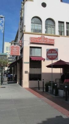
Mercantile Place Marker image. Click for full size.
Photographed By Denise Boose, January 4, 2014
2. Mercantile Place Marker
Mercantile Place and Marker image. Click for full size.
Photographed By Denise Boose, January 4, 2014
3. Mercantile Place and Marker
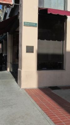
Mercantile Place and Marker image. Click for full size.
Photographed By Denise Boose, January 4, 2014
4. Mercantile Place and Marker
 
 
Credits. This page was last revised on January 30, 2023. It was originally submitted on January 5, 2014. This page has been viewed 565 times since then and 41 times this year. Last updated on June 26, 2020, by Craig Baker of Sylmar, California. Photos:   1, 2, 3, 4. submitted on January 5, 2014, by Denise Boose of Tehachapi, California. • J. Makali Bruton was the editor who published this page.
Share this page.  
Share on Tumblr
m=151951

CeraNet Cloud Computing sponsors the Historical Marker Database.
This website earns income from purchases you make after using our links to Amazon.com. We appreciate your support.
Paid Advertisement
Apr. 18, 2024