Near Henrico in Henrico County, Virginia — The American South (Mid-Atlantic)
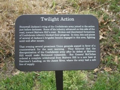
Twilight Action
That evening several prominent Union generals argued in favor of a counterattack for the next morning. They believed that the disorganization of the Confederate army after its defeat at Malvern Hill would make Richmond vulnerable. But General McClellan ordered a complete withdrawal from Malvern Hill to a new base at Harrison’s Landing, on the James River, where the army had a safe line of supply.
Erected by Richmond National Battlefield Park – National Park Service.
Topics. This historical marker is listed in this topic list: War, US Civil.
Location. 37° 25.079′ N, 77° 14.811′ W. Marker is near Henrico, Virginia, in Henrico County. Marker is on Willis Church Road (Virginia Route 156) 0.2 miles north of Carter Mills Road, on the left when traveling south. Marker is located in the Malvern Hill Battlefield Unit of the Richmond National Battlefield Park, in the parking lot on the east side of Willis Church Road. Touch for map. Marker is at or near this postal address: 9051 Malvern Hill Battlefield Terrain, Henrico VA 23231, United States of America. Touch for directions.
Other nearby markers. At least 8 other markers are within walking distance of this marker. Malvern Hill Trail (a few steps from this marker); Methodist Parsonage (within shouting distance of this marker); Battle Commences (within shouting distance of this marker); The Battle of Malvern Hill (within shouting distance of this marker); Willis Church Parsonage (within shouting distance of this marker); Infantry Against Infantry (within shouting distance of this marker); The Gathering Storm (within shouting distance of this marker); a different marker also named The Battle of Malvern Hill (about 500 feet away, measured in a direct line). Touch for a list and map of all markers in Henrico.
Also see . . .
1. Malvern Hill. CWSAC Battle Summaries. (Submitted on January 11, 2009, by Bill Coughlin of Woodland Park, New Jersey.)
2. Touring Richmond’s Battlefields. National Park Service website. (Submitted on January 11, 2009, by Bill Coughlin of Woodland Park, New Jersey.)
3. Malvern Hill Battlefield Podcast. National Park Service website. (Submitted on January 11, 2009, by Bill Coughlin of Woodland Park, New Jersey.)
4. The Seven Days Battle. HistoryCentral.com website.

2. Malvern Hill - CWPT
Civil War Preservation Trust's efforts to preserve portions of the battlefield.
Click for more information.
Click for more information.

Photographed By Craig Swain, March 21, 2010
4. Jackson's Division Moves Up
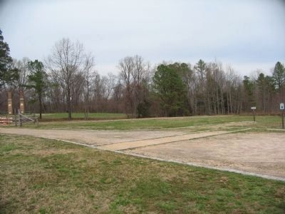
In the closing stages of the battle, portions of Jackson's Division moved up the Willis Church Road (running left to right in this view, note the barricades on the left). Some of the troops moved around the Methodist Parsonage, ruins of which are in the distance on the left.
Credits. This page was last revised on July 7, 2021. It was originally submitted on January 11, 2009, by Bill Coughlin of Woodland Park, New Jersey. This page has been viewed 1,132 times since then and 17 times this year. Photos: 1. submitted on January 11, 2009, by Bill Coughlin of Woodland Park, New Jersey. 2. submitted on March 28, 2010, by Craig Swain of Leesburg, Virginia. 3, 4. submitted on March 31, 2010, by Craig Swain of Leesburg, Virginia.

