Mechanicsville in Hanover County, Virginia — The American South (Mid-Atlantic)
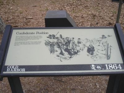
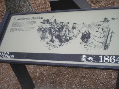
Confederate Position
Cold Harbor - 1864
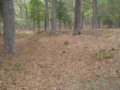
Across open ground came the Union assault, lethally exposed. Today there are trees, some undergrowth. On June 3, 1864, Federal soldiers had no place to take cover.
Erected by Richmond National Battlefield Park - National Park Service.
Topics. This historical marker is listed in this topic list: War, US Civil. A significant historical date for this entry is June 3, 1864.
Location. This marker has been replaced by another marker nearby. 37° 35.447′ N, 77° 17.328′ W. Marker is in Mechanicsville, Virginia, in Hanover County. Marker is on Anderson Wright Drive, on the right when traveling north. Marker is on the tour road in the Cold Harbor Unit of Richmond National Battlefield. Touch for map. Marker is in this post office area: Mechanicsville VA 23111, United States of America. Touch for directions.
Other nearby markers. At least 8 other markers are within walking distance of this location. Confederate Fortifications (a few steps from this marker); Between the Lines (about 500 feet away, measured in a direct line); Confederate Breastworks (about 600 feet away); The Waters Ran Red (about 800 feet away); Grant's Grand Assault (about 800 feet away); A Lethal Occupation (approx. 0.2 miles away); Bayonets Are For Digging (approx. 0.2 miles away); Those People Stand No Chance (approx. 0.2 miles away). Touch for a list and map of all markers in Mechanicsville.
More about this marker. The right side of the marker contains a picture of Confederates manning the entrenchments at Cold Harbor.
Regarding Confederate Position. This marker was replaced by a new one named Confederate Fortifications (See nearby markers).
Also see . . .
1. Cold Harbor. CMSAC Battle Summaries webpage. (Submitted on January 4, 2009, by Bill Coughlin of Woodland Park, New Jersey.)
2. Cold Harbor. Richmond National Battlefield. (Submitted on January 4, 2009, by Bill Coughlin of Woodland Park, New Jersey.)
3. Cold Harbor Battlefield Virtual Tour by Markers. This is one of the many markers along the walking trail, extended loop trail, and auto tour route in the Cold Harbor Battlefield Unit of the Richmond National Battlefield Park. (Submitted on March 9, 2009, by Bernard Fisher of Richmond, Virginia.)
Credits. This page was last revised on June 16, 2016. It was originally submitted on January 4, 2009, by Bill Coughlin of Woodland Park, New Jersey. This page has been viewed 1,003 times since then and 14 times this year. Last updated on January 12, 2009, by Bernard Fisher of Richmond, Virginia. Photos: 1, 2, 3, 4. submitted on January 4, 2009, by Bill Coughlin of Woodland Park, New Jersey. • Kevin W. was the editor who published this page.


