
Near Central in Washington County, Utah — The American Mountains (Southwest)
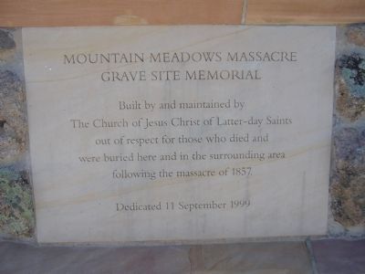
Mountain Meadows Massacre Grave Site Memorial
Photographed by Bill Kirchner, August 29, 2011
1. Mountain Meadows Massacre Grave Site Memorial Marker
Built and maintained by The Church of Jesus Christ of Latter-day Saints out of respect for those who died and were buried here and in the surrounding area following the massacre of 1857.
Erected 1999 by the Church of Jesus Christ of Latter-day Saints. (Marker Number 17.)
Topics and series. This historical marker and memorial is listed in this topic list: Cemeteries & Burial Sites. In addition, it is included in the National Historic Landmarks, and the Utah Pioneer Trails and Landmarks Association series lists. A significant historical year for this entry is 1857.
Location. 37° 28.532′ N, 113° 38.619′ W. Marker is near Central, Utah, in Washington County. It can be reached from Utah Route 18 at milepost 30.5. After turning off highway 18, there is a dirt road to the left that leads to the memorial. Touch for map. Marker is in this post office area: Central UT 84722, United States of America. Touch for directions.

Regionally, this marker and memorial is in Utah’s Color Country. It is also in the American Southwest, in the Mountain West, and on the Colorado Plateau. Globally, it is in North America, the Rocky
this page online
Other nearby markers. At least 8 other markers are within walking distance of this marker: Siege, Murder, and Burials at the Emigrants' Campsite (here, next to this marker); The Mountain Meadows Massacre / Statements from Leaders of the Church of Jesus Christ of Latter-day (within shouting distance of this marker); Execution at the Scene of the Crimes (about 500 feet away, measured in a direct line); The Burial Sites (approx. 0.6 miles away); The Arkansas Wagon Train (approx. 0.6 miles away); The Old Spanish Trail and The California Road (approx. 0.6 miles away); 1990 Mountain Meadows Monument (approx. 0.6 miles away); Leaders of the Arkansas Wagon Train (approx. 0.6 miles away). Touch for a list and map of all markers in Central.
More about this marker. This marker was originally placed in 1932 by the Utah Pioneer Trails and Landmark Association, number 17 in their series.
Related marker. Click here for another marker that is related to this marker.
Photographed by Bill Kirchner, August 29, 2011
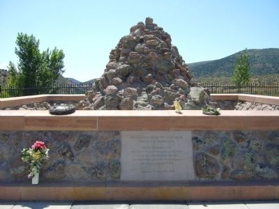
2. Mountain Meadows Massacre Grave Site Memorial Marker
Also see . . . Mountain Meadows Association. (Submitted on September 3, 2011, by Bill Kirchner of Tucson, Arizona.)
Additional keywords. 1999 Mountain Meadows Monument
The Burial Site
Photographed by Bill Kirchner, August 29, 2011
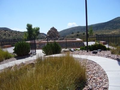
3. Mountain Meadows Massacre Grave Site Memorial
Photographed by Bill Kirchner, August 29, 2011
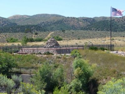
4. Mountain Meadows Massacre Grave Site Memorial
Photographed by Bill Kirchner, August 29, 2011
5. Mountain Meadows Massacre Grave Site Memorial
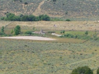
View from Dan Sill Hill.
This is the historic campsite at the south end of the valley. This was a traditional stopping place for pack mule trains traversing the Old Spanish Trail. At this site, the Baker-Fancher Train camped in 1857 and on September 7 the initial siege of the Mountain Meadows massacre took place. Stone monuments with plaques were erected in 1859 and 1932 and a new plaque in 1990.
This is the historic campsite at the south end of the valley. This was a traditional stopping place for pack mule trains traversing the Old Spanish Trail. At this site, the Baker-Fancher Train camped in 1857 and on September 7 the initial siege of the Mountain Meadows massacre took place. Stone monuments with plaques were erected in 1859 and 1932 and a new plaque in 1990.
Photographed by Jeremy Snow, June 13, 2023
6. Gravesite Memorial
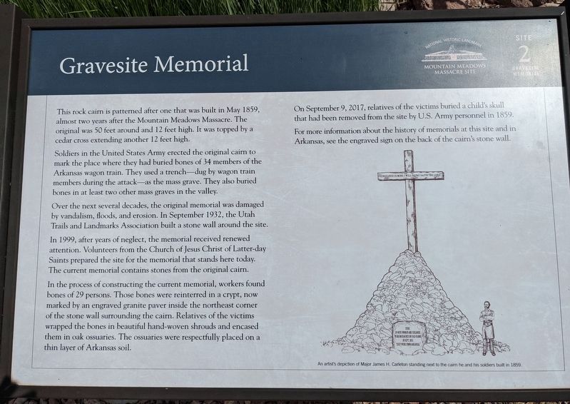
This rock cairn is patterned after one that was built in May 1859, almost two years after the Mountain Meadows Massacre. The original was 50 feet around and 12 feet high. It was topped by a cedar Cross extending another 12 feet hight.
Soldiers in the United States Army erected teh original cairn to mark the place where they had buried bones of 34 members of the Arkansas wagon train. they used a trench-dug by wagon train members during the attack-as the mass grave. They also buried bones in at least two other mass graves in the valley.
Over the next several decades, the original memboiral was damaged by vandalism, floods, and erosion. In September 1932, the Utah Trails and Landmarks Association built a stone wall around the site.
In 1999, after years of neglect, the memorial received renewed attention. Volunteers from the Church of Jesus Christ of Latter-day Saints prepared the site for the memorial that stands here today. The current memorial contains stones from the original cairn.
In the process of construction the current memorial, workers found bones of 29 persons. Those bones were reinterred in a crypt, now marked by an engraved granite paver inside the northeast corner of the stone wall surrounding the cairn. Relative of the victims wrapped the bones in beautiful hand-woven shrounds and encased then in oak ossuaries. The ossuaries were respectfully placed on a thin layer of Arkansas soil.
On September 9, 2017, relatives of the victims buried a child's skull that had been removed from the site by U.S. Army personnel in 1859.
For more information about the history of memorials at this site and in Arkansas, see the engraved sign on the back of the cairn's stone wall.
Credits. This page was last revised on May 23, 2024. It was originally submitted on September 3, 2011, by Bill Kirchner of Tucson, Arizona. This page has been viewed 1,878 times since then and 65 times this year. Last updated on July 5, 2020, by Tyler Thorsted of Orem, Utah. Photos: 1, 2, 3, 4, 5. submitted on September 3, 2011, by Bill Kirchner of Tucson, Arizona. 6. submitted on February 6, 2024, by Jeremy Snow of Cedar City, Utah. • J. Makali Bruton was the editor who published this page.
