Hopkinton in St. Lawrence County, New York — The American Northeast (Mid-Atlantic)
Hopkinton Green Historic District
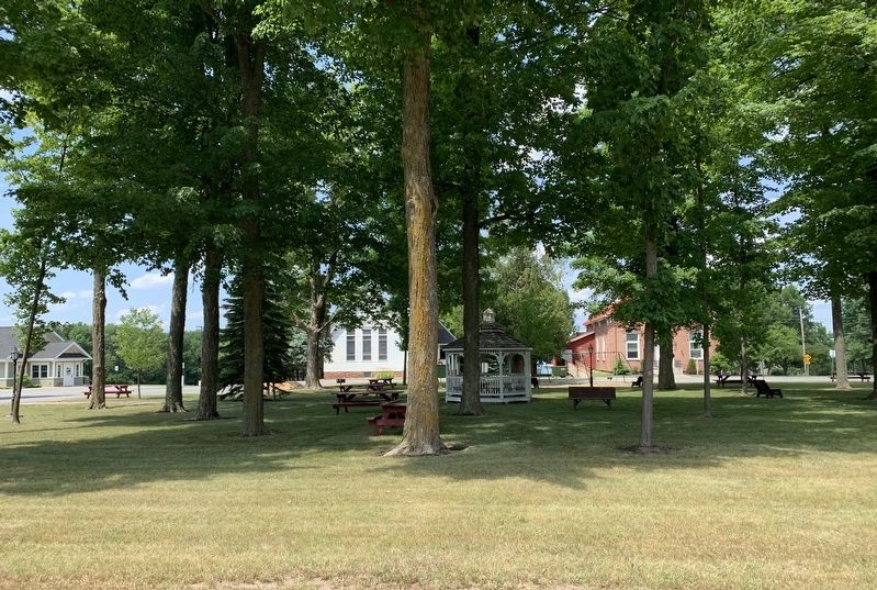
The Hopkinton Green, Town Hall (1870) and Congregational Church (1892) are listed jointly on the U.S. National Register of Historic Places. This area was originally deeded to local citizens in 1808 by town founder Roswell Hopkins "for the inhabitants of the town, to be used for a public Green or Common and for no other use whatever." The Hopkinton Green Historic District was recognized in 2014 by the Keeper of the National Register in Washington, D.C., as a site of cultural and architectural significance worthy of protection and preservation.
The park and buildings represent a distinct New England land-use pattern typical of settlers who migrated westward. By the early 1800s, utilization of such dedicated space had evolved from being simply a common or shared pasture for animals to serving as a permanent focal point for a variety of community functions.
The people of Hopkinton expanded the resources of the Green District in the 1980s by converting an adjacent 1838 house into a museum and library. During the Town Bicentennial Celebration in 2002, a gazebo was placed in the park to memorialize military service veterans. In 2017 the Town constructed a municipal office building and parking area just west of the Green.
Erected 2018.
Topics. This historical marker is listed in this topic list: Settlements & Settlers. A significant historical year for this entry is 1808.
Location. 44° 41.408′ N, 74° 42.231′ W. Marker is in Hopkinton, New York, in St. Lawrence County. Marker is at the intersection of New York State Route 11B and Church Street, on the right when traveling west on State Route 11B. Touch for map. Marker is in this post office area: Nicholville NY 12965, United States of America. Touch for directions.
Other nearby markers. At least 8 other markers are within 9 miles of this marker, measured as the crow flies. British Raid (within shouting distance of this marker); Road Juncture (approx. 2.3 miles away); Parishville (approx. 6.9 miles away); West Branch St. Regis River (approx. 6.9 miles away); Site Of First Bridge (approx. 7 miles away); Parish Tavern (approx. 7 miles away); Town of Stockholm War Memorial (approx. 8.4 miles away); Brasher Falls Vietnam Memorial (approx. 8.8 miles away).
Credits. This page was last revised on July 11, 2020. It was originally submitted on July 7, 2020, by Steve Stoessel of Niskayuna, New York. This page has been viewed 135 times since then and 16 times this year. Photos: 1, 2. submitted on July 7, 2020, by Steve Stoessel of Niskayuna, New York. • Michael Herrick was the editor who published this page.

