Effingham in Effingham County, Illinois — The American Midwest (Great Lakes)
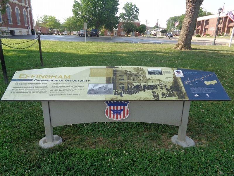
Effingham
Crossroads of Opportunity
For 25 years, Ewington, about three miles southwest of Effingham, served as the county seat. As a county capital on the National Road, the town was primed for growth. Then history came to a crossroads.
In the 1850s, the juggernaut of westward expansion-the railroad-crossed the National Road at Effingham. The confluence of road and rail gave Effingham an economic edge. County residents saw the potential for development, and acted. In 1859 during a high stakes political tug o' war, the location of the county seat went to ballot. The city of Effingham carried the vote.
As Ewington's future faded, streets leading to and from the Effingham courthouse grew into corridors of commerce, art, and industry.
(photo caption:)
Railroads altered the economic, cultural and political landscapes of communities like Ewington and Effingham.
(side quote:)
"Nothing that ever occurred in the county created more excitement and interest than the contest over the removal of the county seat from Ewington to Effingham. There was much at stake, for it meant the unmaking of one town and making of another. Ewington disappeared from the map while Effingham sprang forward into municipal importance. Ewington residents lost their all, while the Effingham promoters netted their fortunes."
-Benjamin F. Kagay, first mayor of Effingham
(aside:)
A Road of Dirt, Rock, And Dreams
In 1806, President Thomas Jefferson signed legislation to provide federal funding for a National Road. Surveyed from Cumberland, Md., to the Mississippi River, the National Road was a highway for pioneers eager to settle the West.
Today, as US 40, the National Road in Illinois spans 164 miles. From Indiana to East St. Louis, you can still see how the ambitions and accomplishments of early Illinois immigrants shaped our communities. You'll find their influence in our art and architecture, our industry and agriculture, and in our way of life. Enjoy your time on the Road.
Erected 2015 by National Road Association of Illinois.
Topics and series. This historical marker is listed in these topic lists: Railroads & Streetcars • Roads & Vehicles. In addition, it is included in the The Historic National Road series list.
Location. 39° 7.289′ N, 88°
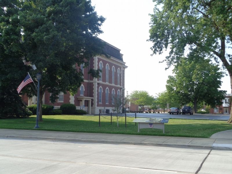
32.466′ W. Marker is in Effingham, Illinois, in Effingham County. Marker is on East Jefferson Avenue west of South 3rd Street (U.S. 45), on the left when traveling east. Marker is near the southeast corner of the former Effingham County Courthouse (now the Effingham County Cultural Center and Museum). Touch for map. Marker is at or near this postal address: 198 E Jefferson Ave, Effingham IL 62401, United States of America. Touch for directions.
Other nearby markers. At least 8 other markers are within 8 miles of this marker, measured as the crow flies. Yates Post No. 88 W.R.C. (here, next to this marker); Effingham County Courthouse (within shouting distance of this marker); Veterans Memorial (within shouting distance of this marker); Lord Thomas Howard, Earl of Effingham (within shouting distance of this marker); Welcome to the Cross at the Crossroads! (approx. 1.9 miles away); Teutopolis (approx. 3.7 miles away); a different marker also named Veterans Memorial (approx. 7˝ miles away); National Road (approx. 7.9 miles away). Touch for a list and map of all markers in Effingham.
Also see . . . Effingham (video). From the Illinois National Road's YouTube channel, this is a short video that talks about the history of Effingham and the roads, as well as recommend historical places to visit while there. (Submitted on July 10, 2020, by Jason Voigt of Glen Carbon, Illinois.)
Credits. This page was last revised on July 10, 2020. It was originally submitted on July 10, 2020, by Jason Voigt of Glen Carbon, Illinois. This page has been viewed 249 times since then and 15 times this year. Photos: 1, 2. submitted on July 10, 2020, by Jason Voigt of Glen Carbon, Illinois.

