Martinsville in Clark County, Illinois — The American Midwest (Great Lakes)
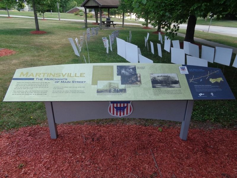
Martinsville
The Merchants of Main Street
Many merchants have shops on the National Road, known locally as Main Street. Before the day is done, you'll stop by the general store for groceries and a Sunday shirt, ask the blacksmith to edge your knives, see the milliner's about a new hat, and buy candy at the confectionary.
For you and other area residents, Martinsville's Main Street is more than a road. It's a corridor for commerce and community.
Trade Route
Early Martinsville merchants often relied on a system of barter and exchange to supplement cash transactions. Clark County residents offered farm goods such as eggs, poultry, fruits, and vegetables, in exchange for groceries, dry goods and services. Shopkeepers credited the difference in value to a customer's account.
Martinsville shops also offered credit. Owners kept records of credits and debts in a ledger. Debts were kept "on the books" until a customer settled the account.
Oil and Economy
In the early 1900s, Ohio Oil Company became Martinsville's largest employer. From 1906 to 1908, Ohio Oil constructed 225 oil tanks on 1,200 acres west of town. The oil boom spurred Martinsville's economy and attracted scores of construction workers. From 1900 to 1910, the town's population climbed from 1,000 to 1,500.
(photo captions:)
Blacksmith shops like this one sharpened blades, shaped horseshoes, made hardware for homes and businesses, and kept coaches and wagons moving on the National Road.
Alexander Linn and Arthur Rupp equipped homes, farms and businesses with hardware from Linn's store on Main Street.
Edgar Rowe established a foundry on the National Road in 1898. It still operates today. This photo from 1912 shows Tinus Cunningham at work in Rowe Foundry.
(aside:)
A Road of Dirt, Rock, And Dreams
In 1806, President Thomas Jefferson signed legislation to provide federal funding for a National Road. Surveyed from Cumberland, Md., to the Mississippi River, the National Road was a highway for pioneers eager to settle the West.
Today, as US 40, the National Road in Illinois spans 164 miles. From Indiana to East St. Louis, you can still see how the ambitions and accomplishments of early Illinois immigrants shaped our communities. You'll find their influence in our art and architecture, our industry and agriculture, and in our way of life. Enjoy your time on the Road.
Erected 2015 by National Road Association of Illinois.
Topics and series. This historical marker is listed in these topic lists: Industry & Commerce • Roads & Vehicles. In addition, it is included in the The Historic National Road series list.
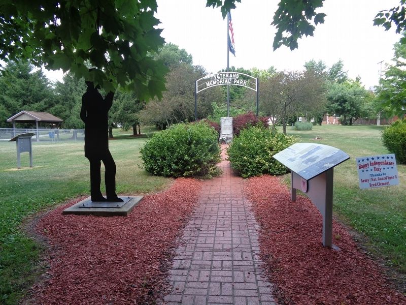
Location. 39° 20.013′ N, 87° 52.907′ W. Marker is in Martinsville, Illinois, in Clark County. Marker is on East Main Street west of Mill Street, on the right when traveling east. Marker is located at a Veterans Memorial walkway, and near a park. Touch for map. Marker is at or near this postal address: 19 W Cumberland St, Martinsville IL 62442, United States of America. Touch for directions.
Other nearby markers. At least 8 other markers are within 7 miles of this marker, measured as the crow flies. Veterans Memorial (a few steps from this marker); The Linn Family / The Rowe Foundry Anvil (within shouting distance of this marker); John Lang (approx. 5.7 miles away); Rev. John Doughty (approx. 5.7 miles away); The Early Settlement of Cumberland (approx. 5.7 miles away); "Large" Pizza Slicer (approx. 6 miles away); Casey (approx. 6.3 miles away); You Are Not Forgotten (approx. 6.3 miles away). Touch for a list and map of all markers in Martinsville.
Also see . . . Martinsville (video). From the Illinois National Road's YouTube channel, this is a short video that talks about the history of Martinsville, as well as recommended historical places to visit while there. (Submitted on July 11, 2020, by Jason Voigt of Glen Carbon, Illinois.)
Credits. This page was last revised on July 11, 2020. It was originally submitted on July 11, 2020, by Jason Voigt of Glen Carbon, Illinois. This page has been viewed 432 times since then and 64 times this year. Photos: 1, 2. submitted on July 11, 2020, by Jason Voigt of Glen Carbon, Illinois.

