Mechanicsville in Hanover County, Virginia — The American South (Mid-Atlantic)
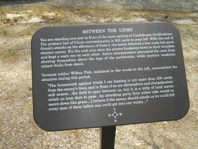
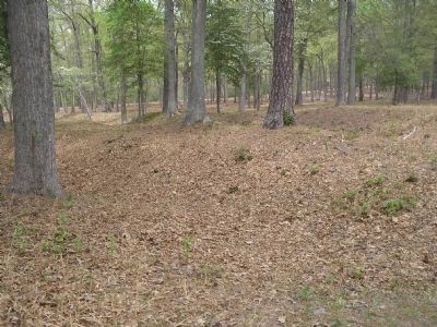
Between the Lines
Vermont soldier Wilbur Fisk, stationed in the woods to the left, summarized the situation during this period:
“The breastwork against which I am leaning is not more than 200 yards from the enemy’s lines, and in front of us are skirmishers and sharpshooters still nearer …. the field is open between us, but it is a strip of land across which no man dare to pass. An attacking party from either side would be mown down like grass …. I believe if the enemy should attack us we could kill every man of them before any could get into our works ….”
Erected by Richmond National Battlefield Park - National Park Service.
Topics. This historical marker is listed in this topic list: War, US Civil. A significant historical date for this entry is June 3, 1874.
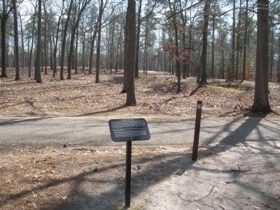
Location. 37° 35.532′ N, 77° 17.349′ W. Marker is in Mechanicsville, Virginia, in Hanover County. Marker is on Anderson Wright Drive, on the right when traveling north. Marker is on the tour road in the Cold Harbor Unit of Richmond National Battlefield. Touch for map. Marker is in this post office area: Mechanicsville VA 23111, United States of America. Touch for directions.
Other nearby markers. At least 8 other markers are within walking distance of this marker. Confederate Fortifications (about 500 feet away, measured in a direct line); Confederate Position (about 500 feet away); Grant's Grand Assault (about 700 feet away); The Cold Harbor Killing Fields (approx. 0.2 miles away); Confederate Breastworks (approx. 0.2 miles away); In Reserve (approx. 0.2 miles away); The Waters Ran Red (approx. ¼ mile away); Firing Blind (approx. ¼ mile away). Touch for a list and map of all markers in Mechanicsville.
More about this marker. On the bottom of the marker is a compass rose that indicates that the marker faces south.
Also see . . .
1. Cold Harbor. CMSAC Battle Summaries webpage. (Submitted on January 12, 2009, by Bill Coughlin of Woodland Park, New Jersey.)
2. Cold Harbor. Richmond National Battlefield. (Submitted on January 12, 2009, by Bill Coughlin of Woodland Park, New Jersey.)
3. Cold Harbor Battlefield Virtual Tour by Markers. This is one of the many
markers along the walking trail, extended loop trail, and auto tour route in the Cold Harbor Battlefield Unit of the Richmond National Battlefield Park. (Submitted on March 9, 2009, by Bernard Fisher of Richmond, Virginia.)
Credits. This page was last revised on June 16, 2016. It was originally submitted on January 12, 2009, by Bill Coughlin of Woodland Park, New Jersey. This page has been viewed 958 times since then and 10 times this year. Photos: 1, 2, 3. submitted on January 12, 2009, by Bill Coughlin of Woodland Park, New Jersey. 4. submitted on March 9, 2009, by Bernard Fisher of Richmond, Virginia.


