Grosse Ile in Wayne County, Michigan — The American Midwest (Great Lakes)
The End of the Line
at the Grosse Ile Depot
Photographed by Joel Seewald, July 9, 2020
1. The End of the Line at the Grosse Ile Depot Marker
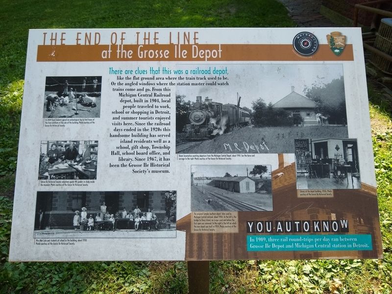
There are clues that this was a railroad depot,
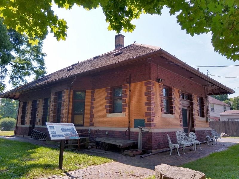
like the flat ground area where the train track used to be. Or the angled windows where the station master could watch trains come and go. From this Michigan Central Railroad depot, built in 1904, local people traveled to work, school or shopping in Detroit, and summer tourists enjoyed visits here. Since the railroad days ended in the 1920s this handsome building has served island residents well as a school, gift shop, Township Hall, school board office, and library. Since 1967, it has been the Grosse Ile Historical Society's museum.
You Auto Know
In 1909, three rail round-trips per day ran between Grosse Ile Depot and Michigan Central station in Detroit.
Erected by MotorCities National Heritage Area, National Park Service.
Topics and series. This historical marker is listed in this topic list: Railroads & Streetcars. In addition, it is included in the MotorCities National Heritage Area series list. A significant historical year for this entry is 1904.
Location. 42° 7.558′ N, 83° 8.512′ W. Marker is in Grosse Ile, Michigan, in Wayne County. It can be reached from
this page online

Regionally, this marker is in Southeast Michigan and in Greater Detroit. It is also in the American Midwest. Globally, it is in North America, on the Great Lakes, in the Western Hemisphere, in the Western World, and in the Anglosphere. Historically, it finds itself in what was once the Viceroyalty of New France and also the Northwest Territory.
Other nearby markers. At least 8 other markers are within walking distance of this marker: Rails Through Grosse Ile (here, next to this marker); Michigan Central Railroad (a few steps from this marker); Recording Movements (within shouting distance of this marker); Across the Water (within shouting distance of this marker); The Livingstone Channel (within shouting distance of this marker); St. James Episcopal Chapel (about 500 feet away, measured in a direct line); Military Outpost
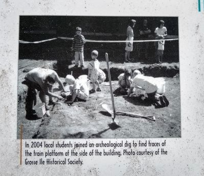
Photo courtesy of the Grosse Ile Historical Society.
2. The End of the Line at the Grosse Ile Depot Marker — upper left image
In 2004 local students joined an archaeological dig to find traces of the train platform at the side of the building.
Also see . . . Michigan Central Railroad Depot. Part of a Wikipedia article about the East River Road Historic District. (Submitted on July 12, 2020, by Joel Seewald of Madison Heights, Michigan.)
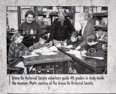
Photo courtesy of the Grosse Ile Historical Society.
3. The End of the Line at the Grosse Ile Depot Marker — middle left image
Grose Ile Historical Society volunteers guide 4th graders in study inside the museum.
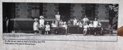
Photo courtesy of the Grosse Ile Historical Society.
4. The End of the Line at the Grosse Ile Depot Marker
Miss Nan Cole and students at school in the building, about 1930.
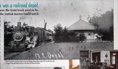
Photo courtesy of the Grosse Ile Historical Society.
5. The End of the Line at the Grosse Ile Depot Marker — upper right image
Steam locomotives awaiting departure from the Michigan Central Depot, about 1910. See the horse and carriage to the right.

Photo courtesy of the Grosse Ile Historical Society.
6. The End of the Line at the Grosse Ile Depot Marker — middle right image
Library at the depot building, 1930s.
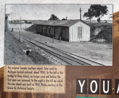
Photo courtesy of the Grosse Ile Historical Society.
7. The End of the Line at the Grosse Ile Depot Marker — lower right image
The original Canada Southern depot, later sued by Michigan Central railroad, about 1900. To the left is the bridge to Stony Island, no longer used and before the first span was removed. To the right is the hill on which the new depot was built in 1904.
Photographed by Joel Seewald, July 9, 2020
8. The End of the Line at the Grosse Ile Depot Marker
Photographed by Joel Seewald, July 9, 2020
9. The End of the Line at the Grosse Ile Depot Marker — plaque
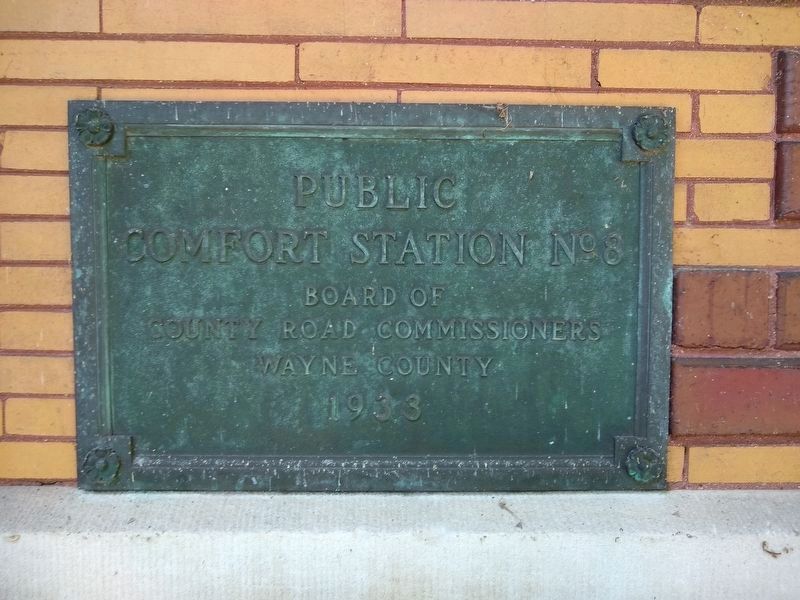
Plaque on corner of building:
Public Comfort Station No 8
Board of County Road Commissioners
Wayne County
1933
Public Comfort Station No 8
Board of County Road Commissioners
Wayne County
1933
Credits. This page was last revised on July 12, 2020. It was originally submitted on July 12, 2020, by Joel Seewald of Madison Heights, Michigan. This page has been viewed 491 times since then and 37 times this year. Photos: 1, 2, 3, 4, 5, 6, 7, 8, 9. submitted on July 12, 2020, by Joel Seewald of Madison Heights, Michigan.
