Marker Logo HMdb.org THE HISTORICAL
MARKER DATABASE
“Bite-Size Bits of Local, National, and Global History”
Grosse Ile in Wayne County, Michigan — The American Midwest (Great Lakes)
 

Across the Water

to Stony Island and Beyond


Across the Water to Stony Island and Beyond Marker image. Click for full size.
Photographed By Joel Seewald, July 9, 2020
1. Across the Water to Stony Island and Beyond Marker
Inscription.
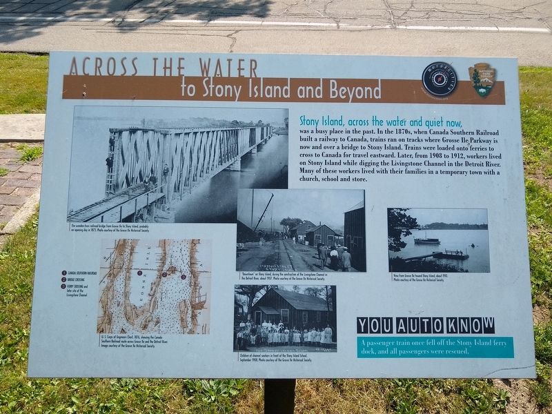
Stony Island, across the water and quiet now,
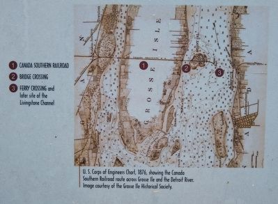
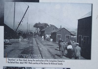
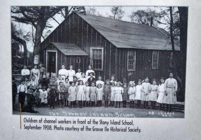
was a busy place in the past. In the 1870s, when Canada Southern Railroad built a railway to Canada, trains ran on tracks where Grosse Ile Parkway is now and over a bridge to Stony Island. Trains were loaded onto ferries to cross to Canada for travel eastward. Later, from 1908 to 1912, workers lived on Stony Island while digging the Livingstone Channel in the Detroit River. Many of these workers lived with their families in a temporary town with a church, school and store.

You Auto Know
A passenger train once fell off the Stony Island ferry dock, and all passengers were rescued.
 
Erected by MotorCities National Heritage Area, National Park Service.
 
Topics and series. This historical marker is listed in these topic lists: Railroads & StreetcarsWaterways & Vessels. In addition, it is included in the MotorCities National Heritage Area series list. A significant historical year for this entry is 1908.
 
Location. 42° 7.558′ N, 83° 8.48′ W. Marker is in Grosse Ile, Michigan, in Wayne County. Marker is at the intersection of East River Road and Grosse Ile Parkway, on the right when traveling south on East River Road. Marker is about 150 feet east of the Grosse Ile
Paid Advertisement
Click on the ad for more information.
Please report objectionable advertising to the Editor.
Click or scan to see
this page online
Historical Society parking lot. Touch for map. Marker is at or near this postal address: 25000 East River Road, Grosse Ile MI 48138, United States of America. Touch for directions.
 
Other nearby markers. At least 8 other markers are within walking distance of this marker. The Livingstone Channel (here, next to this marker); Michigan Central Railroad (within shouting distance of this marker); The End of the Line (within shouting distance of this marker); Rails Through Grosse Ile (within shouting distance of this marker); Recording Movements (within shouting distance of this marker); St. James Episcopal Chapel (about 500 feet away, measured in a direct line); Military Outpost (approx. 0.4 miles away); Grosse Ile Treaty Tree (approx. 0.4 miles away). Touch for a list and map of all markers in Grosse Ile.
 
Across the Water to Stony Island and Beyond Marker - upper left image image. Click for full size.
Photo courtesy of the Grosse Ile Historical Society.
2. Across the Water to Stony Island and Beyond Marker - upper left image
The wooden-truss railroad bridge from Grosse Ile to Stony Island, probably on opening day in 1873.
Across the Water to Stony Island and Beyond Marker — lower left image image. Click for full size.
Image courtesy of the Grosse Ile Historical Society
3. Across the Water to Stony Island and Beyond Marker — lower left image
U. S. Corps of Engineers Chart, 1876, showing the Canada Southern Railroad route across Grosse Ile and the Detroit River.
Across the Water to Stony Island and Beyond Marker — upper middle image image. Click for full size.
Photo courtesy of the Grosse Ile Historical Society.
4. Across the Water to Stony Island and Beyond Marker — upper middle image
"Downtown" on Stony Island, during the construction of the Livingstone Channel in the Detroit River, about 1907.
Across the Water to Stony Island and Beyond Marker — lower middle image image. Click for full size.
Photo courtesy of the Grosse Ile Historical Society.
5. Across the Water to Stony Island and Beyond Marker — lower middle image
Children of channel workers in front of the Stony Island School, September 1908.
Across the Water to Stony Island and Beyond Marker — right image image. Click for full size.
Photo courtesy of the Grosse Ile Historical Society.
6. Across the Water to Stony Island and Beyond Marker — right image
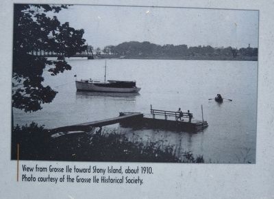
View from Grosse Ile toward Stony Island, about 1910.
Across the Water to Stony Island and Beyond Marker image. Click for full size.
Photographed By Joel Seewald, July 9, 2020
7. Across the Water to Stony Island and Beyond Marker
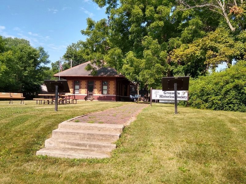
Marker as seen from East River Road. This marker is the one on the left.
 
 
Credits. This page was last revised on July 14, 2020. It was originally submitted on July 13, 2020, by Joel Seewald of Madison Heights, Michigan. This page has been viewed 261 times since then and 37 times this year. Photos:   1, 2, 3, 4, 5, 6, 7. submitted on July 14, 2020, by Joel Seewald of Madison Heights, Michigan.
Share this page.  
Share on Tumblr
m=152752

CeraNet Cloud Computing sponsors the Historical Marker Database.
This website earns income from purchases you make after using our links to Amazon.com. We appreciate your support.
Paid Advertisement
May. 10, 2024