Lander in Fremont County, Wyoming — The American West (Mountains)
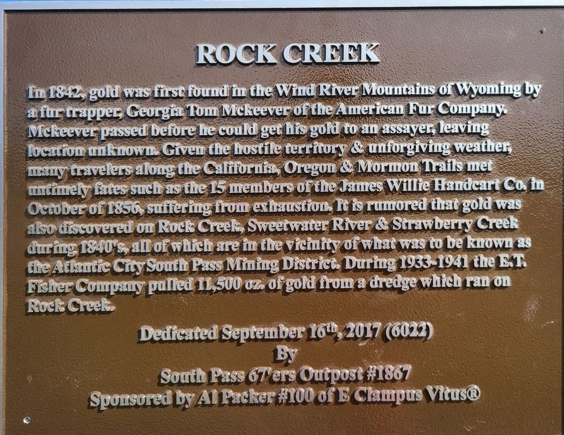
Rock Creek
Erected 2017 by South Pass Outpost #1867 and Al Packer #100 of E Clampus Vitus®.
Topics and series. This historical marker is listed in these topic lists: Industry & Commerce • Natural Resources. In addition, it is included in the E Clampus Vitus series list. A significant historical year for this entry is 1842.
Location. 42° 31.498′ N, 108° 45.603′ W. Marker is in Lander, Wyoming, in Fremont County. Marker is on Dickinson Avenue near Skyline Road, on the right when traveling west. Touch for map. Marker is in this post office area: Lander WY 82520, United States of America. Touch for directions.
Other nearby markers. At least 8 other markers are within 4 miles of this marker, measured as the crow flies. The Atlantic City Project (within shouting distance of this marker); Gold Flakes to Yellowcake Historic Mine Trail (about 300 feet away, measured in a direct line); Fort Stambaugh, 1870-1878 (approx. 1.9 miles away); Miners Delight: The Boom’s Broken Promises (approx. 2.1 miles away); Atlantic City: Surviving the Bust (approx. 2½ miles away); South Pass and South Pass City (approx. 3.4 miles away); The Carissa Mine: Cycle of Boom and Bust (approx. 4 miles away); South Pass City: Wyoming’s Biggest Gold Boom and Bust (approx. 4 miles away). Touch for a list and map of all markers in Lander.
Additional keywords. E Clampus Vitus ECV
Credits. This page was last revised on July 21, 2020. It was originally submitted on July 17, 2020, by Jeffrey Running of Lander, Wyoming. This page has been viewed 359 times since then and 67 times this year. Photo 1. submitted on July 17, 2020, by Jeffrey Running of Lander, Wyoming. • Andrew Ruppenstein was the editor who published this page.
Editor’s want-list for this marker. A wide shot of the marker and its surroundings. • Can you help?
